Related Research Articles

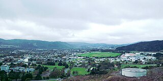
Upper Hutt is a city in the Wellington Region of New Zealand and one of the four cities that constitute the Wellington metropolitan area.

Te Awa Kairangi / Hutt River flows through the southern North Island of New Zealand. It flows south-west from the southern Tararua Range for 56 kilometres (35 mi), forming a number of fertile floodplains, including Kaitoke, central Upper Hutt and Lower Hutt.

Richard Barton was the first European resident of Trentham, Upper Hutt, in New Zealand. He was born in Newport, Isle of Wight, England.
The Wellington Racing Club (WRC) is a racing horse racing club based at Trentham Racecourse in Trentham, Wellington, New Zealand.
Trentham Military Camp is a New Zealand Defence Force (NZDF) facility located in Trentham, Upper Hutt, near Wellington. Originally a New Zealand Army installation, it is now run by Defence and accommodates all three services. It also hosts Joint NZDF facilities including:

The Wairarapa Line is a secondary railway line in the south-east of the North Island of New Zealand. The line runs for 172 kilometres (107 mi), connects the capital city Wellington with the Palmerston North - Gisborne Line at Woodville, via Lower Hutt, Upper Hutt and Masterton.
Heretaunga is a suburb of the city of Upper Hutt, located in the lower (southern) North Island of New Zealand. The settlement, one of the older suburbs in the Hutt Valley, dates from the 1840s when European settlers sought country sections. A prime example of a "leafy" suburb, Heretaunga includes quiet tree-lined streets. It is characterised by large houses, often Edwardian or from the mid-20th century.

The Hutt Valley Line is the electrified train service operated by Transdev Wellington on behalf of Metlink on the section of the Wairarapa Line railway between Wellington and Upper Hutt, New Zealand.

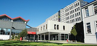
The Wellington Institute of Technology, also known as WelTec, is a New Zealand polytechnic based in Petone, Lower Hutt. WelTec was formed in 2001 by an amalgamation between the Central Institute of Technology and the Hutt Valley Polytechnic In 2020, WelTec, along with 15 other national polytechnics, became subsidiaries of Te Pūkenga – New Zealand Institute of Skills and Technology.

Wallaceville is a suburb of Upper Hutt. It is named after John Howard Wallace, an early New Zealand settler, council politician, businessman and author of one of the first published histories of New Zealand.

Trentham Railway Station is an urban railway station in Trentham, a suburb of the city of Upper Hutt in the Wellington region of New Zealand's North Island. It is on the Hutt Valley Line section of the Wairarapa Line and has two side platforms. The station is served by Metlink's electric multiple unit trains of the "Matangi" FP class.

Heretaunga railway station is a suburban railway station serving Heretaunga in Upper Hutt, New Zealand. The station is located on the Hutt Valley section of the Wairarapa Line, 28.2 km (17.5 mi) north of Wellington. The station is served by Metlink's electric multiple unit trains of the "Matangi" FP class. Trains stopping at Heretaunga run to Wellington and Upper Hutt.

Heretaunga is a former New Zealand parliamentary electorate, in the city of Upper Hutt, that existed from 1954 until 1996.

The Upper Hutt Blockhouse also known as the Wallaceville Blockhouse is a 19th-century American-style military blockhouse situated in Upper Hutt, New Zealand. One of very few such blockhouses built in New Zealand, it is preserved as a Category I historic place. It was built in late 1860 as part of a larger Stockade and was one of two Blockhouses and Stockades built in the Hutt Valley that year. It was occupied by the Hutt Battalion of the Wellington Militia from December 1860 to May 1861 without coming under hostile attack.
Trentham Racecourse is the main thoroughbred horse racecourse for the Wellington city area in New Zealand. It is located in the suburb of Trentham in Upper Hutt, next to Trentham Military Camp.
Hutt County was one of the former counties of New Zealand. It occupied the south-western corner of the North Island, extending south from the Waikanae River and lying to the west of the summits of the Rimutaka Ranges. The county's name arises from the fact that a large amount of its land area lies in the Hutt River catchment.
The Mayor of Upper Hutt is the head of the municipal government of Upper Hutt, New Zealand, and presides over the Upper Hutt City Council. The mayor is directly elected using a First Past the Post electoral system. The Upper Hutt Town Board had seven chairmen, with the role regarded as the predecessor role of mayor. The Upper Hutt Borough Council was proclaimed in 1926, and with that the role of mayor was introduced. In 1966, Upper Hutt became a city council. The current mayor, Wayne Guppy, is the eleventh since the role was created in 1926, and he was first elected in 2001.

St John's Anglican Church in Trentham, Upper Hutt is one of the oldest surviving Anglican churches in the Wellington region of New Zealand.
Richard John Barton II was a New Zealand pastoralist, runholder, businessman and author in the early 20th century in Wellington and the Wairarapa.
The Wellington Naturist Club is a naturist resort located in Te Mārua, Upper Hutt, 38 kilometres (24 mi) northeast of Wellington in the North Island of New Zealand. Its 4.7 hectares of land hold facilities including a miniature golf course, volleyball court, picnic areas, spa and sauna, and extensive rhododendron gardens, with a large hall for a clubhouse. For accommodation, the resort has four lodges and over 150 campsites. The Club was founded in 1950, under the name "Wellington Sun and Health Society".
References
- 1 2 3 "Royal Wellington Golf Club History". Royal Wellington Golf Club. Retrieved 31 March 2017.