South Yorkshire is a metropolitan county in England. It is the southernmost county in the Yorkshire and the Humber region and had a population of 1.34 million in 2011. It has an area of 1,552 square kilometres (599 sq mi) and consists of four metropolitan boroughs, Barnsley, Doncaster, Rotherham and Sheffield. South Yorkshire was created on 1 April 1974 as a result of the Local Government Act 1972. Its largest settlement is Sheffield.

Dunford Bridge is a remote hamlet in the civil parish of Dunford, lying northwest of Sheffield in South Yorkshire, England, 1.3 miles (2 km) from the border with West Yorkshire and 2.3 miles (4 km) from the border with Derbyshire. It lies in the Peak District, 5 miles (8 km) west of Penistone and 5 miles (8 km) south of Holmfirth, within the Metropolitan Borough of Barnsley. Before the Local Government Act 1972 the area covered by South Yorkshire was part of the West Riding of Yorkshire.

Wales is a village and a civil parish in the Metropolitan Borough of Rotherham in South Yorkshire, England. Historically part of the West Riding of Yorkshire, it borders to the south Derbyshire and is astride the M1 motorway. The civil parish of Wales, which has a population of 6,455, increasing to 7,069 at the 2011 Census, encompasses the village and neighbouring settlement Kiveton Park.

Lumbfoot or Lumb Foot is a hamlet in the Haworth, Cross Roads and Stanbury civil parish, and the City of Bradford metropolitan district, England. It is situated approximately 1 mile (1.6 km) from Haworth and less than half a mile north-east from Stanbury. The hamlet is historically part of the West Riding of Yorkshire. Lumbfoot overlooks a number of fields and a small brook, and contains 15 households and a farm. There is no public road; access is by a private road for vehicles, and a public footpath.

Silsden is a town and civil parish in the City of Bradford in West Yorkshire, England, on the River Aire and Leeds and Liverpool Canal between Keighley and Skipton, which had a population of 8,268 at the 2011 Census. The parish includes the hamlet of Brunthwaite.
Thorpe is a variant of the Middle English word thorp, meaning hamlet or small village.

Queensbury is a large village in the metropolitan borough of Bradford, West Yorkshire, England. Perched on a high vantage point above Halifax, Clayton and Thornton and overlooking Bradford itself, Queensbury is one of the highest parishes in England, with views beyond the West Yorkshire conurbation to the hills of Brontë Country and the Yorkshire Dales to the north and north west. It had a population of 8,718 in 2001 which increased to 16,273 in the 2011 Census.

Walkington is a village and civil parish in the East Riding of Yorkshire, England. It is situated approximately 3 miles (4.8 km) to the south-west of the town of Beverley on the B1230 road, and Beverley Grammar School.

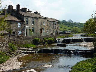
Gayle is a hamlet sited 0.4-mile (0.64 km) south of Hawes in Wensleydale, North Yorkshire, England. The hamlet is noted for the beck that flows through it and the old mill, which featured on the BBC programme Restoration.

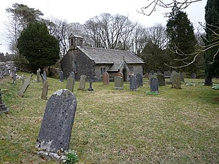
Chapel-le-Dale is a hamlet in the civil parish of Ingleton, North Yorkshire, England. It is in the Yorkshire Dales and was previously in the West Riding of Yorkshire.

Walden is a dale and hamlet in the Yorkshire Dales, North Yorkshire, England. The dale is a side dale of Wensleydale, sometimes known as Waldendale or Walden Dale to distinguish it from the hamlet. The hamlet lies 2 miles (4 km) south of West Burton at the mouth of the dale. The smaller hamlet of Walden Head lies at the head of the dale, 1 mile (2 km) south of Walden.

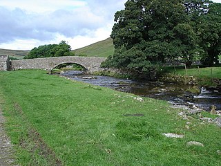
River Skirfare is a small river in North Yorkshire, England, that flows through Littondale and ends where it joins the larger River Wharfe. The source is the confluence of Foxup Beck and Cosh Beck at the hamlet of Foxup.

Thruscross Reservoir is the northernmost of four reservoirs in the Washburn valley, lying north of Otley and west of Harrogate in North Yorkshire, England, near the hamlet of Thruscross. It can be found on an unclassified road from the A59 road. Permission to construct the reservoir was granted via a water order in 1960 and Thruscross was completed in 1966, much later than the other three reservoirs which date back to the nineteenth century.

Lestrem is a commune in the Pas-de-Calais department in the Hauts-de-France region of France.

Mosborough is a village in the City of Sheffield in South Yorkshire, England. Historically part of Derbyshire, the village was named after The Moss river which flows through the village. During the late 19th century and 20th century, the village was noted for its steelmaking, with Hutton & Co. Sickle works being based at nearby Ridgeway. The village expanded due to developments in nearby Owlthorpe, Westfields and Waterthorpe. Mosborough, which was a township at the time, was transferred from Derbyshire to the West Riding of Yorkshire as part of Sheffield.

Egypt is a hamlet near Thornton, in the City of Bradford, West Yorkshire, England.

Hainworth is a hamlet 1 mile (2 km) south of Keighley in West Yorkshire, England. The hamlet faces north across the lower end of the Worth Valley with a steep wooded incline towards Keighley.

Ryecroft is a hamlet near to the village of Harden in West Yorkshire, England. The hamlet is on the road between Harden and Haworth, 1.9 miles (3 km) south of Keighley, 1.9 miles (3 km) west of Bingley and 0.6 miles (1 km) west of the centre of Harden.

Kettleness, is a hamlet in the Scarborough District of North Yorkshire, England. The settlement only consists of half-a-dozen houses, but up until the early 19th century, it was a much larger village. However, most of that village, which was on the headland, slipped into the sea as a result of instability caused by quarrying for the alum industry. Kettleness became a smaller settlement, with houses rebuilt slightly further inland.


