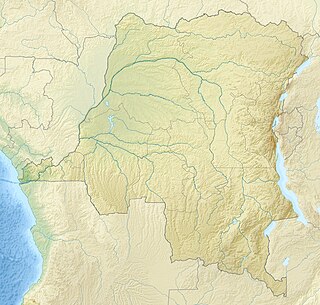
North Kivu is a province bordering Lake Kivu in the eastern Democratic Republic of the Congo. Its capital is Goma.

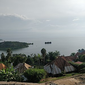
Lake Kivu is one of the African Great Lakes. It lies on the border between the Democratic Republic of the Congo and Rwanda, and is in the Albertine Rift, the western branch of the East African Rift. Lake Kivu empties into the Ruzizi River, which flows southwards into Lake Tanganyika.

Goma is the capital of North Kivu province in the eastern Democratic Republic of the Congo. It is located on the northern shore of Lake Kivu, next to the Rwandan city of Gisenyi. The lake and the two cities are in the Albertine Rift, the western branch of the East African Rift system. Goma lies only 13–18 km (8.1–11.2 mi) south of the active Nyiragongo Volcano. The recent history of Goma has been dominated by the volcano and the Rwandan genocide of 1994, which in turn fuelled the First and Second Congo Wars. The aftermath of these events was still having effects on the city and its surroundings in 2010. The city was captured by rebels of the March 23 Movement during the M23 rebellion in late 2012, but it has since been retaken by government forces.

Kibuye is a city in Karongi District, and the headquarters of the Western Province in Rwanda.

'Gisenyi' historically rendered as Gisenyi, is a city in Rubavu district in Rwanda's Western Province. Gisenyi is contiguous with Goma, the city across the border in the Democratic Republic of the Congo.

Rutshuru is a town located in the North Kivu province of the eastern Democratic Republic of the Congo, and is headquarters of an administrative district, the Rutshuru Territory. The town lies in the western branch of the Albertine Rift between Lakes Edward and Kivu. The Ugandan border is 15 km east and the Rwandan border is 30 km south-east. Lava flows from the Nyamuragira volcano, 40 km south-west, have come within 7 km of the town in recent years.

National Road No. 2 is an 863-km road in the Democratic Republic of the Congo. It runs from the eastern city of Goma, which lies on the northern shore of Lake Kivu across the border from the Rwandan city of Gisenyi, around the western shore of Lake Kivu via Katana towards Bukavu. At Kavumu there is a junction with the southern spur to Bukavu, but National Road 2 turns north-west and runs 400 km to Lubutu and then 240 km to the river port of Kisangani, which is the farthest navigable point on the Congo River from the capital Kinshasa. Riverboats and small ships link Kisangani to Kinshasa.
Tourism in Rwanda is the largest source of foreign exchange earnings in Rwanda and was projected to grow at a rate of 25% every year from 2013-18. The sector is the biggest contributor to the national export strategy. Total revenues generated from the sector in 2014 alone was USD 305 millions. The sector has also attracted direct foreign investments with major international hotel brands setting up shop in the country including Marriot Hotels & Resorts, Radisson Blu, Park Inn by Radisson, Sheraton Hotels and Resorts, Protea Hotels by Marriott, Golden Tulip Hotels, and Zinc. With its new world-class convention center Rwanda is set to become a regional and international conference hub owing to ever improving conference facilities, an excellent and expanding transportation network, and straightforward immigration procedures such as the ability for online visa applications, visa-at-gate policy for all Africans, and a one tourist visa policy for the EAC.

Muhanga is a district (akarere) in Rwanda. Its administrative centre is located in the city of Muhanga.

Rubavu District is one of the seven districts of the country district (akarere) in Western Province, Rwanda. Its capital is Gisenyi, It has a large beach resort and border city. It has a total surface area of 388.3 Km2.
Karongi is a district (akarere) in Western Province, Rwanda. Its capital is Rubengera, but the district also contains Kibuye, Rwanda, the provincial capital and a major Rwandan lakeside resort.

Rutsiro is a district (akarere) in Western Province, Rwanda. Its headquarter is located in Gihango sector.
Laurent Nkunda is a former General in the Armed Forces of the Democratic Republic of Congo (DRC) and is the former warlord operating in the province of Nord-Kivu, sympathetic to Congolese Tutsis and the Tutsi-dominated government of neighbouring Rwanda. Nkunda, who is himself a Congolese Tutsi, commanded the former DRC troops of the 81st and 83rd Brigades of the DRC Army. He speaks English, French, Swahili, Kinyarwanda, Lingala and Kinande. On January 22, 2009, he was put under house arrest in Gisenyi when he was called for a meeting to plan a joint operation between the Congolese and Rwandan militaries.
Gisenyi Airport is an airport in Rwanda. It has IATA airport code GYI.
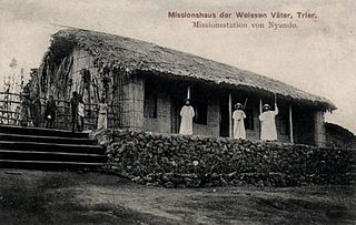
Nyundo is a community in the Rubavu District of Western Province, Rwanda, on the Sebeya River to the east of Gisenyi. It is the location of one of the first Catholic missions to be established in Rwanda, and today is the headquarters of the Roman Catholic Diocese of Nyundo.
Symbion Thermal Power Station is a proposed 56 megawatts (75,000 hp) methane gas-fired thermal power plant located at the Cape of Busororo near the town of Nyamyumba in Rubavu District, in the Western Province of Rwanda.
Maison St Benoit is a small Benedictine nunnery in Kigufi, Rwanda.
John Methuen Coote was a British colonial administrator who served in the East Africa Protectorate. He is known for a stand-off with the Belgians over the location of the border between the Belgian Congo and the British territories.

The Kivu frontier incident was a 1909–1910 stand-off between Belgian, British and German forces in the region around Lake Kivu, now divided between the Democratic Republic of the Congo, Uganda and Ruanda. War was averted through diplomatic negotiations, and it was agreed that the western and northwestern part of the region came within the jurisdiction of the Belgian Congo, while the eastern part was divided between the British Uganda Protectorate to the northeast and the Rwanda district of German East Africa to the southeast.
Burungu is a settlement in the North Kivu province of the Democratic Republic of the Congo.