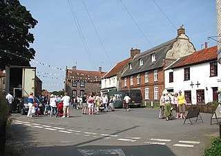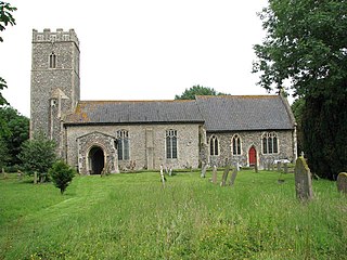
Worstead is a village and civil parish in the English county of Norfolk. It lies 3 miles (5 km) south of North Walsham, 5 miles (8 km) north of Wroxham, and 13 miles (21 km) north of Norwich. The village is served by Worstead railway station on the Bittern Line. For the purposes of local government, the parish falls within the district of North Norfolk.

South Norfolk is a local government district in Norfolk, England. Its council is based in Long Stratton. The population of the Local Authority District was 124,012 as taken at the 2011 Census.

Morston is a village and civil parish in the English county of Norfolk. It covers an area of 8.68 km2 (3.35 sq mi) and had a population of 86 in 42 households at the 2001 census. The population remained less than 100 at the 2011 Census and was included in the civil parish of Blakeney. For the purposes of local government, it falls within the district of North Norfolk.

Northwold is a village and civil parish in the English county of Norfolk. It covers an area of 19.72 km2 (7.61 sq mi) and had a population of 1,070 in 448 households at the 2001 census, increasing to 1,085 at the 2011 Census. For the purposes of local government, it falls within the district of King's Lynn and West Norfolk. The civil parish also includes the hamlets of Whittington and Little London.

Keswick is a village and former civil parish, now in the parish of Keswick and Intwood, in the South Norfolk district, in the county of Norfolk, England. It is situated some 3 miles (4.8 km) to the south of the city of Norwich. It should not be mistaken for the coastal settlement of Keswick, near Bacton, which is also in Norfolk.

Hapton is a village and former civil parish, now in the parish of Tharston and Hapton, in the South Norfolk district, in the county of Norfolk, England, located about nine miles south of Norwich. In 1931 the parish had a population of 159. On 1 April 1935 the parish was abolished and merged with Tharston.

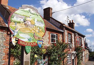
Warham is a village and civil parish in the English county of Norfolk. It is situated about 5 km (3.1 mi) inland from the north Norfolk coast, 5 km (3.1 mi) south-east of the town of Wells-next-the-Sea and 50 km (31 mi) north-west of the city of Norwich.

Dickleburgh and Rushall is a civil parish in South Norfolk. It covers an area of 14.90 km2 (5.75 sq mi) and had a population of 1356 in 565 households at the 2001 census, increasing to 1,472 at the 2011 Census.

Rushall is a suburb in the Metropolitan Borough of Walsall in the West Midlands, England. It is centred on the main road between Walsall and Lichfield. It is mentioned in the Domesday Book but has mostly developed since the 1920s. Rushall was historically a part of the county of Staffordshire before it was incorporated with much of the old Aldridge-Brownhills Urban District into the modern-day Walsall district.

Dickleburgh is a village and former civil parish, now in the parish of Dickleburgh and Rushall, in the South Norfolk district of the English county of Norfolk. The village is located 3.5 miles east of Diss and 17 miles south-west of Norwich. In 2021 it had a population of 1166.

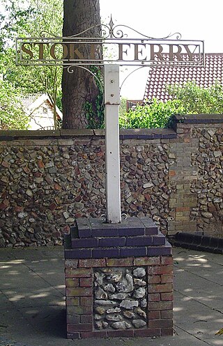
Stoke Ferry is a village and civil parish in the English county of Norfolk, 6.5 miles south-east of Downham Market. The village lies on the River Wissey, previously known as the River Stoke. It covers an area of 9.15 km2 (3.53 sq mi) and had a population of 896 in 358 households as of the 2001 UK Census, the population increasing to 1,020 at the 2011 UK Census. For the purposes of local government, it falls within the district of King's Lynn and West Norfolk.

Heydon is a village and civil parish in Norfolk, England.

Larling is a village and former civil parish, now in the parish of Roudham and Larling, in the Breckland district, in the county of Norfolk, England. The village is 8.5 miles east north east of Thetford, 21.4 miles west south west of Norwich and 94 miles north east of London. In 1931 the parish had a population of 159.

Tilney St Lawrence is a village and a civil parish in the English county of Norfolk The village is 52.3 miles (84.2 km) west of Norwich, 9.7 miles (15.6 km) south-south-west of King's Lynn and 104 miles (167 km) north of London. The nearest town is Wisbech which is 8.3 miles (13.4 km) west-south-west of the village. The village lies to the south of the route of the A47 between Peterborough and Kings Lynn. The parish of Tilney St Lawrence in the 2001 census had a population of 1,465, increasing to 1,576 at the 2011 Census. For the purposes of local government, the parish falls within the district of King's Lynn and West Norfolk.

Whinburgh and Westfield is a civil parish in the English county of Norfolk. It covers an area of 7.56 km2 (2.92 sq mi) and had a population of 307 in 134 households at the 2001 census. 10 years later it has a population of 342 according to the 2011 census. For the purposes of local government, it falls within the district of Breckland. The civil parish is located south of the nearby town Dereham and is formed from the two ancient parishes which centred round the churches of St Mary's Whinburgh and St Andrew's Westfield, and until 1894 the churches performed all the functions of local government. Norfolk was a county of small villages and parishes. The County of Norfolk Review Order, 1935, sought to rationalise this, and under this Westfield Parish was 'abolished' and merged with Whinburgh Parish. The name of the resultant parish was not changed from Whinburgh. For many years nothing was done about the parish's name, but on 2 August 1995, at the request of the Parish Council, Breckland Council sealed a 'Notice of the Change of Parish Name' and the parish then became Whinburgh and Westfield.

Roudham and Larling is a civil parish in the English county of Norfolk. It includes the villages of Roudham and Larling. It covers an area of 15.20 km2 (5.87 sq mi) and had a population of 278 in 119 households at the 2001 census, increasing to a population of 301 in 119 households at the 2011 Census. For the purposes of local government, it falls within the district of Breckland. River Thet flows next to Roudham and Larling.

Houghton is a small village and a civil parish in the English county of Norfolk. It covers an area of 7.64 km2 (2.95 sq mi) and had a population of 69 in 36 households at the 2001 census. At the 2011 census the population of the parish was again below 100, and was therefore included in the civil parish of West Rudham.

Walpole is a civil parish in Norfolk, England. The parish includes the conjoined villages of Walpole St Andrew and Walpole St Peter. Walpole Highway and Walpole Cross Keys are separate civil parishes.

Shimpling is a village and former civil parish 16 miles (26 km) south of Norwich, now in the parish of Burston and Shimpling, in the South Norfolk district, in the county of Norfolk, England. In 1931 the parish had a population of 134.

Tivetshall is a civil parish in the South Norfolk district, in the county of Norfolk, England. The parish includes the villages of Tivetshall St Margaret and Tivetshall St Mary. In 2011 the area the parish currently covers had a population of 591. The parish touches Aslacton, Burston and Shimpling, Dickleburgh and Rushall, Great Moulton, Gissing, Pulham Market and Wacton.


