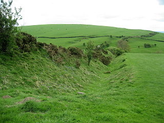
Offa's Dyke is a large linear earthwork that roughly follows the current border between England and Wales. The structure is named after Offa, the Anglo-Saxon king of Mercia from AD 757 until 796, who is traditionally believed to have ordered its construction. Although its precise original purpose is debated, it delineated the border between Anglian Mercia and the Welsh kingdom of Powys.

Offa's Dyke Path is a long-distance footpath broadly following the Wales–England border. Officially opened on 10 July 1971, by Lord Hunt, it is one of Britain's National Trails and draws walkers from throughout the world. About 60 miles (97 km) of the 177-mile (285 km) route either follows, or keeps close company with, the remnants of Offa's Dyke, an earthwork, most of which was probably constructed in the late 8th century on the orders of King Offa of Mercia.

The A44 is a major road in the United Kingdom that runs from Oxford in southern England to Aberystwyth in west Wales.

Kington is a market town, electoral ward and civil parish in Herefordshire, England. According to the Parish, the ward had a population of 3,240 while the 2011 census had a population of 2,626.

Radnor Forest in the county of Radnorshire, Wales is a rock dome composed of Silurian shales, mudstones and limestone in Mid Wales, and a forest only in the medieval sense of an unenclosed area used for hunting. It lies within the Welsh Marches region since Offa's Dyke lies nearby to the east.

Moreton on Lugg is a village in Herefordshire, England, between Hereford, 4.25 miles (6.84 km) to the south, and Leominster, to the north.
Dowsby is a village and civil parish in the South Kesteven district of Lincolnshire, England. It is situated on the western edge of The Fens at the junction of the east-west B1397 road and the north-south B1177. It is 1 mile (1.6 km) north-east from Rippingale and just south of Pointon. The civil parish includes the hamlet of Graby. Nearby to the east, along the B1397 at Dowsby Fen, is Car Dyke. The civil parish population taken at the 2011 census was 204.
Yazor is a small village and civil parish in the English county of Herefordshire. The parish includes the hamlet of Yarsop about 1 mile (2 km) to the north. Yazor is some 8 miles (13 km) north west of the city of Hereford on the A480 road and about 1 mile (2 km) east of Offa's Dyke. It was formerly served by Moorhampton railway station located in the parish. The population of the parish at the 2011 Census was 122.

Byford is a village and civil parish on the River Wye in Herefordshire, England, about 11 km (7 mi) west of Hereford. According to the 2001 census it had a population of 119, increasing to 201 at the 2011 Census.

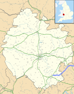
North Herefordshire is a constituency represented in the House of Commons of the UK Parliament since its 2010 creation by Bill Wiggin, a Conservative.
Offchurch is a village and civil parish on the River Leam, 3 miles (4.8 km) east of Leamington Spa in Warwickshire. The population of the civil parish at the 2011 census was 250.

Gladestry is a small village and community in Radnorshire, Powys, mid Wales, close to the border with England at the end of the Hergest Ridge and south of the large moorland area of Radnor Forest. People living in Gladestry rely on the nearby town of Kington, Herefordshire for shops, employment, and public services.

Longtown is a linear village and parish in Herefordshire, England. The parish includes the village of Clodock and had a population in mid-2010 of 543, increasing to 620 at the 2011 Census.
Lyonshall is a historic village and civil parish in Herefordshire, England. The civil parish includes the hamlet of Penrhos. According to the 2001 census the civil parish had a population of 750 increasing to 757 at the 2011 Census.
Moreton Morrell is a village and civil parish in the county of Warwickshire, England. It is part of the historic hundred of Kington and is located about three and a half miles north west of the village of Kineton. The settlement was first mentioned in the Domesday Book as Moreton. From at least Norman times, it has consisted of the village of Moreton and the hamlet of Morrell. The parish of Moreton Morrell is bounded on the east and south east by the Fosse Way, and consists of Little Morrell in the north, the village of Moreton Morrell, and Moreton Paddox in the south.

Knill is a village and civil parish in Herefordshire, England.
The England–Wales border, sometimes referred to as the Wales–England border or the Anglo–Welsh border, is the border between England and Wales, two constituent countries of the United Kingdom. It runs for 160 miles (260 km) from the Dee estuary, in the north, to the Severn estuary in the south. It has followed broadly the same line since the 8th century, and in part that of Offa's Dyke; the modern boundary was fixed in 1536, when the former marcher lordships which occupied the border area were abolished and new county boundaries were created.
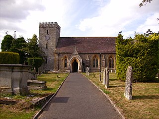
Titley is a village and civil parish in Herefordshire, England. It lies on the B4355 between Kington and Presteigne.
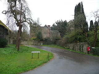
Rodd, Nash and Little Brampton is a civil parish in the county of Herefordshire, England, and is 18 miles (29 km) north-west from the city and county town of Hereford. The parish borders Powys in Wales at its north-west. Within the parish is the final home and studio of the 20th-century Australian artist Sydney Nolan.

Staunton on Arrow is a village and civil parish in the county of Herefordshire, England, and is 17 miles (27 km) north-west from the city and county town of Hereford. The closest large town is the market and minster town of Leominster, 8 miles (13 km) to the east. Within the parish is the site of the Iron Age hill fort of Wapley Hill.
