
Lozère is a landlocked department in the region of Occitanie in Southern France, located near the Massif Central, bounded to the northeast by Haute-Loire, to the east by Ardèche, to the south by Gard, to the west by Aveyron, and the northwest by Cantal. It is named after Mont Lozère. With 76,604 inhabitants as of 2019, Lozère is the least populous French department.

Cantal is a department in the Auvergne-Rhône-Alpes region of France, with its prefecture in Aurillac. Its other principal towns are Saint-Flour and Mauriac; its residents are known as Cantalians. Cantal borders the departments of Puy-de-Dôme, Haute-Loire, Aveyron, Lot, Lozère and Corrèze, in the Massif Central natural region.
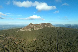
Haute-Loire is a department in the Auvergne-Rhône-Alpes region of south-central France. Named after the Loire River, it is surrounded by the departments of Loire, Ardèche, Lozère, Cantal and Puy-de-Dôme. In 2019, it had a population of 227,570; its inhabitants are called Altiligériens in French.

The following is a list of the 152 communes of the Lozère department of France.

The Garabit viaduct is a railway arch bridge spanning the Truyère, near Ruynes-en-Margeride, Cantal, France, in the mountainous Massif Central region.

The arrondissement of Saint-Flour is an arrondissement of France in the Cantal department in the Auvergne-Rhône-Alpes region. It has 98 communes. Its population is 37,697 (2016), and its area is 2,510.6 km2 (969.3 sq mi).

The arrondissement of Mende is an arrondissement of France in the Lozère department in the Occitanie région. Its INSEE code is 482 and its capital city, and prefecture of the department, is Mende. Its population is 63,180 (2016), and its area is 3,479.4 km2 (1,343.4 sq mi).

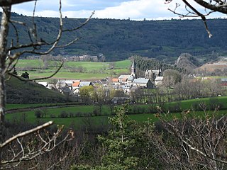
Paulhac-en-Margeride is a commune in the Lozère departement in southern France.
Saint-Denis-en-Margeride is a commune in the Lozère department in southern France.
Jaleyrac is a commune in the Cantal department in south-central France.
Lafeuillade-en-Vézie is a commune in the Cantal department in south-central France.

Raulhac is a commune in the Cantal department in south-central France.

Ytrac is a commune in the Cantal department in south-central France.

Loubaresse is a former municipality located in the Cantal department in Auvergne, southern France. On 1 January 2016, it was merged into the new commune Val-d'Arcomie.
Vabres is a commune in the Cantal department in south-central France.
Margerides is a commune in the Corrèze department in central France.
Émile Nouguier was a French civil engineer and architect. He is famous for co-designing the Eiffel Tower, built 1887–1889 for the 1889 Universal Exposition in Paris, France, the Garabit viaduct, the highest in the world at the time, near Ruynes-en-Margeride, Cantal, France, and the Faidherbe Bridge over the Sénégal River in Senegal.
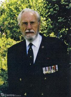
John Hind Farmer (1917-2012) was a member of the Special Operations Executive (SOE) during the Second World War. He was head of the FREELANCE network active in Auvergne from May to June 1944. Subsequently he worked for MI6 and is said to have been involved in a British plot to assassinate President Nasser of Egypt.
Neussargues en Pinatelle is a commune in the Cantal department in south-central France. The municipality was established on 1 December 2016 and consists of the former communes of Celles, Chalinargues, Chavagnac, Neussargues-Moissac and Sainte-Anastasie.
The canton of Neuvéglise-sur-Truyère is an administrative division of the Cantal department, southern France. It was created at the French canton reorganisation which came into effect in March 2015. Its seat is in Neuvéglise-sur-Truyère.


