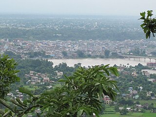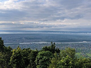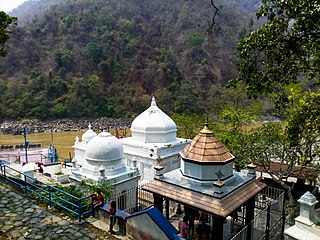
Banepa is a municipality and historical town in a valley situated at about 1,500 m (4,900 ft) above sea level in central Nepal which is at about 25 kilometres (16 mi) east from Kathmandu. At the time of the 2011 Nepal census, it has a population of 67,690. The main attraction of Banepa is the temple of Chandeshwori, located approximately 1 km (0.62 mi) northeast of the town along the Rudramati River. The Dhaneshwor Temple is 1 KM south of the town. Banepa is also known for its eight different temples of Lord Ganesh, Narayanthan, Bhimshenthan and eight different ponds.

Chitwan District is one of 77 districts of Nepal, and takes up the southwestern corner of Bagmati Province. Bharatpur, largest city of Nepal after Kathmandu, is its administrative centre. It covers 2,238.39 km2 (864.25 sq mi), and in 2011 had a population of 579,984 people. Bharatpur is the commercial and service centre of South Central Nepal and a major destination for higher education, health care and transportation in the region. Chitwan lies in the Terai region of Nepal. It is in the drainage basin of the Gandaki River and is roughly triangular, taking that river as its meandering northwestern border, and a modest watershed border, with India, as the basis of its southern limit. Local government: Bharatpur Metropolitan, Rapti Municipality, Ratnanagar Municipality, Kalika Municipality, Khairahani Municipality, Madi Municipality, Ikshyakamana Gaupalika

Kurseong is a town and a municipality in Darjeeling district in the Indian state of West Bengal. It is the headquarters of the Kurseong subdivision.

Bharatpur is a city in southern central Nepal. It is the third most populous city of Nepal after Kathmandu and Pokhara with 369,377 inhabitants in 2021. It is also the second largest metropolitan city in Nepal by area. It is the district headquarter of the Chitwan District.

Inaruwa is the headquarter of Sunsari district that lies in the Koshi province of Eastern Nepal. Inaruwa is a municipality since the time of Panchayat in the year 2047 BS. After 2015, it has been operating under a mayor-council form of government and is currently led by Mayor Kedar Bhandari. Spanning 77.92 square kilometers, the municipality is home to a population of nearly 75 thousand residents.

Janakpurdham or Janakpur is a sub-metropolitan city in Dhanusha district, Madhesh Province, Nepal. The city is a hub for religious and cultural tourism. A headquarter of Dhanusha district, Janakpur is also the capital for Madhesh Province.
Bhutahi Paterwa is a village development committee in Dhanusa District in the Janakpur Zone of south-eastern Nepal.Currently, it is situated in Mithila Bihari Municipality ward no. 01 of Madhesh Pradesh. At the time of the 2021 Nepal census it had a population of 4,736 persons living in more than 1000 individual households in 9.3 km2.Most people living in this village follow Hinduism.The main inhabitants are Mandal, Daha, Dhanuk, Yadav, Shah, Das, Thakur, Sharma, Sada (Mushahar) and many more.It has various religious and cultural places such as Maharani Mai Temple (Sthan), Ram Janaki Temple (Kutti), Bhuinya Baba Mandir, Mrigakund etc.There is a Ganesh Temple in the southern part of the village.There is a big and attractive temple of Maharani Mai on the bank of Chhath Pokhari.One of the exciting place in the village is Purni Pokhari.It includes Naga Baba Mandir, Hanuman Mandir, Mahadev(Shiv) Mandir, Dihabar Mandir etc.
Mahendranagar is a town in Chhireshwarnath Municipality of Dhanusa District in the Janakpur Zone of south-eastern Nepal. The formerly Village Development Committee was converted into municipality merging along with existing VDCs Ramdaiya, Sakhuwa Mahendranagar, Hariharpur and Digambarpur on 18 May 2014. At the time of the 1991 Nepal census it had a population of 10,209 persons living in 1916 individual households. Mahendranagar acts as bridge between Dhalkebar and Janakpur. Basically it is popular for its largest cattle market in the Nepal. It is assumed that 65% of cattle for e.g. buffalo, goats in Kathmandu valley are brought from here. The town is named after late king Mahendra.
Balara (Maithili/Nepali: बलरा) is a municipality in Sarlahi District, a part of Madhesh Province in Nepal. It was formed in 2016 occupying current 12 sections (wards) from previous 9 former VDCs. It occupies an area of 48.55 km2 with a total population of 45,194.
Mirchaiya formerly known as Ramnagar Mirchaiya is a municipality in Siraha District in the Madhesh Province of south-eastern Nepal. The municipality was established on 18 May 2014 by merging the existing Rampur Birta, Malhaniyakhori, Radhopur, Ramnagar Mirchaiya, Phulbariya, Sitapur PraDa and Maheshpur Gamharia Village Development Committees. At the time of the 2017 municipality records, it had a population of approx. 52,000 people living in approx 8,496 individual households. This is one of the main business markets for Katari and the southern part of the Siraha district. Raw material produced here includes padday, miazem, and sugar cane.
Banganga is a municipality in Kapilvastu District in the Lumbini Zone of southern Nepal. Banganga Municipality has total of 233.6 km2. According to the 2011 census, total population of the municipality is 75, 242 with population density of 322 person per km2 and density without forest is 804 persons per km2.

Suri is a city and a municipality in the Indian state of West Bengal. It is the headquarters of the Birbhum district.
Rajgadh is one of the villages in the southern part of the Jhapa district in Nepal. Its elevation range is 80–120 m above sea level. Some of its land area is covered with dense forest, known as the Charkose Jhadi. Its neighbouring VDCs are Chakchaki, Goldhhap, Sharanamati, Jalthal and Gherabari. It also borders India.
Gaindakot is a municipality in Nawalpur District in the Lumbini Zone of southern Nepal. It became a municipality in May 2014 by merging the existing Mukundapur, Amarapuri, and Gaindakot VDCs. It was again expanded by merging Ratanpur VDC. It is situated on the shore of Narayani River in the lap of Maula Kalika temple. So this place has a great possibility of tourism development. At the time of the 2011 Nepal census, it had a population of 58,841 and 13,623 individual households according to 2011 Nepal census. Contributed in the article by Prashant Subedi
Murgiya is a town in Sainamaina Municipality 3 & 4, Rupandehi District, Nepal. People of different castes, cultures and religions live here. Being one of the most developed area on Sainamaina Municipalities, there are a variety of shops which makes it as a Main Market of Sainamaina as well.Here is well developed market for various things like Hardware,vet supplies and clothing.

Barahakshetra Municipality is a newly formed municipality located in Sunsari District of Koshi Province in Nepal. The area of the municipality is 222 km2 and according to 2021 Census of Nepal the population of the municipality is 91,087 Barahakshetra is a famous pilgrimage site that remains inside Barahakshetra Municipality. Also saptakoshi River flows inside the Municipality.

Basuki Bihari is a big village in the Madhubani district in State of Bihar, India. According to India Population Census 2011 the population of the village is 14385. The majority of people of this village speak in Maithili language. The total area of the village is 13.62 km2. The village is divided into two Gram Panchayat Basuki Bihari North and Basuki Bihari South. The head of the Gram Panchayat is called as Mukhiya. Mukhiya is elected by adult people of the village. The election of Mukhiya is held by the Election Commission of Bihar state. This village is known for social cultural activities like Durga Puja, Chhath, Kali Puja and Sarswati Puja. The village is connected by State Highway No 75 from Darbhanga to Madhwapur. This village is only two kilometres far from the Indo-Nepal Border at Madhwapur in Madhubani district.


