Sabana Grande, Caracas

Last updated
Sabana Grande, Caracas
Venezuela location map (+claimed).svg
Red pog.svg
Coordinates: 10°29′21″N66°52′25″W / 10.4892714°N 66.8737124°W / 10.4892714; -66.8737124
Time zone UTC−4 (VET)
Aerial view of the Sabana Grande Area, downtown district. The Sabana Grande Area in Caracas, downtown district. July 2018. Photo taken by Vicente Quintero and marcos kirschstein.jpg
Aerial view of the Sabana Grande Area, downtown district.

The Sabana Grande district is divided into several middle class neighborhoods located in the Parroquia El Recreo of the Libertador Municipality, in the geographical center of the Metropolitan District of Caracas. It owes its name to the old town of Sabana Grande.[ citation needed ]

Contents

History of Sabana Grande

Foundation and early years

Originally, the area where today stands the commercial and financial sector Sabana Grande, was an agricultural town in which there were some coffee plantations, such as Hacienda Ibarra, which extended to the Central University of Venezuela and part of the neighborhoods Colinas de Bello Monte and Las Mercedes. At first, the town of Sabana Grande was connected to the agricultural community of Chacao. [1] Hacienda Ibarra was expropriated during the government of Isaías Medina Angarita to modernize the city and part of the previous house is still conserved in the campus of the Central University of Venezuela. [2] The main house of this hacienda was located in Bello Monte of the financial district Sabana Grande, and this house no longer exists. [3] The town of Sabana Grande was the communication route between Caracas to the large plantations (haciendas) located on the outskirts of the city. [4]

Although PDVSA La Estancia has done a research, [1] they have no consensus on the date of foundation of Parroquia El Recreo. [5] Some say that around 1852, the area was elevated to a foreign parish by the Caracas authorities, which served to overcome its status as a hamlet, given the significant number of inhabitants and buildings. [6] Others say that, Parroquia El Recreo was created on November 22, 1864 and not in 1852. [5] According to the historian Manuel Landaeta Rosales (1847-1920), El Recreo was founded on November 22, 1952 as a civil parish. [7] Later, on February 22, 1964, it was founded as an ecclesiastical parish. [7]

On November 4, 1870, the area was integrated into the city of Caracas by the Caracas authorities in the government of Antonio Guzmán Blanco and was named "The Immaculate Conception and San Jose del Recreo" by the presbyter Jose Botel Peraza. Over time, Sabana Grande became a popular summer destination for college students and that's why the area was known as "El Recreo". Sabana Grande was definitively separated from Chacao when it was annexed as the eastern parish of Caracas. [1]

19th century

Towards the end of the 19th century, the Hippodrome of Sabana Grande (Las Delicias area), run by the Jockey Club of Caracas, operated in the area, and its executives included the prominent artist Arturo Michelena. This hippodrome was the first in Caracas and worked in the area until 1906 when the racecourse was moved to El Paraíso neighborhood. [8] [9] [10]

This important commercial district of Caracas also had the first two commercial centers of Caracas: The East Shopping Center (on Casanova Avenue) and The Gran Avenida, formerly known as Fifth Avenue Shopping Center. [11] The first one is still open on "Avenida Casanova" and the second one was located at the exit of the Metro Plaza Venezuela, where the bus stop to San Antonio de Los Altos is located. The East Sabana Grande Shopping Center was built by the architect Diego Carbonell, with a ring of shops around a central parking lot separate from the street, which meant that some stores had double access. [11]

Caracas Metro

In the eighties, the construction of Sabana Grande station of Caracas Metro brought more people to the financial district of Sabana Grande. Since then, Sabana Grande became a place of mass recreation. The financial district of Sabana Grande has three metro stations: Plaza Venezuela, Sabana Grande and Chacaíto. This district is the best covered by the Caracas Metro. The boulevard of Sabana Grande was built from the surroundings of "La Previsora Tower" to the Plaza Brión de Chacaíto. The Plaza Brión de Chacaíto was built according to the commercial and financial district of Sabana Grande, despite belonging to Chacao Municipality today. As a result of the problems of authority between the Caracas Metro and the Libertador Municipality, the Sabana Grande district lost maintenance and surveillance in the 1990s. [12] In 1994, the Caracas Metro finally granted the administration of the Boulevard of Sabana Grande to the Libertador Municipality of Caracas. [12]

See also

Related Research Articles

<span class="mw-page-title-main">Caracas</span> Capital and largest city of Venezuela

Caracas, officially Santiago de León de Caracas (CCS), is the capital and largest city of Venezuela, and the center of the Metropolitan Region of Caracas. Caracas is located along the Guaire River in the northern part of the country, within the Caracas Valley of the Venezuelan coastal mountain range. The valley is close to the Caribbean Sea, separated from the coast by a steep 2,200-meter-high (7,200 ft) mountain range, Cerro El Ávila; to the south there are more hills and mountains. The Metropolitan Region of Caracas has an estimated population of almost 5 million inhabitants.

<span class="mw-page-title-main">Chacao Municipality</span> Municipality in Miranda, Venezuela

Chacao is one of the five political and administrative subdivisions of the city of Caracas, Venezuela. The other four are Baruta, El Hatillo, Libertador and Sucre. This legal entity is known as the Caracas Metropolitan District. Chacao is also one of the 21 municipalities that make up the State of Miranda, Venezuela.

<span class="mw-page-title-main">Altamira, Caracas</span> Neighbourhood in Chacao Municipality, Miranda, Venezuela

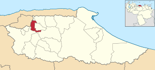
Altamira is a neighborhood located in the Chacao municipality of Caracas, Venezuela. It has its own Metro Station, many hotels and restaurants, and it is an important business and residential center of the city. It is also an important tourist destination and cultural center in Caracas. The Francisco de Miranda avenue and the Distibuidor Altamira are both located in Altamira. This neighborhood borders El Ávila National Park to the north, La Castellana neighborhood to the west, Los Palos Grandes to the east, and Bello Campo neighborhood to the south. It has an estimated area of 161 hectares or approximately 1.61 square kilometers.

<span class="mw-page-title-main">Municipalities of Venezuela</span> Subdivisions of the States of Venezuela

Municipalities of Venezuela are subdivisions of the States of Venezuela. There are 335 municipalities dividing the 23 states and the Capital District.

<span class="mw-page-title-main">Baruta Municipality</span> Municipality in Miranda, Venezuela

Baruta is a municipality within the Metropolitan District of Caracas in Venezuela.

<span class="mw-page-title-main">El Hatillo Municipality</span> Municipality in Miranda, Venezuela

El Hatillo Municipality is an administrative division of the State of Miranda, Venezuela; along with Baruta, Chacao, Libertador and Sucre, it is one of the five municipalities of Caracas, the capital of Venezuela. It is located in the southeastern area of Caracas, and in the northwestern part of the State of Miranda.

<span class="mw-page-title-main">Petare</span> Place in Miranda, Venezuela

Dulce Nombre de Jesus de Petare is a neighborhood in Miranda, Venezuela, and is part of the Metropolitan District of Caracas. It is located in the Sucre Municipality, one of the five divisions of Caracas. The city was founded in 1621 under the name of San Jose de Guanarito. It grew to become a part of the Greater Caracas area as the latter expanded in area and population. Petare had a population of 372,106 inhabitants and about 448,861 according to 2020 estimates. Petare is the biggest slum in Venezuela, and in South America.

<span class="mw-page-title-main">El Tigre</span> City in Anzoátegui, Venezuela

El Tigre is a city of Anzoategui, a state located east of Venezuela's capital city of Caracas. Located in what is called the "Guanipa Mesa", a river (Tigre) runs across the city. The average temperature is 79°F, all year around, and the annual average rainfall is 1,200mm. One nearby tourist destination is the Chimire Cliffs.

<span class="mw-page-title-main">El Rosal, Caracas</span> Neighborhood of Caracas, Venezuela

El Rosal is a neighbourhood of Caracas, Venezuela, in the Chacao municipality. It is located at East Caracas, near the geographic center of Caracas and is one of its financial centres. It has an estimated area of 50.9 hectares

<span class="mw-page-title-main">East Caracas</span> Municipalities of East Caracas in Miranda, Venezuela

East Caracas generally refers to the eastern portions of Caracas, and may refer specifically to the municipalities from the Metropolitan District of Caracas located in Miranda State: Chacao, Baruta, Sucre, and El Hatillo. It concentrates the 34.8% population of the Metropolitan District of Caracas, and the 21.7% population of the Greater Caracas Area. Caracas Country Club, the richest neighborhood of the city, is located between El Recreo and Chacao districts.

<span class="mw-page-title-main">Neomar Lander</span> Venezuelan protester killed in 2017

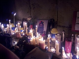
Neomar Alejandro Lander Armas was a Venezuelan barman and protester killed during the 2017 Venezuelan protests.

<span class="mw-page-title-main">El Recreo Shopping Mall</span> Shopping mall in Caracas, Venezuela

El Recreo Shopping Mall is a large shopping mall in the commercial, financial, tourist and cultural district of Sabana Grande, Caracas, Venezuela. According to Top Shopping Centers magazine, the mall averaged three million visitors per month in 2013-2014. At 28 metres (92 ft) and seven floors below grade, it is Latin America's deepest construction and part of the late-1990s real-estate boom in Sabana Grande. El Recreo Shopping Mall was designed by Venezuelan architects Carlos Gómez de Llarena and Moisés Benacerraf. The shopping center's twin towers—the 125-metre (410 ft) Citibank and Movilnet Towers—are the tallest skyscrapers in the Venezuelan capital. The mall is connected to the Gran Meliá Caracas Hotel.

<span class="mw-page-title-main">Boulevard of Sabana Grande</span>

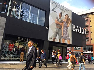
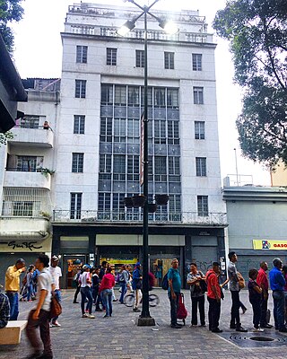
The Boulevard of Sabana Grande is an important leisure and shopping area located in eastern Caracas in the geographic center of the Metropolitan District of Caracas. It is a pedestrian-only, tree-shaded public space. In 2011, the boulevard of Sabana Grande went through a rehabilitation process founded by PDVSA La Estancia. A commercial and financial district, Sabana Grande is the commercial corridor, and a tourist district of Caracas. The boulevard of Sabana Grande is home to the most important ornithological collection in Latin America, the William Phelps Ornithological Collection. Until the beginning of the 20th century, it was called Calle Real because it was the town's main road.

<span class="mw-page-title-main">William Phelps Ornithological Collection</span> Science museum in Caracas, Venezuela

The William Phelps Ornithological Collection, also known as the Phelps Ornithological Museum, is a museum of natural sciences dedicated to the study, exhibition and preservation of the birds of Venezuela and the rest of Latin America. The collection is located east of Caracas and in the geographic center of Greater Caracas, in the heart of the Sabana Grande district. The William Phelps ornithological collection is the most important in Latin America and it is also the most important private collection in the world in its research area.

<span class="mw-page-title-main">City Market Shopping Mall</span> Shopping mall in Caracas, Venezuela

City Market Shopping Mall is an important shopping center located east of Caracas and in the geographical center of the Gran Caracas. It is part of the district of Sabana Grande designed by architect Enrique Feldman., Overall, he City Market Mall has a structure of 20 thousand square meters, five floors and 222 premises. Feldman took advantage of the strategic location of the project to integrate the mall with the Boulevard of Sabana Grande.

<span class="mw-page-title-main">Plaza Venezuela station</span> Caracas metro station

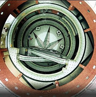
Plaza Venezuela is a Caracas Metro station on Lines 1 and 3. The Line 1 station was opened on 27 March 1983 as part of the extension of the line from La Hoyada to Chacaíto. The station is between Colegio de Ingenieros and Sabana Grande.

<span class="mw-page-title-main">Sabana Grande station</span> Caracas metro station

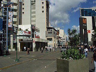
Sabana Grande is a Caracas Metro station on Line 1. It was opened on 27 March 1983 as part of the extension of Line 1 from La Hoyada to Chacaíto. The station is between Plaza Venezuela and Chacaíto.

<span class="mw-page-title-main">Chacaíto station</span> Caracas metro station

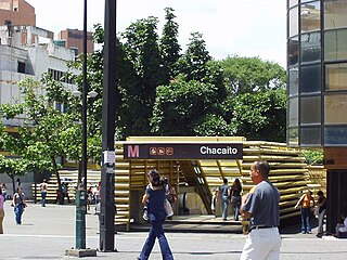
Chacaíto is a Caracas Metro station on Line 1. It was opened on 27 March 1983 as the eastern terminus of the extension of Line 1 from La Hoyada. On 23 April 1988 the line was extended to Los Dos Caminos. The station is between Sabana Grande and Chacao.

References

  1. 1 2 3 Flores Ramírez, Gildred Del Valle (2015). "Reordenamiento integral de la avenida casanova y su zona de injerencia" (PDF). Tesis de grado Universidad Simón Bolívar USB. Archived (PDF) from the original on 20 March 2018. Retrieved 20 March 2018.
  2. "Caracas y sus Casas de Hacienda. De la tradición a la Modernidad". Linkedin. Margarita Peña Gómez.[ dead link ]
  3. "Historia de la Casona Hacienda Ibarra". Actualidad 24. 2016. Archived from the original on 11 March 2018. Retrieved 17 March 2018.
  4. Martín Frechilla, Juan José (2004). Diálogos reconstruidos para una historia de la Caracas moderna. Caracas, Venezuela: CDCH UCV.
  5. 1 2 "Revista Epale Caracas". p. 83.
  6. Hernández V, José G. Anécdotas Hípicas Venezolanas presenta Sabana Grande: Cuna del Hipismo en Venezuela (1895–1896) Archived 2012-09-07 at the Wayback Machine
  7. 1 2 Landaeta Rosales, Manuel (1908). La iglesia y plaza de la Candelaria de Caracas. University of North Carolina at Chapel Hill University Library. Caracas : Impr. Bolívar.
  8. Veloso Saad, José. 1976: La Caracas de aquellos tiempos. Caracas. 160p.
  9. Schael, Guillermo José. 1985: Caracas la ciudad que no vuelve. Cuarta Edición. Talleres de Gráficas Armitano, S.A. Caracas. 223p. ISBN   980-265-037-4
  10. Oficina de las Repúblicas Americanas. 1993: Venezuela 1899. Ediciones de la Presidencia de la República. Caracas. 279p.
  11. 1 2 González Casas, Gónzalo. "Compraventas en CCS: De la bodega esquinera al mall". CCScity450 (in European Spanish). Archived from the original on 2018-06-12. Retrieved 2018-05-01.
  12. 1 2 Andrade Racenis, Vanessa (2004). "Sabana Grande Punto de Encuentro" (PDF). Tesis de Grado: 60. Archived (PDF) from the original on 2018-01-27. Retrieved 2018-03-22.