Sacramento, Kentucky

Last updated
Sacramento, Kentucky
Sacramento-Main-ky.jpg
Sacramento
McLean County Kentucky Incorporated and Unincorporated areas Sacramento Highlighted 2167638.svg
Location in McLean County, Kentucky
Coordinates: 37°24′59″N87°16′4″W / 37.41639°N 87.26778°W / 37.41639; -87.26778 Coordinates: 37°24′59″N87°16′4″W / 37.41639°N 87.26778°W / 37.41639; -87.26778
Country United States
State Kentucky
County McLean
Incorporated1860 [1]
Named for the California city or river [2]
Area
[3]
  Total0.43 sq mi (1.12 km2)
  Land0.43 sq mi (1.11 km2)
  Water0.00 sq mi (0.00 km2)
Elevation
492 ft (150 m)
Population
 (2020) [4]
  Total429
  Density997.67/sq mi (384.99/km2)
Time zone UTC-6 (Central (CST))
  Summer (DST) UTC-5 (CDT)
ZIP code
42372
Area code 270
FIPS code 21-67638
GNIS feature ID0502550

Sacramento is a home rule-class city in McLean County, Kentucky, in the United States. The population was 429 as of the 2020 census. [4] It is included in the Owensboro metropolitan area.

Contents

History

Early history

The first community at the site was known as "Crossroads", but the post office established in 1852 was named "Social Hill". In 1854, George L. Helm platted the town and renamed it Sacramento. [2] Local tradition holds the name was suggested by John Vickers, recently returned from the California Gold Rush. [5] The city was incorporated on October 8, 1860, [1] and the post office followed suit the next year. [2]

The Battle of Sacramento

Sacramento was the site of a Civil War battle between Union forces under Maj. Eli H. Murray and Confederate forces under Colonel Nathan Bedford Forrest. Nicknamed "Forrest's First Fight", the Battle of Sacramento took place on December 28, 1861. [6] The battle began when a Confederate sympathizer named Mollie Morehead [6] informed Forrest that a Union force was watering their horses nearby. Forrest used the element of surprise to rout the Union troops. [7] The city holds an annual reënactment of the battle in which local residents participate, along with professional and amateur reënactors.

Geography

Sacramento is located in southern McLean County at 37°24′59″N87°16′4″W / 37.41639°N 87.26778°W / 37.41639; -87.26778 (37.416489, -87.267839). [8] The city is concentrated around the intersection of Kentucky Route 81/Kentucky Route 85 (Main Street) and Kentucky Route 254 (2nd Street), northeast of Madisonville. KY 81 and KY 85 converge in the northeastern part of town, and diverge just south of the city. KY 81 leads north 10 miles (16 km) to Calhoun, the county seat, and southeast the same distance to [[South Carrollton, Kentucky|South Carrollton], while KY 85 leads east 8 miles (13 km) to Island and west 15 miles (24 km) to Madisonville. KY 254 also leads to Madisonville, by a more northerly route of 18 miles (29 km).

According to the United States Census Bureau, Sacramento has a total area of 0.43 square miles (1.1 km2), all land. [3]

Demographics

Historical population
CensusPop.Note
1860 373
1870 195−47.7%
1880 172−11.8%
1890 29772.7%
1900 43446.1%
1910 4380.9%
1920 410−6.4%
1930 327−20.2%
1940 37915.9%
1950 378−0.3%
1960 42913.5%
1970 4371.9%
1980 53823.1%
1990 5634.6%
2000 517−8.2%
2010 468−9.5%
2020 429−8.3%
U.S. Decennial Census [9]

As of the census [10] of 2000, there were 517 people, 219 households, and 150 families residing in the city. The population density was 1,229.5 inhabitants per square mile (474.7/km2). There were 238 housing units at an average density of 566.0 per square mile (218.5/km2). The racial makeup of the city was 93.81% White, 3.09% African American, 0.77% Native American, 0.58% from other races, and 1.74% from two or more races. Hispanic or Latino of any race were 0.97% of the population.

There were 219 households, out of which 27.4% had children under the age of 18 living with them, 49.3% were married couples living together, 15.1% had a female householder with no husband present, and 31.5% were non-families. 26.9% of all households were made up of individuals, and 12.8% had someone living alone who was 65 years of age or older. The average household size was 2.36 and the average family size was 2.77.

In the city, the population was spread out, with 22.2% under the age of 18, 10.3% from 18 to 24, 25.7% from 25 to 44, 26.7% from 45 to 64, and 15.1% who were 65 years of age or older. The median age was 36 years. For every 100 females, there were 95.8 males. For every 100 females age 18 and over, there were 89.6 males.

The median income for a household in the city was $23,889, and the median income for a family was $27,344. Males had a median income of $22,045 versus $22,083 for females. The per capita income for the city was $11,811. About 19.1% of families and 21.8% of the population were below the poverty line, including 25.8% of those under the age of 18 and 21.7% of those age 65 or over.

Related Research Articles

<span class="mw-page-title-main">Hopkins County, Kentucky</span> County in Kentucky, United States

Hopkins County is a county located in the western part of the U.S. state of Kentucky. As of the 2020 census, the population was 45,423. Its county seat is Madisonville. Hopkins County was created December 9, 1806 from Henderson County. It was named for General Samuel Hopkins, an officer in both the American Revolutionary War and War of 1812, and later a Kentucky legislator and U.S. Congressman.

<span class="mw-page-title-main">Boyle County, Kentucky</span> County in Kentucky, United States

Boyle County is a county located in the central part of Kentucky. As of the 2020 census, the population was 30,614. Its county seat is Danville. The county was formed in 1842 and named for John Boyle (1774–1835), a U.S. Representative, chief justice of the Kentucky Court of Appeals, and later federal judge for the District of Kentucky, and is part of the Danville, KY Micropolitan Statistical Area.

<span class="mw-page-title-main">Perryville, Kentucky</span> City in Kentucky, United States

Perryville is a home rule-class city along the Chaplin River in western Boyle County, Kentucky, in the United States. The population was 751 at the time of the 2010 U.S. Census. It is part of the Danville Micropolitan Statistical Area.

<span class="mw-page-title-main">Crofton, Kentucky</span> City in Kentucky, United States

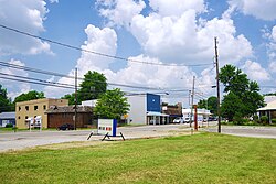
Crofton is a home rule-class city in Christian County, Kentucky, in the United States. The population was 749 at the 2010 census.

<span class="mw-page-title-main">Brownsville, Kentucky</span> City in Kentucky, United States

Brownsville is a home rule-class city in Edmonson County, Kentucky, in the United States. It is the county seat and is a certified Kentucky Trail Town. The population was 836 at the time of the 2010 census, down from 921 at the 2000 census. It is included in the Bowling Green metropolitan area. It is just outside Mammoth Cave National Park.

<span class="mw-page-title-main">Martin, Kentucky</span> City in Kentucky, United States

Martin is a home rule-class city in Floyd County, Kentucky, in the United States. The population was 634 as of the 2010 census.

<span class="mw-page-title-main">Warsaw, Kentucky</span> City in Kentucky, United States

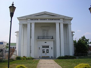
Warsaw is a home rule-class city in and the county seat of Gallatin County, Kentucky, United States, located along the Ohio River. The name was suggested by a riverboat captain, who was reading Thaddeus of Warsaw, by Jane Porter, when the city was being founded.

<span class="mw-page-title-main">Hanson, Kentucky</span> City in Kentucky, United States

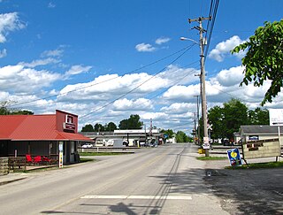
Hanson is a home rule-class city in Hopkins County, Kentucky, in the United States. The population was 742 at the 2010 census, up from 625 at the 2000 census.

<span class="mw-page-title-main">Madisonville, Kentucky</span> City in Kentucky, United States

Madisonville is a home rule-class city in and the county seat of Hopkins County, Kentucky, United States, located along Interstate 69 in the state's Western Coal Fields region. The population was 19,591 at the 2010 census. Madisonville is a commercial center of the region and is home to Madisonville Community College.

<span class="mw-page-title-main">Mortons Gap, Kentucky</span> City in Kentucky, United States

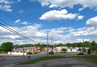
Mortons Gap is a home rule-class city in Hopkins County, Kentucky, in the United States. The population was 728 at the 2020 census, down from 863 at the 2010 census.

<span class="mw-page-title-main">Nebo, Kentucky</span> City in Kentucky, United States

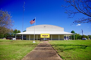
Nebo is a home rule-class city in Hopkins County, Kentucky, in the United States. The population was 236 as of the 2010 census.

<span class="mw-page-title-main">Nortonville, Kentucky</span> City in Kentucky, United States

Nortonville is a home rule-class city in Hopkins County, Kentucky, in the United States. The population was 1,204 as of the 2010 census.

<span class="mw-page-title-main">Kuttawa, Kentucky</span> City in Kentucky, United States

Kuttawa is a home rule-class city in Lyon County, Kentucky, in the United States. The population was 649 as of the 2010 census, up from 596 in 2000.

Reidland is an unincorporated community and census-designated place (CDP) in McCracken County, Kentucky, United States. The population was 4,526 at the 2020 census. It is part of the Paducah, KY-IL Micropolitan Statistical Area.

<span class="mw-page-title-main">Island, Kentucky</span> City in Kentucky, United States

Island is a home rule-class city in McLean County, Kentucky, in the United States. The population was 429 at the 2020 census. It is included in the Owensboro metropolitan area.

<span class="mw-page-title-main">Burgin, Kentucky</span> City in Kentucky, United States

Burgin is a home rule-class city in Mercer County, Kentucky, in the United States. Its population was 965 at the 2010 census.

<span class="mw-page-title-main">South Carrollton, Kentucky</span> City in Kentucky, United States

South Carrollton is a home rule-class city in Muhlenberg County, Kentucky, United States. The population was 184 at the 2000 census. Founded as Randolph Old Farm in 1838, an early pioneer changed the name of the city to honor his son, Carroll. The name was prefixed with south in order to disambiguate the city from Carrollton, Kentucky.

<span class="mw-page-title-main">Providence, Kentucky</span> City in Kentucky, United States

Providence is a home rule-class city in Webster County, Kentucky, in the United States. The population was 3,193 at the time of the 2010 United States Census, making the most populous community in the county.

<span class="mw-page-title-main">Dawson Springs, Kentucky</span> City in Kentucky, United States

Dawson Springs is a home rule-class city in Hopkins and Caldwell counties in the U.S. state of Kentucky. As of the 2020 census, the population of the city was 2,452.

<span class="mw-page-title-main">Eubank, Kentucky</span> City in Kentucky, United States

Eubank is a home rule-class city in Pulaski and Lincoln counties in southern Kentucky. The population was 319 at the 2010 census.

References

  1. 1 2 Commonwealth of Kentucky. Office of the Secretary of State. Land Office. "Sacramento, Kentucky". Accessed 26 August 2013.
  2. 1 2 3 Rennick, Robert. Kentucky Place Names, p. 259. University Press of Kentucky (Lexington), 1987. Accessed 4 October 2013.
  3. 1 2 "2022 U.S. Gazetteer Files: Kentucky". United States Census Bureau. Retrieved May 11, 2023.
  4. 1 2 "P1. Race – Sacramento city, Kentucky: 2020 DEC Redistricting Data (PL 94-171)". U.S. Census Bureau. Retrieved May 11, 2023.
  5. Battle of Sacramento. "Sacramento".
  6. 1 2 Battle of Sacramento. Main page.
  7. Battle of Sacramento. "History".
  8. "US Gazetteer files: 2010, 2000, and 1990". United States Census Bureau. 2011-02-12. Retrieved 2011-04-23.
  9. "Census of Population and Housing". Census.gov. Retrieved June 4, 2015.
  10. "U.S. Census website". United States Census Bureau . Retrieved 2008-01-31.