Cantabria is an autonomous community and province in northern Spain with Santander as its capital city. It is called a comunidad histórica, a historic community, in its current Statute of Autonomy. It is bordered on the east by the Basque autonomous community, on the south by Castile and León, on the west by the Principality of Asturias, and on the north by the Cantabrian Sea.
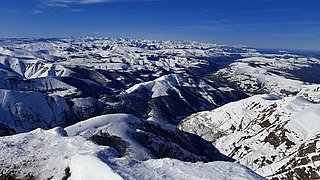
The Cantabrian Mountains or Cantabrian Range are one of the main systems of mountain ranges in Spain. They stretch for over 300 km (180 miles) across northern Spain, from the western limit of the Pyrenees to the Galician Massif in Galicia, along the coast of the Cantabrian Sea. Their easternmost end meets the Sistema Ibérico.

Torrelavega is a municipality and important industrial and commercial hub in the single province Autonomous Community of Cantabria, northern Spain.

The Battle of Santander was a battle fought in the War in the North campaign of the Spanish Civil War during the summer of 1937. Santander's fall on 26 August assured the Nationalist conquest of the province of Santander, now Cantabria. The battle devastated the Republic's "Army of the North"; 60,000 soldiers were captured by the Nationalists.

Liébana is a comarca of Cantabria (Spain). It covers 575 square kilometres and is located in the far southwest of Cantabria, bordering Asturias, León and Palencia. It is made up of the municipalities of: Cabezón de Liébana, Camaleño, Cillorigo de Liébana, Pesaguero, Potes, Tresviso and Vega de Liébana.
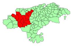
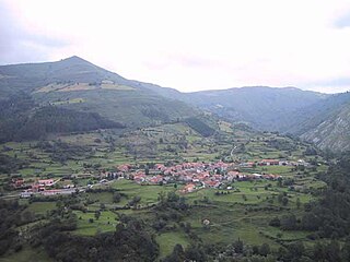
The Besaya valley is both a comarca located in the center of Cantabria, along the course of the Besaya River, and the natural valley of said river. Its capital is Torrelavega.

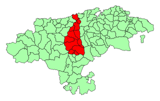
Campoo is a comarca of Cantabria (Spain) located in the High Ebro, with a surface little bigger than 1,000 km2, and including the municipalities of Hermandad de Campoo de Suso, Campoo de Enmedio, Campoo de Yuso, Valdeolea, Valdeprado del Río, Valderredible, Reinosa, Las Rozas de Valdearroyo, Santiurde de Reinosa, Pesquera, and San Miguel de Aguayo. Their inhabitants are called Campurrians . Its highest elevation is the Cuchillón peak, and the lowest is Pesquera, with the capital, Reinosa at 850 m.
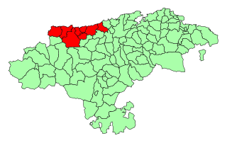
The Western Coast of Cantabria is a comarca of said Spanish autonomous community which comprises the municipalities of Val de San Vicente, San Vicente de la Barquera, Valdáliga, Comillas, Udías, Ruiloba, Alfoz de Lloredo and Santillana del Mar.

Valles Pasiegos is an administrative comarca in Cantabria, Spain. It is formed by the valleys of the Pas and Miera rivers, each one being a natural comarca of its own.

The Saja is a river in the autonomous community of Cantabria, northern Spain. It flows into the Cantabric sea. Part of its course is inside the Saja-Besaya Natural Park
The Sierra del Escudo de Cabuérniga is a mountain range in Cantabria, Spain. It is a northern foothill of the Cantabrian Mountains, located between the main ranges and the Bay of Biscay. Its highest point is 927 m high Gándara.

Bárcena Mayor is a village nestled in the mountains of Cantabria, Spain in the municipality of Los Tojos, and is the only residential village within Saja Reservation within the Saja and Nansa valleys community.

Potes is a municipality in the autonomous community of Cantabria in Spain. It is the capital of the Comarca of Liébana and is located in the centre of it. It is bordered to the north by Cillorigo de Liébana, to the west by Camaleño, to the south by Vega de Liébana and to the east by Cabezón de Liébana.

Saja-Besaya Natural Park is Cantabrias largest natural park on the northern slope of the Cantabrian Mountains in West Central Cantabria, Spain. Its hunting reserve is approximately 1800km², the largest and most important in Spain.

Rionansa is a municipality located in the autonomous community of Cantabria, Spain.
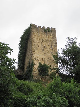
In Cantabria, there is a big number of fortified towers that fulfilled functions of housing and defense. These buildings, generally battlements, were erected mostly between the 13th and 15th centuries by noble families and influenced significantly in the architecture of Cantabria, passing some to be forts-houses, prelude to the future casona montañesa. A curious fact is that there are not in the region circular towers, as yes happens in the neighboring community of Asturias. Currently of the towers that survives several are in a deplorable condition.

Asturias de Santillana is a historical comarca whose territory in large part corresponded to the central and western part of today's autonomous community of Cantabria, as well as the extreme east of Asturias. Most of the province of Asturias belonged to the comarca of Asturias de Oviedo. Also known also as a merindad and documented since the 13th century, Asturias de Santillana comprised the western part of Cantabria including the Saja River valley and the Nansa River. Its borders used to go along the coast from the council of Ribadedeva to the municipality of El Astillero, to the shores of the Bay of Santander), which leads to the administrative division of Trasmiera. From the south it went up to the Cantabrian cordillera. All of the valleys of this comarca are perpendicular to the coast.

The Latarmá, Latarma or Arria river is a fluvial course in Cantabria, Spain. It is a tributary of the Lamasón River and a subaffluent of the Nansa River, to whose river basin it belongs. Measuring 9 kilometres (5.6 mi) in length, it rises from an altitude of 339 metres (1,112 ft) to 180 metres (590 ft) at discharge.
The Nine Valleys lawsuit or simply Valleys lawsuit was a process that confronted the Nine Valleys of the Asturias de Santillana with the Dukedom of the Infantado. Begun in 1544 and it was ruled in 1581 in favor of the Nine Valleys. Its importance was capital in the process of the territorial configuration of Cantabria, since he achieved the independence of the valleys, constituted in the province of the Nine Valleys in 1589, germ in turn of the province of Cantabria of 1778, and caused the retreat of the manorial domains in the region. His memorial occupies 178 folios.
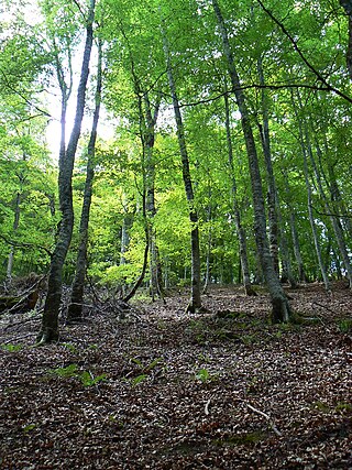
The flora of Cantabria is the result of three determining factors: the climate, the composition of the soil, directly dependent on the types of existing rocks, and the evolutionary history of the different plant formations.