Related Research Articles

Strategic Air Command (SAC) was a United States Department of Defense Specified Command and a United States Air Force (USAF) Major Command responsible for command and control of the strategic bomber and intercontinental ballistic missile components of the United States military's strategic nuclear forces from 1946 to 1992. SAC was also responsible for strategic reconnaissance aircraft; airborne command posts; and most of the USAF's aerial refueling aircraft.

Hunter Army Airfield, located in Savannah, Georgia, United States, is a military airfield and subordinate installation to Fort Stewart located in Hinesville, Georgia.

Wendover Air Force Base is a former United States Air Force base in Utah now known as Wendover Airport. During World War II, it was a training base for B-17 and B-24 bomber crews. It was the training site of the 509th Composite Group, the B-29 unit that carried out the atomic bombings of Hiroshima and Nagasaki.

The 1st Combat Evaluation Group was a Strategic Air Command (SAC) unit. It was formed on 1 August 1961 to merge the 3908th Strategic Standardization Group for SAC aircrew evaluation with the 1st Radar Bomb Scoring Group that had originated from the 263rd Army Air Force Base Unit which transferred from 15th AF to directly under Strategic Air Command c. 1946. The 1CEVG formed after SAC switched to low-level tactics to counter Soviet surface-to-air missiles and SAC had "developed a Radar Bomb Scoring field kit for use in NIKE Systems" in early 1960 for scoring SAC training missions against US Hercules SAM sites. The 1CEVG headquarters included an Office of History and a "standardization and evaluation school" for command examiners.

The Nevada Test and Training Range (NTTR) is one of two military training areas at the Nellis Air Force Base Complex in Nevada and used by the United States Air Force Warfare Center at Nellis Air Force Base. The NTTR land area includes a "simulated Integrated Air Defense System", several individual ranges with 1200 targets, and 4 remote communication sites. The current NTTR area and the range's former areas have been used for aerial gunnery and bombing, for nuclear tests, as a proving ground and flight test area, for aircraft control and warning, and for Blue Flag, Green Flag, and Red Flag exercises.
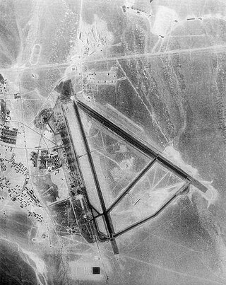
Tonopah Air Force Base is a Formerly Used Defense Site (FUDS) in the USA that was a Tonopah Basin military installation until shortly after it was designated an Air Force Base in 1948. Two of the runways still in use are maintained by Nye County, Nevada; and World War II building foundations and three hangars of the base remain at the municipal Tonopah Airport.
Formerly Used Defense Sites are properties that were owned by, leased to, or otherwise possessed by the United States and under the jurisdiction of the United States Secretary of Defense. The term also refers to the U.S. military program created in 1986 for assessment and environmental restoration, if any, led by the U.S. Army Corps of Engineers.
Cheli Air Force Station, in Bell, southeastern Los Angeles County, California, was a United States Air Force installation and a Cold War Radar Bomb Scoring site of the Strategic Air Command, from 1947 to 1961.
Radar Bomb Scoring is a combat aviation ground support operation used to evaluate Cold War aircrews' effectiveness with simulated unguided bomb drops near radar stations of the United States Navy, the USAF Strategic Air Command, and Army Project Nike units. USAF RBS used various ground radar, computers, and other electronic equipment such as jammers to disrupt operations of the bomber's radar navigator, AAA/SAM simulators to require countermeasures from the bomber, and Radar Bomb Scoring Centrals for estimating accuracy of simulated bombings. Scores for accuracy and electronic warfare effectiveness were transmitted from radar sites such as those at Strategic Range Training Complexes.
RBS Express railroad trains were 3 mobile United States Air Force radar stations for 1CEVG Radar Bomb Scoring (RBS) of Strategic Air Command bomber crews beginning in March 1961. Electronic equipment included the "MSQ-39, TLQ-11, MPS-9, and the IFF/SIF for the MSQ-39" along with support railcars, and the trains were temporarily used at various rail sites with the radar antennas emplaced using hoists built onto flatcars. Pulled by a "contracted locomotive" that left the train at the site, and a North American B-25 Mitchell was used for calibration of the radar station.

The Badlands Bombing Range (BBR) refers to Rapid City Army Air Base target ranges for World War II which included the current Air Force Retained Area, an inactive 2,486-acre (10.06 km2) United States Air Force site "20 miles southeast" of Scenic, South Dakota. The retained area is the remainder of 341,726 acres (1,382.92 km2) federally acquired in 1942 under eminent domain at the Pine Ridge Indian Reservation. In addition to use by World War II aircraft, BBR was used for a post-war Army National Guard gunnery range and a Cold War Radar Bomb Scoring site.

The 99th Range Group is an inactive United States Air Force (USAF) unit. It was last stationed at Nellis AFB, Nevada, where it was responsible for the Nevada Test and Training Range (NTTR).
The Bayshore Bomb Scoring Site is a Formerly Used Defense Site (FUDS) that was used as a Strategic Air Command radar station for Radar Bomb Scoring. The site was activated in 1963 at Charlevoix, Michigan by Detachment 6 of the 1CEVG's Radar Bomb Scoring Division. Det 6 moved to the site from Ironwood, Michigan,* and was tracking the 1971 Big Rock Point B-52 crash.
The Stockton Ordance Depot was a World War II vehicle repair facility, supply depot, and camp for German and Italian prisoners of war. The installation was also used as a USAF radar station and a DLA Defense Distribution Center.

Hawthorne Bomb Plot is a Formerly Used Defense Site that had a Strategic Air Command (SAC) AUTOTRACK radar station during the Cold War. Operations began at a temporary RBS train site for RBS Express #2 was at the Hawthorne area in December 1961, and the 11th Radar Bomb Scoring Squadron subsequently established the fixed military installation for Radar Bomb Scoring in Babbitt, Nevada, the military housing community near the local Navy/Army depot.
The Interior Radar Bomb Scoring Site opened in August 1960 on Hurley Butte, adjacent to the Pine Ridge Indian Reservation and a few miles from Interior, South Dakota. The Interior RBSS is a Formerly Used Defense Site, that closed in 1968.
The 3903rd Radar Bomb Scoring Group was a military evaluation unit under direct command of Strategic Air Command (SAC) headquarters for scoring simulated bomb runs using automatic tracking radar stations. Initially an Army Air Forces Base Unit (AAFBU) and then a squadron, the 3903rd RBS Group was personnel, assets, and detachments were redesignated the 1st Radar Bomb Scoring Group and then the 1CEVG Radar Bomb Scoring Division when the RBS Group merged with the 3908th Strategic Standardization Group in 1961, the year RBS Express trains began to be used for low-altitude Boeing B-52 Stratofortress operations..
Havre Electronic Bomb Scoring Site is a Formerly Used Defense Site for USAF evaluation of aircrews on training missions. The site was initially established for the 1965 Fairchild Trophy, the Strategic Air Command Bombing and Navigation Competition. ; the RBS Express was stationed at a siding near Chinook, Montana; and a new "temporary mobile radar site" 35 mi (56 km) northeast of Havre, Montana, was announced in 1982. The 1983 site was in Hill County, Montana, with seven semi-trailers, and a new permanent site was approved by 1984 for also north of Havre "Upon decommissioning of [the mobile site at] Havre, MT Serial Number 7 went to Detachment 18, Forsyth, Montana for SAC Bomb-Comp 1987 and then to Detachment 20, 1 CEVG in early 1988."

Fairfax Field was a wartime (WWII) facility of the United States Army Air Forces and later, the United States Air Force. The installation was north of Kansas City, Kansas. Used as a pre-war Naval Air Station, the United States Army Air Forces leased the municipal airfield and built an Air Force Plant and modification center for North American B-25 Mitchell medium bomber production. Military use of the site continued as late as 1957 by the Strategic Air Command's 3903rd Radar Bomb Scoring Group for bombing practice.
References
- ↑ "Army Corps of Engineers, Formerly Used Defense Sites - List of Sites Sorted by". corpsfuds.org. Archived from the original on 5 October 2013. Retrieved 15 January 2022.
- ↑ Finding of No Department of Defense Actions Indicated: …Milford Radar Bomb Scoring Site (PDF) (Report). CorpsFUDS.org. Retrieved 8 July 2012.[ permanent dead link ] ((Google Maps shows 2 locations)
- 1 2 3 4 Prepared by EMASSIST, INC. (May 2005). Salt Lake City Air Reserve Center: DERP-FUDS site no. J08UT092700 (No DoD Actions Indicated document) (Report). U.S. Army Corps of Engineers . Retrieved 17 July 2012.
The site has formerly been known as Salt Lake City Air Base, Salt Lake City Army Air Field, Salt Lake City Bomb Scoring Site, Salt Lake City Radar Bomb Scoring Site, and Air Force Installation No. 2247. The site is 0.34 of an acre. … Bldg No. 1305 [was used] After renovation, the Air Force used it as an airman dormitoryfor the radar bomb scoring detachments.
[ permanent dead link ] (includes p. 5 site map has a designator mark corresponding to 40.781126,-111.956327 on the newer Google image) - ↑ "title tbd". Archived from the original (biography) on 13 May 2008.
About May 1954 he was assigned to a semi-mobile Radar Bomb Scoring/Electronic Counter Measures Unit (SAC) at Phoenix, Arizona – in December 1954 that unit relocated to the municipal airport at Salt Lake City, Utah.
- ↑ "Spokane Daily Chronicle - Google News Archive Search". news.google.com.
- ↑ Gwynn, J. Wallace (4 October 1980). Great Salt Lake. Utah Geological Survey. ISBN 9781557910837 – via Google Books.
- ↑ "Subscription" . Salt Lake City: Salt Lake Tribune. 17 March 1950. p. 24. Retrieved 7 June 2023– via NewspaperArchive.com.
- ↑ "Bombers To Descend Near Alto Series of Mock Air Attacks". The Cherokeean. Rusk, Texas. 28 December 1961. Retrieved 9 July 2012.
At the target area near Greenville, radar bomb scoring equipment mounted on an Air Force train
- ↑ "The Tooele Army Depot". UtahRails.net. 5 August 2011. Retrieved 8 July 2012.
- ↑ Livingood, Jay. "Rail Bomb 'Scorer' Gets Overhaul At Hill Air Base". The Deseret News . Retrieved 8 July 2012.