San Carlos, Arizona

Last updated

San Carlos, Arizona
Gila County Incorporated and Unincorporated areas San Carlos highlighted.svg
Location in Gila County and the state of Arizona
Usa edcp location map.svg
Red pog.svg
San Carlos
Location in the United States
USA Arizona location map.svg
Red pog.svg
San Carlos
San Carlos (Arizona)
Coordinates: 33°21′4″N110°27′8″W / 33.35111°N 110.45222°W / 33.35111; -110.45222
Country Flag of the United States (23px).png  United States
State Flag of Arizona.svg  Arizona
County Gila
Area
[1]
  Total8.58 sq mi (22.23 km2)
  Land8.58 sq mi (22.21 km2)
  Water0.01 sq mi (0.01 km2)
Elevation
2,650 ft (801 m)
Population
 (2020)
  Total3,987
  Density464.85/sq mi (179.48/km2)
Time zone UTC-7 (MST (no DST))
ZIP code
85550
Area code 928
FIPS code 04-62910
GNIS feature ID 10812

San Carlos (Western Apache : Sengaah [2] ) is a census-designated place (CDP) in Gila County, Arizona, United States. The population was 4,038 at the 2010 census, [3] up from 3,716 in 2000.

Contents

San Carlos is the largest community in and the seat of government for the San Carlos Apache Indian Reservation.

San Carlos' economy is underdeveloped and is based mainly on retail service industries, construction trades, and public administration.

Geography

San Carlos is located in southeastern Gila County at 33°21′4″N110°27′36″W / 33.35111°N 110.46000°W / 33.35111; -110.46000 (33.351069, -110.459862). [4] Its eastern border is the San Carlos River, which is also the Graham County line. The San Carlos River flows south 8 miles (13 km) to San Carlos Lake, an impoundment on the Gila River.

According to the United States Census Bureau, the CDP has a total area of 8.6 square miles (22.2 km2), of which 0.004 square miles (0.01 km2), or 0.06%, is water. [3]

San Carlos is located within the San Carlos Apache Indian Reservation.

Demographics

Historical population
CensusPop.Note
1970 2,542
1980 2,6685.0%
1990 2,9189.4%
2000 3,71627.3%
2010 5,28842.3%
2020 3,987−24.6%
source: [5]

As of the census [6] of 2000, there were 3,716 people, 921 households, and 754 families living in the CDP. The population density was 420.9 inhabitants per square mile (162.5/km2). There were 994 housing units at an average density of 112.6 per square mile (43.5/km2). The racial makeup of the CDP was 92.6% Native American, 4.6% White, 0.2% Black or African American, 0.3% Asian, 0.2% from other races, and 2.0% from two or more races. 2.6% of the population were Hispanic or Latino of any race.

There were 921 households, out of which 49.1% had children under the age of 18 living with them, 46.1% were married couples living together, 29.4% had a female householder with no husband present, and 18.1% were non-families. 14.4% of all households were made up of individuals, and 2.7% had someone living alone who was 65 years of age or older. The average household size was 4.0 and the average family size was 4.4.

In the CDP, the population was spread out, with 42.1% under the age of 18, 8.7% from 18 to 24, 28.0% from 25 to 44, 15.8% from 45 to 64, and 5.4% who were 65 years of age or older. The median age was 24 years. For every 100 females, there were 96.4 males. For every 100 females age 18 and over, there were 96.2 males.

The median income for a household in the CDP was $13,412, and the median income for a family was $14,219. Males had a median income of $16,216 versus $22,563 for females. The per capita income for the CDP was $4,615. About 57.5% of families and 58.8% of the population were below the poverty line, including 62.4% of those under age 18 and 56.5% of those age 65 or over.

Transportation

San Carlos Apache Nnee Bich'o Nii Transit provides transportation on the reservation and to Safford and Globe. [7]

Education

San Carlos is served by the San Carlos Unified School District.

Related Research Articles

<span class="mw-page-title-main">Gila County, Arizona</span> County in Arizona, United States

Gila County is in the central part of the U.S. state of Arizona. As of the 2020 census, the population was 53,272. The county seat is Globe.

<span class="mw-page-title-main">Graham County, Arizona</span> County in Arizona, United States

Graham County is a county in the southeastern part of the U.S. state of Arizona. As of the 2020 census, the population was 38,533, making it the third-least populous county in Arizona. The county seat is Safford.
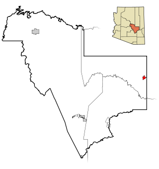
<span class="mw-page-title-main">Canyon Day, Arizona</span> CDP in Gila County, Arizona

Canyon Day is a census-designated place (CDP) in Gila County, Arizona, United States, on the Fort Apache Indian Reservation. The population was 1,209 at the 2010 census.

<span class="mw-page-title-main">Central Heights-Midland City, Arizona</span> CDP in Gila County, Arizona

Central Heights-Midland City is an unincorporated community and census-designated place (CDP) in Gila County, Arizona, United States. The area is home to the Pinal Cemetery which serves the community in gereneral but also contains Croatian and Serbian dedicated sections. The Gila County Health and Human Services offices are located within the region. One of the communities few nurseries is located along Golden Hill Road, a notable road in the Central Heights-Midland City area. The population was 2,534 at the 2010 census.

<span class="mw-page-title-main">Claypool, Arizona</span> CDP in Gila County, Arizona

Claypool is a census-designated place (CDP) in Gila County, Arizona, United States. The population was 1,538 at the 2010 census, down from 1,794 at the 2000 census. It was named after W. D. Claypool, a member of both the State House of Representatives and State Senate in the 1910s and 1920s.

<span class="mw-page-title-main">Globe, Arizona</span> City in Arizona, United States

Globe is a city in Gila County, Arizona, United States. As of the 2020 census, the population of the city was 7,249. The city is the county seat of Gila County. Globe was founded c. 1875 as a mining camp. Mining, tourism, government and retirees are most important in the present-day Globe economy.

<span class="mw-page-title-main">Miami, Arizona</span> Town in Gila County, Arizona

Miami is a town in Gila County, Arizona, United States. Miami is a classic Western copper boom-town. Miami's old downtown has been partly renovated, and the Bullion Plaza Museum features the cultural, mining and ranching history of the Miami area.

<span class="mw-page-title-main">Peridot, Arizona</span> CDP in Gila and Graham Counties, Arizona, US

Peridot is an unincorporated community and census-designated place (CDP) in Gila and Graham counties in the U.S. state of Arizona. The population was 1,350 at the 2010 census.

<span class="mw-page-title-main">Top-of-the-World, Arizona</span> CDP in Gila County, Arizona

Top-of-the-World is a census-designated place (CDP) in Gila and Pinal counties in the U.S. state of Arizona. The population was 274 at the 2020 census, up from 231 at the 2010 census, and down from 330 at the 2000 census.

<span class="mw-page-title-main">Pima, Arizona</span> Town in Graham County, Arizona

Pima is a town in Graham County, Arizona, United States. As of the 2010 census, the population of the town was 2,387, up from 1,989 in 2000. The estimated population in 2018 was 2,512. Pima is part of the Safford Micropolitan Statistical Area.
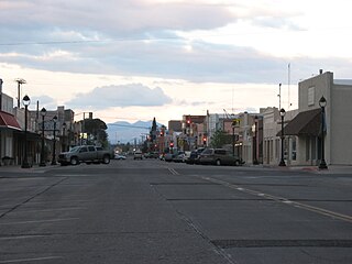
<span class="mw-page-title-main">Safford, Arizona</span> City in Arizona, United States

Safford is a city in Graham County, Arizona, United States. According to the 2020 Census, the population of the city is 10,129. The city is the county seat of Graham County.

<span class="mw-page-title-main">Thatcher, Arizona</span> Town in Graham County, Arizona

Thatcher is a town in Graham County, Arizona, United States. According to the 2010 Census, the population of the town is 4,865. It is part of the Safford Micropolitan Statistical Area.

<span class="mw-page-title-main">Cibecue, Arizona</span> Fort Apache Indian Reservation community

Cibecue is a census-designated place (CDP) in Navajo County, Arizona, United States, on the Fort Apache Indian Reservation. The population was 1,713 in the 2010 United States Census.

<span class="mw-page-title-main">East Fork, Arizona</span> CDP in Navajo County, Arizona

East Fork is a census-designated place (CDP) in Navajo County, Arizona, United States, on the Fort Apache Indian Reservation. The population was 699 at the 2010 census.

<span class="mw-page-title-main">Jeddito, Arizona</span> CDP in Navajo County, Arizona

Jeddito is a census-designated place (CDP) in Navajo County, Arizona, United States. The population was 293 at the 2010 census.

<span class="mw-page-title-main">Whiteriver, Arizona</span> Census designated place in Arizona, United States

Whiteriver is a census-designated place (CDP) located on the Fort Apache Indian Reservation in Navajo County, Arizona, United States. The population was 4,104 at the 2010 census, making it the largest settlement on the Reservation.

<span class="mw-page-title-main">Blackwater, Arizona</span> CDP in Pinal County, Arizona

Blackwater is a native village and census-designated place (CDP) on the Gila River Reservation in Pinal County, Arizona, United States. The population was 1,062 at the 2010 census, up from 504 in 2000.
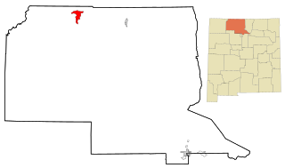
<span class="mw-page-title-main">Dulce, New Mexico</span> Census-designated place in New Mexico, United States

Dulce is a census-designated place (CDP) in Rio Arriba County, New Mexico, United States. The population was 2,743 at the 2010 census, almost entirely Native American. It is the largest community and tribal headquarters of the Jicarilla Apache Reservation.

<span class="mw-page-title-main">San Carlos Apache Indian Reservation</span> Indian reservation in Arizona, United States

The San Carlos Apache Indian Reservation, in southeastern Arizona, United States, was established in 1872 as a reservation for the Chiricahua Apache tribe as well as surrounding Yavapai and Apache bands removed from their original homelands under a strategy devised by General George Crook of setting the various Apache tribes against one another. Once nicknamed "Hell's Forty Acres" during the late 19th century due to poor health and environmental conditions, today's San Carlos Apaches successfully operate a Chamber of Commerce, the Apache Gold and Apache Sky Casinos, a Language Preservation program, a Culture Center, and a Tribal College.

<span class="mw-page-title-main">Bylas, Arizona</span> CDP in Graham County, Arizona

Bylas is an unincorporated community and census-designated place in Graham County, Arizona, United States, located within the San Carlos Apache Indian Reservation. As of the 2010 census, its population was 1,962. The community has a medical clinic, a police substation, and a market. Bylas is an Apache settlement divided into two communities, one of the White Mountain Apache, the other of San Carlos and Southern Tonto Apache. It is named for Bylas a chief of the Eastern White Mountain Apache band.

References

  1. "2020 U.S. Gazetteer Files". United States Census Bureau. Retrieved October 29, 2021.
  2. William J. de Reuse (2006), A Practical Grammar of the San Carlos Apache Language, Lincom Europa
  3. 1 2 "Geographic Identifiers: 2010 Demographic Profile Data (G001): San Carlos CDP, Arizona". U.S. Census Bureau, American Factfinder. Retrieved November 3, 2016.[ dead link ]
  4. "US Gazetteer files: 2010, 2000, and 1990". United States Census Bureau. February 12, 2011. Retrieved April 23, 2011.
  5. "Census of Population and Housing (1790–2010)". U.S. Census Bureau . Retrieved August 7, 2010.
  6. "U.S. Census website". United States Census Bureau . Retrieved January 31, 2008.
  7. "Globe/Safford Route". Nnee Bich'o Nii Transit. Retrieved January 27, 2020.