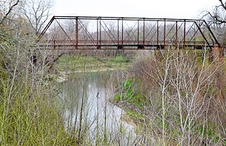
Milam County is a county located in the U.S. state of Texas. As of the 2020 census, its population was 24,754. The county seat is Cameron. The county was created in 1834 as a municipality in Mexico and organized as a county in 1837. Milam County is named for Benjamin Rush Milam, an early settler and a soldier in the Texas Revolution.

Thorndale is a city in Milam County, Texas, United States, with a small section in Williamson County. The population was 1,263 at the 2020 census. It was founded in 1878, approximately three miles west of its present site, and moved to its current site in 1880.
Independence is an unincorporated community in Washington County, Texas, United States. According to the Handbook of Texas, the community had a population of 140 in 2000. It is located about an hour northwest of the Greater Houston metropolitan area.

The Little River is a river in Central Texas in the Brazos River watershed. It is formed by the confluence of the Leon River and the Lampasas River near Little River, Texas in Bell County. It flows generally southeast for 75 miles (121 km) until it empties into the Brazos River about 5 miles (8.0 km) southwest of Hearne, at a site called Port Sullivan in Milam County. The Little River has a third tributary, the San Gabriel River, which joins the Little about 8 miles (13 km) north of Rockdale and five miles southwest of Cameron. Cameron, the county seat of Milam County and the only city of any significant size on the Little River, was established in 1846.
Wallisville is an unincorporated town in northern Chambers County, Texas, United States. According to the Handbook of Texas, the community had a population of 460 in 2000. It is located within the Greater Houston metropolitan area.
Illinois Bend is an unincorporated community in Montague County, Texas, United States. According to the Handbook of Texas, the community had a population of 30 in 2000.
Belcherville is an unincorporated community in Montague County, Texas, United States. According to the Handbook of Texas, the community had a population of 34 in 2000.
Bonita is an unincorporated community in north-central Montague County, Texas, United States. According to the Handbook of Texas, the community had a population of 25 in 2000.

Clodine is an unincorporated community in Fort Bend County, Texas, United States. According to the Handbook of Texas, the community had a population of 31 in 1990. It is located in the Greater Houston metro area.
Davilla is an unincorporated community in Milam County, Texas, United States. According to the Handbook of Texas, the community had a population of 200 in 2000.
Marak is an unincorporated community in Milam County, Texas, United States.
McMahan is an unincorporated community in Caldwell County, in the U.S. state of Texas. According to the Handbook of Texas, the community had a population of 125 in 2000. It is located within the Greater Austin metropolitan area.
Harkeyville is an unincorporated community in San Saba County, in the U.S. state of Texas. According to the Handbook of Texas, the community had a population of 12 in 2000.
Baileyville is an unincorporated community located in Milam County, Texas, United States. According to the Handbook of Texas, the community had a population of 45 in 1990.
Detmold is an unincorporated community located in Milam County, Texas, United States.
Hanover is an unincorporated community located in Milam County, Texas, United States. According to the Handbook of Texas, the community had a population of 27 in 2000.
Jones Prairie is an unincorporated community located in Milam County, Texas, United States. According to the Handbook of Texas, the community had a population of 35 in 2000.
Liberty Hill is an unincorporated community located in Milam County, Texas, United States. According to the Handbook of Texas, the community had a population of 25 in 2000.
Marlow is an unincorporated community located in Milam County, Texas, United States. According to the Handbook of Texas, the community had a population of 45 in 2000.
Maysfield is an unincorporated community located in Milam County, Texas, United States. According to the Handbook of Texas, the community had a population of 140 in 1990, which did not see a change in figures in 2000.


