
Sanatorium Park (Welsh: Parc Sanatorium) is a public park in the Canton district of western Cardiff, Wales. It includes open green space, wildflower hedgerows, two play areas, and a football goal with a half basketball court.
Sanatorium Park (Welsh: Parc Sanatorium) is a public park in the Canton district of western Cardiff, Wales. It includes open green space, wildflower hedgerows, two play areas, and a football goal with a half basketball court.
The entrances to the park are from Treganna Street and Lawrenny Avenue, [1] and from the Ely Trail footpath that runs through the park. [2] The River Ely runs along the western side of the park; Trelai Park (the site of former Ely Racecourse) is on the other side of the river, but there is no pedestrian bridge between the parks. The Grangetown Viaduct carries the A4232 road over the southern edge of the park. Ysgol Gymraeg Treganna, a Welsh-medium primary school, is on the northern edge of the park. [3]
Lansdowne Hospital was located to the northeast of the park; the buildings have been demolished and the site is now used for housing. [4]

Sanatorium Park adjoins of the site of the former Ely Paper Works, latterly known as the Arjo Wiggins Teape Paper Mill, which opened in 1865 and closed in 2000. Samuel Evans and Thomas Owen took over the works in 1877, and by 1889 the works was producing between 145 and 150 tons of paper per week. [5] After the works closed, the site was cleared in preparation for redevelopment. Work started on a new housing development of the 53-hectare site in 2015, named The Mill. [6]
Canton Brickworks adjoined the park and was situated at the end of Sanitorium Road. It is shown on maps published between 1898 and 1938, but by 1947 it had been demolished. [7]

In April 2020, Cardiff City Council started construction of a football pitch in the east of the park, near to the children's play area; the pitch was to be enclosed in a 3-metre (10 ft) high fence. There was opposition from local residents who had been unaware of the plans, and in May 2020 work was suspended pending further consultation. [8]
In early June 2020, residents were informed that work was about to resume. The pitch was now to be in a different area of the park, and the work would have restricted access to areas of the park which was then being extensively used due to the COVID-19 pandemic restrictions then in force. The resumption of work was strongly opposed by local residents some of whom obstructed the construction workers. The renewed protests resulted in the council suspending work for a second time. [9]
The development was eventually completed, and in December 2020, it was reported that the new football pitch regularly flooded after heavy rain, leaving it waterlogged and unplayable. The pitch is used by Fitzalan High School and by Ysgol Gymraeg Treganna, the local primary school. [10]
Llandaff is a district, community and coterminous electoral ward in the north of Cardiff, capital of Wales. It was incorporated into the city in 1922. It is the seat of the Bishop of Llandaff, whose diocese within the Church in Wales covers the most populous area of Wales.

Cwmbran is a town in the county borough of Torfaen in South Wales.

Bargoed is a town and community in the Rhymney Valley, Wales, one of the South Wales Valleys. It lies on the Rhymney River in the county borough of Caerphilly. It straddles the ancient boundary of Glamorgan and Monmouthshire, with Bargoed lying in Glamorgan and Aberbargoed in Monmouthshire. 'Greater Bargoed', as defined by the local authority Caerphilly County Borough Council, consists of the towns of Bargoed and Aberbargoed and the village of Gilfach. The combined population of these settlements is about 13,000. The town's rugby club Bargoed RFC holds the world record for the most consecutive league wins in a row and was World Rugby magazine's team of the year in 2005. The town’s football team AFC Bargoed who also hold a rich history are currently rebuilding and have a good young squad, finishing 2nd in the TERV Premier League 2022

Whitchurch is a suburb and community in the north of Cardiff, capital of Wales. It is approximately 3 miles north of the centre of the city on the A470 road and A4054 road. It falls within the Whitchurch & Tongwynlais ward. The population of the community in 2011 was 14,267.

Bute Park and Arboretum is a park in Cardiff, Wales. It comprises 130 acres (53 ha) of landscaped gardens and parkland that once formed the grounds of Cardiff Castle. The park is named after the 3rd Marquess of Bute, whose family owned the castle.
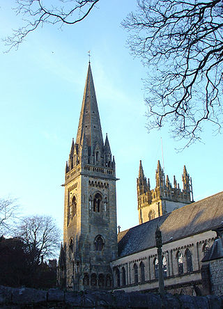
Canton is an inner-city district and community in the west of Cardiff, capital of Wales, lying 2 miles (3.2 km) west of the city's civic centre. It is located adjecent to Pontcanna, Cardiff. Canton is one of the most ethnically diverse of Cardiff's suburbs, with a significant Pakistani and Indian population. The total population of Canton increased to 14,304 at the 2011 census. It is also the most Welsh-speaking district of central Cardiff, with 19.1% of the population speaking Welsh.

Llandysul, also spelt Llandyssul, is a small town and community in the county of Ceredigion, Wales. As a community it consists of the townships of Capel Dewi, Horeb, Pontsian, Pren-gwyn, Tregroes, Rhydowen and the village of Llandysul itself. Llandysul lies in south Ceredigion in the valley of the River Teifi and is visited for its fishing and canoeing. The community had a population of 2732, as of 2011. The village itself has a population of 1484.

Griffithstown is a large suburb of Pontypool in the borough of Torfaen, Wales, within the historic boundaries of Monmouthshire. It is an ecclesiastical parish, formed in May 1898, from Llanfrechfa Upper and Panteg, and includes Sebastopol, but, under the provisions of the Local Government Act 1894, became a separate civil parish.
St Teilo's Church in Wales High School is a co-educational secondary school now located in Llanedeyrn, Cardiff.


Caerau is a community in the west of Cardiff, capital city of Wales. Often considered part of Wenvoe by gully, Heol Trelai is the main road or avenue, lined with large trees. Dominated mostly by private housing, it has the Western Leisure Centre, supermarkets, schools and churches.

Ysgol Gyfun Gymraeg Glantaf is a Welsh-medium coeducational secondary school in Llandaff North, a district in the north of Cardiff, Wales; it is the largest of its kind in the country. Of the three Welsh-medium secondary schools serving Cardiff, it was the first to be established; the others are Ysgol Gyfun Gymraeg Plasmawr and Ysgol Gyfun Gymraeg Bro Edern. As of 2017, 36% of pupils came from Welsh-speaking homes.
Ysgol Gymraeg Bro Morgannwg is a Welsh medium comprehensive school in the town of Barry in the Vale of Glamorgan, on the coast of south Wales. It is located adjacent to Barry Hospital.
Ysgol Gymraeg Pwll Coch is a large Welsh-medium primary school in the Leckwith area of western Cardiff, in Wales.

Ysgol Gymraeg Ystalyfera Bro Dur is a Welsh-medium comprehensive school in Neath Port Talbot, Wales. The school provides education to three to eighteen-year-old pupils in Neath Port Talbot and south Powys from three campuses in Ystalyfera and Port Talbot.
Pwll-coch is an area part of the district of Canton in Cardiff, Wales. It was formerly a separate hamlet in the parish of Llandaff near Cardiff. It was located on the junction of Windway Road and the main road from Cardiff to Ely, a short distance from Ely Bridge.