Related Research Articles
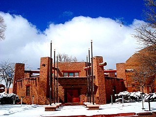
Apache County is in the northeast corner of the U.S. state of Arizona. Shaped in a long rectangle running north to south, as of the 2010 census, its population was 71,518. The county seat is St. Johns.

Navajo County is in the northern part of the U.S. state of Arizona. As of the 2010 census, its population was 107,449. The county seat is Holbrook.
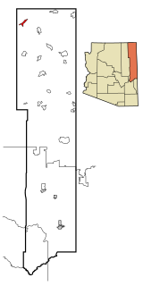
Dennehotso is a census-designated place (CDP) in Apache County, Arizona, United States. The population was 746 at the 2010 census.
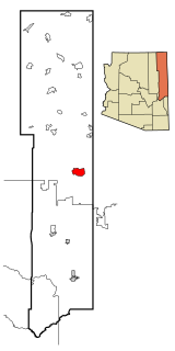
Houck is a census-designated place (CDP) in Apache County, Arizona, United States. The population was 1,024 at the 2010 census.
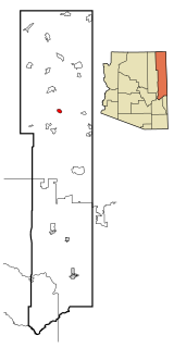
Nazlini is a census-designated place (CDP) in Apache County, Arizona, United States. The population was 489 at the 2010 census. Nearby are Nazlini Creek and Nazlini Canyon. Nazlini Canyon is the site of many Native American ruins and campsites that were abandoned when erosion made them unusable.

Rock Point is a census-designated place (CDP) in Apache County, Arizona, United States. The population was 642 at the 2010 census. Its name is descriptive of the point where Chinle Creek enters some high sandstone walls.

The Fort Apache Indian Reservation is an Indian reservation in northeastern Arizona, United States, encompassing parts of Navajo, Gila, and Apache counties. It is home to the federally recognized White Mountain Apache Tribe of the Fort Apache Reservation, a Western Apache tribe. It has a land area of 1.6 million acres and a population of 12,429 people as of the 2000 census. The largest community is in Whiteriver.
Whiteriver Unified School District is a school district in Navajo County, Arizona, United States.
Chinle Unified School District No. 24 (CUSD) is a public unified school district headquartered in Chinle, a census-designated place in Apache County, Arizona, on the Navajo Nation, United States. It is managed by a five-member elected school board, each of whom is Navajo, and operates by state rules. As of 2020, nearly all of the district's 3600 students are Navajo.
Window Rock High School is a public high school in Fort Defiance, a census-designated place in unincorporated Apache County, Arizona. WRHS is the only high school in the Window Rock Unified School District.
Ganado Unified School District is located in Ganado, Arizona, Apache County. The district includes four schools: Ganado High School, Ganado Middle School, Ganado Intermediate School and Ganado Primary School. Ganado Primary School is known for effectively using a holistic approach to language and culture and as "one of the best examples of a school culture that supports professional development".

Sanders is a census-designated place (CDP) in Apache County, Arizona, United States. Sanders is located at the junction of U.S. Route 191 and Interstate 40. As of the 2010 census, it had a population of 630.
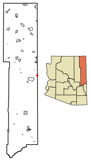
Lupton is an unincorporated community and census-designated place (CDP) in Apache County, Arizona, United States. Lupton is located along Interstate 40 at the New Mexico border, 21 miles (34 km) southwest of Gallup, New Mexico. Lupton has a post office with ZIP code 86508. As of the 2010 census, the Lupton CDP had a population of 25.
Red Rock is an unincorporated community and census-designated place (CDP) in Apache County, Arizona, United States. Red Rock is located on the Navajo Nation near the New Mexico border, 16 miles (26 km) northeast of Lukachukai. Red Rock has a post office with ZIP code 86544; the post office uses the Red Valley name. As of the 2010 census, the Red Rock CDP had a population of 169.
Red Mesa Unified School District #27 is a public school district headquartered in Red Mesa, unincorporated Apache County, Arizona, near Teec Nos Pos on the Navajo Nation. It has a five-member elected school board, who oversee operations of schools that are regulated by state standards.
Ganado High School is a high school in Ganado, Arizona. It is the only high school under the jurisdiction of the Ganado Unified School District.
Young Public School District 5 is a school district in Gila County, Arizona serving the community of Young, Arizona. It operates only one school, Young Public School, which comprises grades K though 8.

Cornfields is a chapter of the Navajo Nation and a census-designated place (CDP) in Apache County, Arizona, United States. The population was 255 at the 2010 census.
Toyei is a census-designated place (CDP) in Apache County, Arizona, United States. The population was 13 at the 2010 census.
Wide Ruins is a chapter of the Navajo Nation and a census-designated place (CDP) in Apache County, Arizona, United States. The population was 176 at the 2010 census.
References
- 1 2 3 4 5 6 "Search for Public School Districts – District Detail for Sanders Unified District (4156)". National Center for Education Statistics . Institute of Education Sciences . Retrieved 2022-03-05.
- ↑ "2020 CENSUS - SCHOOL DISTRICT REFERENCE MAP: Apache County, AZ" (PDF). U.S. Census Bureau. p. 2 (PDF p. 3/4). Retrieved 2021-07-12.