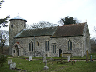
Shereford is a small village and former civil parish, now in the parish of Dunton, in the North Norfolk district, in the county of Norfolk, England. It is located about 4 kilometres (2 mi) west of the market town of Fakenham. It lies on the east bank of the River Wensum facing Dunton across the river. In 1931 the parish had a population of 97. On 1 April 1935 the parish was abolished to form Dunton.
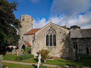
Great Ryburgh is a village and former civil parish, now in the parish of Ryburgh, in the North Norfolk district, in the county of Norfolk, England. In 1961 the parish had a population of 484. On 1 April 1987 the parish was abolished and merged with Little Ryburgh to form "Ryburgh".

Bircham Newton is the smallest of the three villages that make up the civil parish of Bircham, in the west of the English county of Norfolk. The village is located about 1 km north of the larger village of Great Bircham, 20 km north-east of the town of King's Lynn, and 60 km north-west of the city of Norwich. In 1931 the parish had a population of 487. On 1 April 1935 the parish was abolished to form Bircham.

Morningthorpe is a village and former civil parish, now in the parish of Morningthorpe and Fritton in the South Norfolk district, in the county of Norfolk, England. It is situated some 20 kilometres (12 mi) south of the city of Norwich. The parish includes the villages of Morningthorpe and Fritton. The two villages are 1 km apart.

Great Bircham is the largest of the three villages that make up the civil parish of Bircham, in the west of the English county of Norfolk. The village is located about half a mile south of the village of Bircham Newton, the same distance west of the village of Bircham Tofts,12 miles north-east of the town of King's Lynn, and 38 miles north-west of the city of Norwich. The King's Head is a hotel and bar. In 1931 the parish had a population of 327. On 1 April 1935 the parish was abolished to form Bircham.
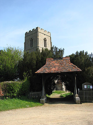
Morley Saint Botolph is a village and former civil parish, now in the parish of Morley, in the South Norfolk district, in the county of Norfolk, England. It is situated 4 km south-west of the town of Wymondham and 23 km south-west of the city of Norwich. The village name is normally abbreviated to "Morley St Botolph". In 1931 the parish had a population of 204.
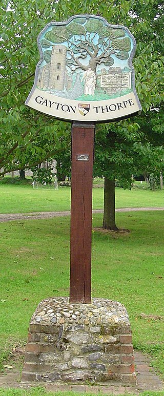
Gayton Thorpe is a village and former civil parish, now in the parish of Gayton, in the King's Lynn and West Norfolk district, in the county of Norfolk, England. The village is located 7.1 miles (11.4 km) south-east of King's Lynn and 31 miles (50 km) north-west of Norwich. In 1931 the parish had a population of 136.

West Lexham is a village and former civil parish, now in the parish of Lexham, in the Breckland district, in the county of Norfolk, England. It is 5.9 miles (9.5 km) north of the town of Swaffham, 30.6 miles (49.2 km) west north west of Norwich and 105 miles (169 km) north east of London. In 1931, the parish had a population of 101. On 1 April 1935 the parish was abolished to form Lexham.
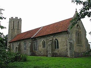
Buckenham is a small village in the civil parish of Strumpshaw, in the Broadland district, in the county of Norfolk, England, situated on the northern bank of the River Yare around 7 miles (11 km) south-east of Norwich. In 1931 the parish had a population of 128.

Moulton St Mary is a village and former civil parish, now in the parish of Beighton, in the Broadland district, in the county of Norfolk, England. It is about 2 miles south of Acle. The village has a garden centre and a car garage. In 1931 the parish had a population of 228.
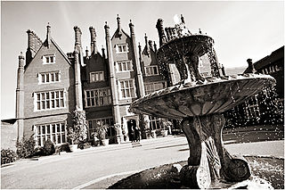
Dunston is a village in the civil parish of Stoke Holy Cross, in the South Norfolk district, in the county of Norfolk, England. It is located in the valley of the River Tas between Stoke Holy Cross and Caistor St. Edmund, approximately 3 miles south of Norwich. It has a common which is popular with walkers. In 1931 the parish had a population of 63. On 1 April 1935 the civil parish was abolished and merged with Stoke Holy Cross.

Gaywood is an eastern suburb of King's Lynn, in the King's Lynn and West Norfolk district, in the county of Norfolk, England.

Houghton Saint Giles is a village and former civil parish, now in the parish of Barsham, in the North Norfolk district, in the English county of Norfolk. It has also been referred to as Houghton-le-Dale or Houghton-in-the-Hole. In 1931 the parish had a population of 142.
Lynford is a village and civil parish in the Breckland District of Norfolk. The parish covers an area of 24.72 km2 (9.54 sq mi), and the 2001 Census recorded a population of 157 in 81 households. Lynford lies 4 miles (6.4 km) north east of Brandon and between Mundford, 2 miles (3.2 km) to the north west, and Thetford, 6.5 miles (10.5 km) to the south east, on the A134. It lies deep within Breckland forestry land between the Stanford Training Area and Thetford Forest.

Reymerston is a village and former civil parish, now in the parish of Garvestone, Reymerston and Thuxton, in the Breckland district, in the county of Norfolk, England, six miles north west of Wymondham, six miles south east of Dereham, and a half mile south west of Thuxton. In 1931 the parish had a population of 220. The village retains a church, St. Peter, which has a weekly service and special events. One of the village's residents was Wing Commander Ken Wallis, who lived at Reymerston Hall. He built autogyros and constructed "Little Nellie" for the James Bond film You Only Live Twice. On the 1st of April 1935 the parish was merged with Thuxton to form "Garveston"; later the parish was renamed to "Garvestone, Reymerston and Thuxton".
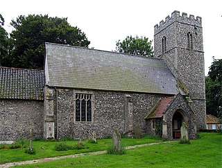
Metton is a small village and former civil parish, now in the parish of Sustead, in the North Norfolk district, in the county of Norfolk, England. The village is 2.1 km west of Roughton, 5.2 km south of Cromer, 29.3 km north of Norwich and 11.2 km northwest of North Walsham. In 1931 the parish had a population of 86. On 1 April 1935 the parish was abolished and merged with Sustead.
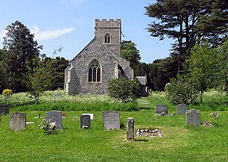
Colton is a village and former civil parish, 8 miles (13 km) west of Norwich, now in the parish of Marlingford and Colton, in the South Norfolk district, in the county of Norfolk, England. In 1931 the parish had a population of 175.

Limpenhoe is a village and former civil parish, now in the Cantley, Limpenhoe and Southwood, in the Broadland district, in the county of Norfolk, England. It is located on the north bank of the River Yare, between the villages of Cantley and Reedham, 8.2 miles (13.2 km) south-west of Great Yarmouth and 10.8 miles (17.4 km) south-east of Norwich. In 1931 the parish had a population of 156.

Carleton Forehoe is a village and former civil parish 9 miles (14 km) west of Norwich, now in the parish of Kimberley, in the South Norfolk district of Norfolk, England. In 1931 the parish had a population of 123.

West Tofts is a deserted medieval village in the civil parish of Lynford, within the Breckland district, in the county of Norfolk, England. It is within the Stanford Training Area, an army training area. In 1931 the parish had a population of 332. On 1 April 1935 the parish was abolished and merged with Lynford.


