Related Research Articles

Garrett County is the westernmost county of the U.S. state of Maryland. As of the 2010 census, the population was 30,097, making it the third-least populous county in Maryland. Its county seat is Oakland. The county was named for John Work Garrett (1820–1884), president of the Baltimore and Ohio Railroad. Created from Allegany County, Maryland in 1872, it was the last Maryland county to be formed.
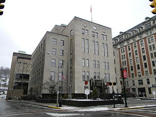
Harrison County is a county in the U.S. state of West Virginia. As of the 2010 census, the population was 69,099. The county seat is Clarksburg.

Sardis is a census-designated place (CDP) in southeastern Lee Township, Monroe County, Ohio, United States. It is unincorporated, but has a post office with the ZIP code of 43946. As of the 2010 census, it had a population of 559.

Hannibal is a census-designated place in eastern Ohio Township, Monroe County, Ohio, United States. It has a post office with the ZIP code 43931. As of the 2016 estimate, it had a population of 451.

Harriettsville is an unincorporated community in western Elk Township, Noble County, Ohio, United States. It lies along State Route 145 at its intersection with County Road 46. The East Fork of Duck Creek, a subsidiary of the Ohio River that meets the river near Marietta, runs along State Route 145 past the community. It lies 8 miles (13 km) northeast of Lower Salem by road, and 13 miles (21 km) directly southeast of Caldwell, the county seat of Noble County.
Sardis was a community in northern Pushmataha County, Oklahoma, United States, six miles northwest of Clayton.
Brown is an unincorporated community in Harrison County, in the U.S. state of West Virginia.
Opekiska was an unincorporated community located in Monongalia County, West Virginia, United States. The Opekiska Post Office is no longer open.

Webster was an unincorporated community in Belmont Township, Rooks County, Kansas, United States.
Basnettville is an unincorporated community in Marion County, in the U.S. state of West Virginia.
Bingamon is an unincorporated community in Marion County, in the U.S. state of West Virginia.
Jarvisville is an unincorporated community in Harrison County, in the U.S. state of West Virginia.
Palmer is an extinct town in Braxton County, in the U.S. state of West Virginia. The GNIS classifies it as a populated place.
Rinehart is an unincorporated community in Harrison County, in the U.S. state of West Virginia.
Romines Mills is an unincorporated community in Harrison County, in the U.S. state of West Virginia.
Vernon is an unincorporated community in Braxton County, in the U.S. state of West Virginia.
Vincen is an unincorporated community in Tyler and Wetzel counties, in the U.S. state of West Virginia.
Vinton is a ghost town in Nicholas County, in the U.S. state of West Virginia.
West is an unincorporated community in Wetzel County, in the U.S. state of West Virginia.
Far is an unincorporated community in Wetzel County, West Virginia, United States.
References
- ↑ U.S. Geological Survey Geographic Names Information System: Sardis, West Virginia
- ↑ "Post Offices". Jim Forte Postal History. Retrieved 1 June 2016.CS1 maint: discouraged parameter (link)
- ↑ Kenny, Hamill (1945). West Virginia Place Names: Their Origin and Meaning, Including the Nomenclature of the Streams and Mountains. Piedmont, WV: The Place Name Press. p. 554.
Municipalities and communities of Harrison County, West Virginia, United States | ||
|---|---|---|
| Cities |  | |
| Towns | ||
| CDPs | ||
| Unincorporated communities |
| |
Coordinates: 39°20′15″N80°25′04″W / 39.33750°N 80.41778°W
| | This article about a location in Harrison County, West Virginia is a stub. You can help Wikipedia by expanding it. |