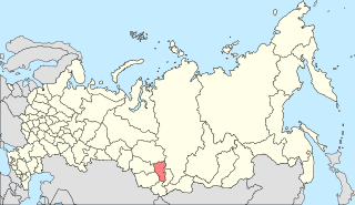
South Central Siberia is a geographical region north of the point where Russia, China, Kazakhstan and Mongolia come together.
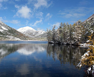
The Southern Siberian rainforest is an area of temperate rainforest in South Central Siberia that occurs primarily along the Altai and Sayan mountain ranges in Khakassia and Tuva as well as a small area in the Khamar-Daban Mountains near Lake Baikal in Buryatia. The forest encompasses a total area of approximately 6,000 square kilometres (2,300 sq mi). The larger portion of the forest in the Altai and Sayan Mountains runs across a latitude range that encompasses between 51.5 degrees to 56 degrees north latitude, and a longitude range running between 86 degrees to 95 degrees east longitude. The region overlaps with the Golden Mountains of Altai World Heritage Site. Ecological zones range from hemiboreal forest to a forest-steppe ecotone and include a wider variety of plant species than surrounding areas.

Azas Nature Reserve is a Russian 'Zapovednik', located in the central part of the Todzha basin of south-central Asia about 500 km west of Lake Baikal. The reserve stretches along the Azas River, and is situated in the Todzhinsky District of Tuva.

Altai Nature Reserve is a Russian zapovednik in the Altai Mountains of south Siberia, Russia. It is part of the UNESCO World Heritage Site "Golden Mountains of Altai", recognized as an area of high biodiversity and isolation from human intrusion. It is also included in the UNESCO World Network of Biosphere Reserves. The Altai Reserve includes the 30 km (19-mile) east bank of Lake Teletskoye and stretches 230 km into the high mountains to the southeast of the lake. It is situated in Ulagansky District and Turochaksky District in the north and east of the Altai Republic.
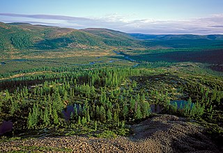
Baikal-Lena Nature Reserve is a Russian 'zapovednik' located on the northwest coast of Lake Baikal in southern Siberia. It protects both lake shore and the source of the Lena River. The reserve stretches along the western coast of Lake Baikal for about 120 km, with an average width of 65 km. The reserve is situated in the Kachugsky District of Irkutsk Oblast. As of December 1996, the Baikal-Lena Reserve is included in the list of sites of World Cultural and Natural Heritage, and a World Heritage Site with Pribaikalsky National Park. The Baikal-Lena Reserve is managed jointly with Pribaikalsky National Park, which is immediately to the south, thus protecting a continuous 580 km of shoreline on Lake Baikal.

Central Siberia Nature Reserve is a Russian 'zapovednik'. With over 1 million hectares of protected area, it is one of the largest forest reserves in the world. The reserve is located in the middle Yenisei, lower Bakhta and lower Stony Tunguska river valleys, of the Central Siberian Plateau. Notably, the territory covers both banks of the Yenisei for over 60 km. The reserve is situated in the Turukhansky District of Krasnoyarsk Krai.

Sokhondo Nature Reserve is a Russian 'zapovednik' in the south of Eastern Siberia, 25 km north of the border with Mongolia. It is the farthest source of the Amur River, and is centered on the Sokhondo Mountain massif, in the highest sector of the Khentei-Chikoy Highlands in the Khentei Range mountain range. The Sokhondo massif has two peaks, and is an ancient volcano. Also within the borders are many lakes of glacial origin. In 1985, Sokhondo was named a UNESCO MAB Biosphere Reserve. The reserve is situated in the Chita district of Chita Oblast.
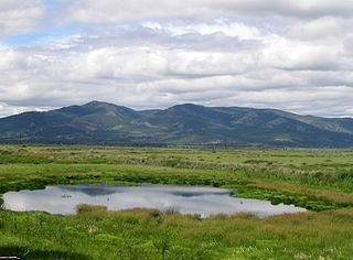
The Trans-Baikal conifer forests ecoregion covers a 1,000 km by 1,000 km region of mountainous southern taiga stretching east and south from the shores of Lake Baikal in the Southern Siberia region of Russia, and including part of northern Mongolia. Historically, the area has been called "Dauria", or Transbaikal. It is in the Palearctic realm, and mostly in the boreal forests/taiga biome with a subarctic, humid climate. It covers 200,465 km2 (77,400 sq mi).

Sayano-Shushenski Nature Reserve is a Russian 'zapovednik' reserve in a remote area of the West Sayan Mountains of south Siberia. It is on the southern bank of the Yenisei River along the Sayano-Shushenskoye reservoir. The reserve thus protects a large section of the wooded, mountainous territory above the reservoir created by the Sayano-Shushenskaya Dam, the largest power plant in Russia. Both the reserve and the dam were established 1976, and a major purpose of the reserve besides conservation is the study of the ecological effects of a large reservoir on the local ecology. The reserve covers an area of 390,368 ha (1,507.22 sq mi). It is situated in the Shushensky District of Krasnoyarsk Krai.
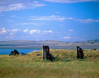
Khakasski Nature Reserve is a Russian 'zapovednik' covering two large mountain areas, and a cluster of seven steppe sites located within the left bank of the Minusinsk depression. The reserve is situated in the Tashtypsky District of Khakassia. It was originally created to preserve steppe ecosystems, wetlands and waterfowl nesting sites, and a historical complex of monuments and cemeteries from the 4-11 centuries BC. The reserve is particularly noted for its variety of large lakes on the Yenisei River migration route for birds. The current configuration of protected sectors was established in 1999, and covers a total area of 267,483 ha (1,032.76 sq mi).

Kuznetsk Alatau Nature Reserve is a Russian 'zapovednik' on the Kuznetsk Alatau, a mountain ridge in the Altai-Sayan mountain region in southwestern Siberia. The Kuznetsk Alatau consists of several ranges of medium height, between which there are river valleys. The reserve is in the watershed of the Tom River and the Chuly River. It is spread over three districts of Kemerovo Oblast: Tisulsky District, Mezhdurechensky District, and Novokuznetsky District. The reserve was established in 1989 and covers an area of 412,900 ha (1,594 sq mi).

Tigirekskiy Nature Reserve is a Russian 'zapovednik' in the northwest mid-level mountains of the Altai-Sayan region. The reserve was established for the protection and study of the relic pre-glacial dark taiga of the higher elevations, and the mountain-steppe of the river valleys and lower regions. The site features extensive karst landscape and caves. The reserve is situated in the Zmeinogorsky, Tretyakovsky and Krasnoshchyokovsky districts of Altai Krai. It was formally established in 1999, and covers a total area of 40,693 ha (157.12 sq mi).

The West Siberian taiga ecoregion covers the West Siberian Plain in Russia, from the Ural mountains in the west to the Yenisei River in the east, and roughly from 56° N to 66° N latitude. It is a vast, flat lowland region of boreal forests (taiga), and wetlands, covering an area about 1,800 km west–east, by 1,000 km north–south.

The Northeast Siberian taiga ecoregion is an area of "sparse taiga forest" between the Lena River and the Kolyma River in northeastern Siberia, Russia. The ecoregion's internal borders form a patchwork of territory constituting the southern part of the East Siberian Lowland, as well as lowlands around the East Siberian Mountains, including the ridges and peaks of the Verkhoyansk Range and the Chersky Range. On the southern border of the ecoregion is the north coast of the Sea of Okhotsk, giving the region maritime boreal forests as well as the continental forests situated inland. The ecoregion is one of the largest tracts of virgin boreal forest in the world, due to the very sparse population and difficult access. It is mostly in the Sakha Republic.
The Okhotsk-Manchurian taiga ecoregion is an area of coniferous forests in the Russian Far East, covering the Amur River delta, the west coast of the Okhotsk Sea, and the rugged extension of the northern Sikhote-Alin Mountains that run southwest-to-northeast through the Primorsky and Khabarovsk regions. It is the southernmost taiga forest in Eurasia. The ecoregion is distinguished from surrounding ecoregions by the slightly warmer climate due to the maritime influence and the shield of the mountains to the west, and by the mixing of flora and fauna species from Okhotsk-Kamchatka communities to the north and Manchurian species from the south. The forest at lower altitudes is "light taiga", and "dark taiga" at higher altitudes.

The Urals montane tundra and taiga ecoregion covers the main ridge of the Ural Mountains - a 2,000 km (north-south) by 300 km (west-east) region. The region is on the divide between European and Asian ecoregions, and also the meeting point of tundra and taiga. It is in the Palearctic realm, and mostly in the Boreal forests/taiga ecoregion with a Humid continental climate, cool summer climate. It covers 174,565 km2 (67,400 sq mi).

The Altai montane forest and forest steppe ecoregion covers patches of the subalpine forest belt on the Altai Mountains, crossing the border region where Russia, Kazakhstan, Mongolia and China meet. The region has high biodiversity, as it is located in transition zones between different ecoregions, altitudes, and climate zones. It is in the Palearctic realm, with a Cold semi-arid climate. It covers 35,199,998 km2 (13,590,795 sq mi).

The Da Hinggan-Dzhagdy Mountains conifer forests ecoregion covers the Greater Khingan Mountains of northern Manchuria (China), and across the border north into Russia where it follows the mountain ridge for another 500 km to the east. The mountain forests exhibit a floral community called "Daurian flora", a combination of the Siberian taiga to the north and the Manchurian floral types to the south. The eastern slopes are steep and drained by many rivers, the western slopes are gentler, and there are grasslands on some slopes. The ecoregion is in the Palearctic realm, with a Cold semi-arid climate. It covers 35,199,998 km2 (13,590,795 sq mi).

The Daurian forest steppe ecoregion is a band of grassland, shrub terrain, and mixed forests in northeast Mongolia and the region of Siberia, Russia that follows the course of the Onon River and Ulz River. The region has been described as a “sea of grass that forms the best and most intact example of an undisturbed steppe ecosystem and is also one of the last areas in the Palearctic that still supports stable herds of larger vertebrates” in a semi-mountainous area. The area also has flat wetlands that are important to migratory birds. The ecoregion is in the Palearctic realm, with a dry-winter subarctic climate that borders on a very cold semi-arid climate (BSk) in its southwestern parts. It covers 209,012 km2 (80,700 sq mi).

The South Siberian Mountains are one of the largest mountain systems of the Russian Federation. The total area of the system of mountain ranges is more than 1.5 million km². The South Siberian Mountains are located in the Siberian and Far Eastern Federal Districts of Russia, as well as partly in Mongolia. The territory of the mountain system is one of the Great Russian Regions.


