Schipluiden

Last updated
Schipluiden
Schipluiden - gemeentehuis.jpg
Former city hall of Schipluiden
Map - NL - Midden-Delfland - Wijk 00 Schipluiden - Buurt 00 Schipluiden.svg
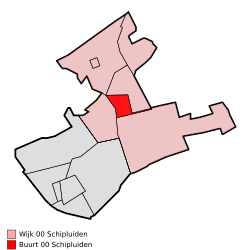
Location of Schipluiden in the municipality of Midden-Delfland
Coordinates: 51°58′35″N4°18′53″E / 51.97639°N 4.31472°E / 51.97639; 4.31472
Country Netherlands
Province South Holland
Municipality Midden-Delfland
Population
 (2009)
4.536 (woonkern Schipluiden)
[1]
Schipluiden Schipluiden vanaf brug.jpg
Schipluiden

Schipluiden is a village in the western Netherlands, in the province of South Holland. It is the seat of the council of the municipality of Midden-Delfland.

The village was founded relatively late in the 15th century and evolved around the Keenenburg castle, which no longer exists. The current Dutch Reformed church in the village centre belonged to the Catholic Teutonic Knights before 1572, when the Calvinists took over control of the church. The village inhabitants worked in the food trade from the agrarian area Westland to the cities of Vlaardingen and Delft. Most of the population became Roman Catholic in the 17th century. For sermons, they had to go to the Roman Catholic Church, some kilometres out of the village.

In 1855, the municipality of Sint Maartensregt was merged into Schipluiden. [2]

A new Roman Catholic church was built in the 1960s. Schipluiden remained a small agrarian village until the 1950s. Its population began to grow significantly in the second half of the twentieth century as many middle-class people from the cities came to live in the village, but the village has maintained its village culture.

Schipluiden was a separate municipality until 2004, when it became part of Midden-Delfland. [2]

Related Research Articles

South Holland Province of the Netherlands

South Holland is a province of the Netherlands with a population of over 3.7 million as of October 2021 and a population density of about 1,373/km2 (3,560/sq mi), making it the country's most populous province and one of the world's most densely populated areas. Situated on the North Sea in the west of the Netherlands, South Holland covers an area of 3,307 km2 (1,277 sq mi), of which 607 km2 (234 sq mi) is water. It borders North Holland to the north, Utrecht and Gelderland to the east, and North Brabant and Zeeland to the south. The provincial capital is the Dutch seat of government The Hague, while its largest city is Rotterdam. The Rhine-Meuse-Scheldt delta drains through South Holland into the North Sea. Europe's busiest seaport, the Port of Rotterdam, is located in South Holland.

North Brabant Province of the Netherlands

North Brabant, also unofficially called Brabant, is a province in the south of the Netherlands. It borders the provinces of South Holland and Gelderland to the north, Limburg to the east, Zeeland to the west, and the Flemish provinces of Antwerp and Limburg to the south. The northern border follows the Meuse westward to its mouth in the Hollands Diep strait, part of the Rhine–Meuse–Scheldt delta. North Brabant has a population of 2,562,566 as of November 2019. Major cities in North Brabant are Eindhoven, Tilburg, Breda and its provincial capital 's-Hertogenbosch.

Heerlen City and Municipality in Limburg, Netherlands

Heerlen is a city and a municipality in the southeast of the Netherlands. It is the third largest settlement proper in the province of Limburg. Measured as municipality, it is the fourth municipality in the province of Limburg.

Maasland Town in Netherlands

Maasland is a town in the western Netherlands, in the province of South Holland. It lies in the municipality (gemeente) of Midden-Delfland and covers an area of 24.42 km2.

Midden-Delfland Municipality in South Holland, Netherlands

Midden-Delfland is a municipality (gemeente) in the Westland region in the province of South Holland in the Netherlands. It had a population of 19,391 in 2019, and covers an area of 49.38 km2 (19.07 sq mi) of which 2.19 km2 (0.85 sq mi) is water.

IJzendijke Place in Zeeland, Netherlands

IJzendijke is a city in the municipality of Sluis, about 10 km east of Oostburg, in the Dutch province of Zeeland. Its population in 2001 was 1,780.

Hooghalen Town in Drenthe, Netherlands

Hooghalen is a village in the municipality Midden-Drenthe, in the Dutch province Drenthe. In Drenthe it is also called Hoal'n or Hoalen , but then people often mean the entire area, with the neighborhoods Laaghalen, Laaghalerveen and Oosthalen.

Oosterbeek Place in Gelderland, Netherlands

Oosterbeek is a village in the eastern part of Netherlands. It is located in the municipality of Renkum in the province of Gelderland, about 5 km (3.1 mi) west of Arnhem.

Zouteveen Buurtschap in South Holland, Netherlands

Zouteveen is a neighbourhood in the municipality Midden-Delfland in the province South Holland in the Netherlands. It is located between Vlaardingen and Delft, about 3 km south of the town of Schipluiden. There are two hamlets in this area: Negenhuizen and De Kapel.

Ackersdijk en Vrouwenregt is a former municipality in the Dutch province of South Holland, located about halfway between Delft and Schiedam. It existed from 1817 to 1855, when it was joined to the municipality of Vrijenban. The area is now part of the municipalities of Midden-Delfland, Delft, and Pijnacker-Nootdorp.

Kloosterburen Village in Groningen, Netherlands

Kloosterburen is a village in the Dutch province of Groningen. It is located in the municipality of het Hogeland. The village developed around a monastry. Kloosterburen was a separate municipality until 1990, when it was merged with Leens, Ulrum and Eenrum. During the combining of the four municipalities they were called 'de LEUK gemeenten'. In 2019, it became part of Het Hogeland.

Hodenpijl Place in South Holland, Netherlands

Hodenpijl is a hamlet in the Dutch province of South Holland. It is located 3 km southwest of the centre of Delft, in the municipality of Midden-Delfland.

Bavel, Netherlands Dorp in North Brabant, Netherlands

Bavel is a village in the southern Netherlands. It is located in the Dutch province of North Brabant, largely within the municipality of Breda with some rural areas in the municipality of Alphen-Chaam.

t Woudt Place in South Holland, Netherlands

't Woudt is a small village in the Dutch province of South Holland. It is located about 5 km southwest of the city of Delft, in the municipality of Midden-Delfland.

Mill is a village in the former Dutch municipality of Mill en Sint Hubert, in the province of North Brabant. Since 2022 it has been part of the new municipality of Land van Cuijk.

Overtoomse Veld Neighborhood of Amsterdam in North Holland, Netherlands

Overtoomse Veld is a neighborhood of Amsterdam, Netherlands. It is named for the Overtoomse Sluis, which was an old portage point dating from the 14th century on a major cargo route to and from Amsterdam at the junction of two waterschap areas, Hoogheemraadschap van Rijnland and Hoogheemraadschap van Amstelland.

Westland (region), Netherlands

Westland is a region of the Netherlands and lies in the western part of the Province of South Holland. It consists of the municipalities of Westland and Midden-Delfland, and also of the town of Hook of Holland.

De Kapel

De Kapel is a neighbourhood in the municipality of Midden-Delfland, in the province of South Holland in The Netherlands. It lies in the south of this municipality between Negenhuizen and the town of Vlaardingen. The entire area around the crossroads is also referred to as Zouteveen to the former municipality in the Zouteveense and Holiërhoekse polder, which was dissolved in 1855 and went up in Vlaardinger Ambacht, a former separate municipality annexed by Vlaardingen in 1941.

Vlaardingervaart

The Vlaardingervaart or Vlaardingse Vaart is a canal in the municipality of Midden-Delfland in the Dutch province of South Holland, between the Gaag in Schipluiden and Vlaardingen, where through the Oude Haven the water is connected to the Nieuwe Maas.

References

Coordinates: 51°59′N4°19′E / 51.983°N 4.317°E / 51.983; 4.317