Sarpy County is a county located in the U.S. state of Nebraska. As of the 2020 United States Census, the population was 190,604, making it the third-most populous county in Nebraska. Its county seat is Papillion.

Lincoln County is a county in the U.S. state of Nebraska. As of the 2020 census, the population was 34,676. Its county seat is North Platte. Despite the county's name, the state capital city of Lincoln is not in or near Lincoln County, the latter is located in Lancaster County.
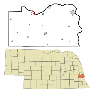
South Bend is a village in Cass County, Nebraska, United States. The population was 99 at the 2010 census. The main landmark is a pedestrian bridge across the Platte River which leads to Schramm Park State Recreation Area. It was built in 2004 on the pillars of the abandoned Rock Island Railroad bridge. 35 trains a day—most of them coal trains—still pass through the area on the BNSF Railway main.

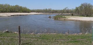
The Platte River is a major river in the State of Nebraska. It is about 310 mi (500 km) long; measured to its farthest source via its tributary, the North Platte River, it flows for over 1,050 miles (1,690 km). The Platte River is a tributary of the Missouri River, which itself is a tributary of the Mississippi River which flows to the Gulf of Mexico. The Platte over most of its length is a broad, shallow, meandering stream with a sandy bottom and many islands—a braided stream.

The North Platte River is a major tributary of the Platte River and is approximately 716 miles (1,152 km) long, counting its many curves. In a straight line, it travels about 550 miles (890 km), along its course through the U.S. states of Colorado, Wyoming, and Nebraska.

The Folsom Lake State Recreation Area surrounds Folsom Lake in the foothills of the Sierra Nevada, and is managed by the California Department of Parks and Recreation. It is located near the city of Folsom, California, about 25 miles (40 km) east of Sacramento.

Lake Oroville is a reservoir formed by the Oroville Dam impounding the Feather River, located in Butte County, northern California. The lake is situated 5 miles (8 km) northeast of the city of Oroville, within the Lake Oroville State Recreation Area, in the western foothills of the Sierra Nevada. Known as the second-largest reservoir in California, Lake Oroville is treated as a keystone facility within the California State Water Project by storing water, providing flood control, recreation, freshwater releases assist in controlling the salinity intrusion into the Sacramento-San Joaquin Delta and protecting fish and wildlife.

The Nebraska Game and Parks Commission (NGPC) is the State of Nebraska's State agency charged with stewardship of the state's fish, wildlife, state park, and outdoor recreation resources. The agency is led by a governor-appointed member commission consisting of 9 commissioners which directs agency management. The commission is also charged with issuing of state hunting licenses, fishing licenses, and boat registrations. The agency also manages State Parks and recreation areas throughout the state. It conducts public education programs for hunting and boating safety. The agency is headquartered in Lincoln, Nebraska.
Nebraska Public Power District (NPPD) is the largest electric utility in the state of Nebraska, serving all or parts of 84 counties. It was formed on January 1, 1970, when Consumers Public Power District, Platte Valley Public Power and Irrigation District (PVPPID) and Nebraska Public Power System merged to become Nebraska Public Power District. NPPD's predecessors were created through the efforts of the Nebraska legislature and financial agent Guy L. Myers as part of a system where all the investor-owned utilities operating in the state of Nebraska were condemned and their properties turned over to 'public power districts' being created at the time. NPPD is a public corporation and political subdivision of the state of Nebraska. The utility is governed by an 11-member Board of Directors, who are popularly elected from NPPD's chartered territory.

Nebraska Highway 31 is a highway in Nebraska. The southern terminus is near Louisville at an intersection with Nebraska Highway 50. The northern terminus is near Kennard at an intersection with U.S. Highway 30. The highway serves as a main north–south highway in the western portion of the Omaha Metro Area.
The Elkhorn River is a river in northeastern Nebraska, United States, that originates in the eastern Sandhills and is one of the largest tributaries of the Platte River, flowing 290 miles (470 km) and joining the Platte just southwest of Omaha, approximately 1 mile (1.6 km) south and 3 miles (4.8 km) west of Gretna.

Lewis and Clark Lake is a 31,400 acre (130 km²) reservoir located on the border of the U.S. states of Nebraska and South Dakota on the Missouri River. The lake is approximately 25 miles (40 km) in length with over 90 miles (140 km) of shoreline and a maximum water depth of 45 feet (14 m). The lake is impounded by Gavins Point Dam and is managed by the U.S. Army Corps of Engineers, Omaha District.
North Platte National Wildlife Refuge is located in the U.S. state of Nebraska and includes 5,047 acres (20.42 km2). Managed by the U.S. Fish and Wildlife Service, the refuge is broken into four separate sections that are superimposed on U.S. Bureau of Reclamation–managed lakes and reservoirs. Together with the Crescent Lake National Wildlife Refuge, the two refuges form the Crescent Lake National Wildlife Refuge Complex.

Platte River State Park is a public recreation area encompassing 453 acres (183 ha) on the southern bluffs of the Platte River two miles (3.2 km) west of Louisville, Nebraska. The state park has a relatively steep, rolling topography compared to the surrounding region, with much of it forested.

Lake McConaughy is a reservoir on the North Platte River. It is located 9 miles (14 km) north of Ogallala, Nebraska, United States, near U.S. Highway 26 and Nebraska Highway 61. The reservoir was named for Charles W. McConaughy, a grain merchant and mayor of Holdrege, Nebraska, one of the leading promoters of the project. Although he did not live to see the completion of the project, his leadership and perseverance eventually culminated in a public power and irrigation project that helped Nebraska become one of the nation's leading agricultural states.

Tourism in Omaha, Nebraska, United States offers visitors history, sports, nature and cultural experiences. Its principal tourist attractions are the Henry Doorly Zoo and the College World Series (CWS). A 2003 study by a Creighton University economist estimated that the CWS added $33.8 million to the city's economy that year. With 1.1 million visitors annually, the Henry Doorly Zoo is Nebraska's most popular tourist attraction. In 2007 Omaha hosted the USA Roller Sports National Championships, along with 10,000 people who auditioned for the American Idol television show at Qwest Center Omaha.
Eugene T. Mahoney State Park is a public recreation area located on the Platte River, off Interstate 80, approximately four miles (6.4 km) east of Ashland, Nebraska. The state park features lodging and conferencing facilities, an aquatic center, marina, multi-purpose trails, the Kountze Memorial Theater, multiple facilities for event rentals, and a 70-foot (21 m) observation tower overlooking the Platte River Valley.

Fremont Lakes State Recreation Area (SRA) is a state park in eastern Nebraska, United States. The recreation area is located along the Platte River, approximately 3 miles (4.8 km) west of Fremont, or about 40 miles (64 km) northwest of Omaha. The recreation area is managed by the Nebraska Game and Parks Commission.


 Domestic geese and mallards