Scipio, Utah

Last updated
Scipio, Utah
Scipio Utah town hall.jpeg
The old Scipio town hall, April 2010
Millard County Utah incorporated and unincorporated areas Scipio highlighted.svg
Location in Millard County and the state of Utah.
Coordinates: 39°14′51″N112°6′17″W / 39.24750°N 112.10472°W / 39.24750; -112.10472 Coordinates: 39°14′51″N112°6′17″W / 39.24750°N 112.10472°W / 39.24750; -112.10472
Country United States
State Utah
County Millard
Settled1859
Named for Scipio Kenner
Area
[1]
  Total1.04 sq mi (2.70 km2)
  Land1.04 sq mi (2.70 km2)
  Water0.00 sq mi (0.00 km2)
Elevation
[2]
5,315 ft (1,620 m)
Population
 (2010)
  Total327
  Estimate 
(2019) [3]
332
  Density318.92/sq mi (123.12/km2)
Time zone UTC-7 (Mountain (MST))
  Summer (DST) UTC-6 (MDT)
ZIP code
84656
Area code 435
FIPS code 49-67880 [4]
GNIS feature ID1445376 [2]

Scipio is a town on the eastern edge of Millard County, Utah, United States. The population was 290 at the 2000 census.

Contents

Geography

According to the United States Census Bureau, the town has a total area of 5.5 square miles (14 km2), all land. It lies in the oval-shaped Round Valley, 37 miles (60 km) south-southwest of Nephi, at the junction of Interstate 15 (I‑15) and U.S. Route 50 (US‑50). The nearest town, approximately 15 miles (24 km) southwest on I‑15, is Holden. About 30 miles (48 km) south-southeast are the towns of Redmond, Salina, and Aurora. About halfway between Scipio and Salina is Lake Scipio, on the west side of US‑50. To the east lie the Valley Mountains, with the highest peak reaching around 8,189 feet (2,496 m). To the south are the Pahvant Mountains, which rise above 10,000 feet (3,000 m).

Climate

According to the Köppen Climate Classification system, Scipio has a hot-summer humid continental climate, abbreviated "Dfa" on climate maps. The hottest temperature recorded in Scipio was 107 °F (41.7 °C) on July 18, 1998, while the coldest temperature recorded was −40 °F (−40.0 °C) on January 9, 1937 and January 22, 1937. [5]

Climate data for Scipio, Utah, 1991–2020 normals, extremes 1895–present
MonthJanFebMarAprMayJunJulAugSepOctNovDecYear
Record high °F (°C)69
(21)
70
(21)
79
(26)
89
(32)
96
(36)
102
(39)
107
(42)
103
(39)
101
(38)
89
(32)
77
(25)
69
(21)
107
(42)
Mean maximum °F (°C)52.5
(11.4)
58.5
(14.7)
71.1
(21.7)
78.2
(25.7)
87.0
(30.6)
95.2
(35.1)
99.8
(37.7)
96.3
(35.7)
90.9
(32.7)
81.6
(27.6)
67.8
(19.9)
56.0
(13.3)
98.6
(37.0)
Average high °F (°C)38.0
(3.3)
43.4
(6.3)
54.1
(12.3)
60.6
(15.9)
71.5
(21.9)
83.5
(28.6)
91.2
(32.9)
88.4
(31.3)
79.5
(26.4)
65.0
(18.3)
50.4
(10.2)
38.4
(3.6)
63.7
(17.6)
Daily mean °F (°C)27.0
(−2.8)
32.4
(0.2)
41.1
(5.1)
46.7
(8.2)
55.9
(13.3)
66.5
(19.2)
75.1
(23.9)
72.9
(22.7)
62.5
(16.9)
49.4
(9.7)
37.3
(2.9)
27.1
(−2.7)
49.5
(9.7)
Average low °F (°C)16.0
(−8.9)
21.3
(−5.9)
28.1
(−2.2)
32.7
(0.4)
40.3
(4.6)
49.6
(9.8)
59.0
(15.0)
57.4
(14.1)
45.6
(7.6)
33.8
(1.0)
24.1
(−4.4)
15.9
(−8.9)
35.3
(1.9)
Mean minimum °F (°C)−8.6
(−22.6)
0.2
(−17.7)
10.7
(−11.8)
17.3
(−8.2)
24.6
(−4.1)
33.4
(0.8)
43.9
(6.6)
41.9
(5.5)
29.3
(−1.5)
17.4
(−8.1)
2.6
(−16.3)
−9.0
(−22.8)
−13.0
(−25.0)
Record low °F (°C)−40
(−40)
−38
(−39)
−17
(−27)
−2
(−19)
13
(−11)
20
(−7)
28
(−2)
26
(−3)
8
(−13)
0
(−18)
−24
(−31)
−36
(−38)
−40
(−40)
Average precipitation inches (mm)1.35
(34)
1.27
(32)
1.29
(33)
1.34
(34)
1.33
(34)
0.55
(14)
0.52
(13)
0.84
(21)
1.02
(26)
1.24
(31)
1.06
(27)
1.37
(35)
13.18
(334)
Average snowfall inches (cm)6.4
(16)
4.8
(12)
3.9
(9.9)
1.2
(3.0)
0.1
(0.25)
0.0
(0.0)
0.0
(0.0)
0.0
(0.0)
0.0
(0.0)
0.3
(0.76)
3.5
(8.9)
9.4
(24)
29.6
(74.81)
Average precipitation days (≥ 0.01 in)6.66.97.27.56.93.14.05.14.25.75.76.469.3
Average snowy days (≥ 0.1 in)2.82.01.80.60.00.00.00.00.00.21.32.911.6
Source 1: NOAA [6]
Source 2: National Weather Service [5]

Demographics

Historical population
CensusPop.Note
1870 465
1880 57423.4%
1890 567−1.2%
1900 5781.9%
1910 546−5.5%
1920 543−0.5%
1930 5440.2%
1940 5959.4%
1950 491−17.5%
1960 328−33.2%
1970 264−19.5%
1980 257−2.7%
1990 29113.2%
2000 290−0.3%
2010 32712.8%
2019 (est.)332 [3] 1.5%
U.S. Decennial Census [7]

As of the census [4] of 2000, there were 290 people, 112 households, and 91 families residing in the town. The population density was 340.8 people per square mile (131.7/km2). There were 139 housing units at an average density of 163.4 per square mile (63.1/km2). The racial makeup of the town was 97.59% White, 0.34% Native American, 0.69% from other races, and 1.38% from two or more races. Hispanic or Latino of any race were 3.79% of the population.

There were 112 households, out of which 28.6% had children under the age of 18 living with them, 72.3% were married couples living together, 6.3% had a female householder with no husband present, and 18.8% were non-families. 18.8% of all households were made up of individuals, and 13.4% had someone living alone who was 65 years of age or older. The average household size was 2.59 and the average family size was 2.95.

In the town, the population was spread out, with 24.8% under the age of 18, 8.6% from 18 to 24, 14.8% from 25 to 44, 24.5% from 45 to 64, and 27.2% who were 65 years of age or older. The median age was 46 years. For every 100 females, there were 105.7 males. For every 100 females age 18 and over, there were 105.7 males.

The median income for a household in the town was $30,227, and the median income for a family was $35,625. Males had a median income of $30,714 versus $13,750 for females. The per capita income for the town was $14,003. None of the families and 1.7% of the population were living below the poverty line, including no under eighteens and 1.3% of those over 64.

History

Scipio was settled in 1859. Early names included Round Valley and Craball, but it was eventually named for Scipio Africanus Kenner, a young lawyer who helped the pioneers to obtain legal title to the land. [8] In 1861, George A. Smith organized a branch of The Church of Jesus Christ of Latter-day Saints in the town. [9] A Fort Scipio also existed here at one time.

There are several pioneer-style homes in the town. Several houses are found on the National Register of Historic Places. They include the Peter Quarnberg House, the Merien and Rosabelle Robins House, the Thuesen-Petersen House and the Pharo Village (a Fremont site) south of Scipio. Also on the Historic Register is the Scipio Town Hall built in 1935 which includes a museum for the family, D.U.P. and a Senior Citizens Center. The Scipio Town Hall was intended for use as a town hall and as a meeting place for all civic and political functions in the community.

See also

Related Research Articles

<span class="mw-page-title-main">Millard County, Utah</span> County in Utah, United States

Millard County is a county in the U.S. state of Utah. As of the 2010 United States Census, the population was 12,503. Its county seat is Fillmore, and the largest city is Delta.

<span class="mw-page-title-main">Salina, New York</span> Town in New York, United States

Salina is a town in Onondaga County, New York, United States. As of the 2020 Census, the population was 33,223. The name of the town is derived from the Latin word for "salt." Salina is a northern suburb of Syracuse.

<span class="mw-page-title-main">Minersville, Utah</span> Town in the state of Utah, United States

Minersville is a town in southeastern Beaver County, Utah, United States. The population was 807 at the 2020 census, down from the 2010 figure of 907.

<span class="mw-page-title-main">Antimony, Utah</span> Town in the state of Utah, United States

Antimony is a town in Garfield County, Utah, United States. The population was 122 at the 2010 census, the same as the 2000 census.

<span class="mw-page-title-main">Hatch, Utah</span> Town in the state of Utah, United States

Hatch is a town in Garfield County, Utah, United States. The population was 133 at the 2010 census. It is 260 miles (420 km) south of Salt Lake City.

<span class="mw-page-title-main">Levan, Utah</span> Town in Utah, United States

Levan is a town in Juab County, Utah, United States. As of the 2020 census it had a population of 862.

<span class="mw-page-title-main">Nephi, Utah</span> City in Utah, United States

Nephi is a city in Juab County, Utah, United States. It is part of the Provo–Orem metropolitan area. The population was 6,443 at the 2020 census. It is the county seat of Juab County. It was settled by Mormon pioneers in 1851 as Salt Creek, and it acquired its current name in 1882. It is the principal city in the Juab Valley, an agricultural area. Nephi was named after Nephi, son of Lehi, from the Book of Mormon.

<span class="mw-page-title-main">Fillmore, Utah</span> City in Utah, United States

Fillmore is a city and the county seat of Millard County, Utah, United States. The population was 2,592 at the 2020 United States Census. It is named for the thirteenth US President Millard Fillmore, who was in office when Millard County was created by the Utah Territorial legislature.

<span class="mw-page-title-main">Hinckley, Utah</span> Town in the state of Utah, United States

Hinckley is a town in Millard County, Utah, United States, in the middle of the Sevier Desert. Irrigation water from the Sevier River, passing nearby, has been used to turn Hinckley into a farming oasis. The mountains that are common in Utah are seen only in the distance, and beyond the reach of the river, a severe desert prevails. The population was 696 at the 2010 census.

<span class="mw-page-title-main">Holden, Utah</span> Town in the state of Utah, United States

Holden is a town in Millard County, Utah, United States. The population was 378 at the 2010 census.

<span class="mw-page-title-main">Lynndyl, Utah</span> Town in the state of Utah, United States

Lynndyl is a town in Millard County, Utah, United States. The population was 106 at the 2010 census.

<span class="mw-page-title-main">Meadow, Utah</span> Town in the state of Utah, United States

Meadow is a town in Millard County, Utah, United States. The population was 254 at the 2000 census. Originally called Meadow Creek, the town is located about eight miles south of Fillmore.

<span class="mw-page-title-main">Aurora, Utah</span> City in Utah, United States

Aurora is a city in north-central Sevier County, Utah, United States. The population was 1,016 at the 2010 census.

<span class="mw-page-title-main">Redmond, Utah</span> Town in the state of Utah, United States

Redmond is a town in Sevier County, Utah, United States. The population was 730 at the 2010 census. Redmond was first settled in 1876, and named for red mounds to the west of the town.

<span class="mw-page-title-main">Henefer, Utah</span> Town in the state of Utah, United States

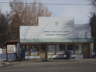
Henefer is a town in Summit County, Utah, United States. It is part of the Salt Lake City, Utah Metropolitan Statistical Area. The population was 766 at the 2010 census.

<span class="mw-page-title-main">Rush Valley, Utah</span> Town in the state of Utah, United States

Rush Valley is a town in Tooele County, Utah, United States, located in the northwest of Rush Valley. It is part of the Salt Lake City, Utah Metropolitan Statistical Area. The population was 447 at the 2010 census, with an estimate population of 494 in 2019.

<span class="mw-page-title-main">Vernon, Utah</span> Town in the state of Utah, United States

Vernon is a town in southeastern Tooele County, Utah, United States.

<span class="mw-page-title-main">Leeds, Utah</span> Town in Washington County, Utah

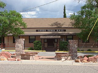
Leeds is a town in Washington County, Utah, United States. The population was 820 at the 2010 census.

<span class="mw-page-title-main">Bicknell, Utah</span> Town in the state of Utah, United States

Bicknell is a town along State Route 24 in Wayne County, Utah, United States. As of the 2010 census, the town population was 327.

<span class="mw-page-title-main">Huntsville, Utah</span> Town in the state of Utah, United States

Huntsville is a town in Weber County, Utah, United States. The population was 608 at the 2010 census. It is located in Ogden Valley. It is part of the Ogden–Clearfield, Utah Metropolitan Statistical Area, as well as the Ogden Valley census county division.

References

  1. "2019 U.S. Gazetteer Files". United States Census Bureau. Retrieved August 7, 2020.
  2. 1 2 U.S. Geological Survey Geographic Names Information System: Scipio, Utah
  3. 1 2 "Population and Housing Unit Estimates". United States Census Bureau. May 24, 2020. Retrieved May 27, 2020.
  4. 1 2 "U.S. Census website". United States Census Bureau . Retrieved 2008-01-31.
  5. 1 2 "NOAA Online Weather Data - NWS Salt Lake City". National Weather Service. Retrieved October 30, 2022.
  6. "U.S. Climate Normals Quick Access - Station: Scipio, UT". National Oceanic and Atmospheric Administration. Retrieved October 30, 2022.
  7. "Census of Population and Housing". Census.gov. Retrieved June 4, 2015.
  8. Lyman, Edward Leo; Linda King Newell (January 1999). A History of Millard County. Utah Centennial County History Series. Salt Lake City: Utah State Historical Society. p. 99. ISBN   0-913738-38-7.
  9. Andrew Jenson. Encyclopedic History of the Church of Jesus Christ of Latter-Day Saints . (Salt Lake City: Deseret Book, 1941) p. 783

Commons-logo.svg Media related to Scipio, Utah at Wikimedia Commons