Scribner, Nebraska

Last updated

Scribner, Nebraska
Scribner, Nebraska downtown 1.JPG
Downtown Scribner
Dodge County Nebraska Incorporated and Unincorporated areas Scribner Highlighted.svg
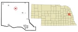
Location of Scribner, Nebraska
Coordinates: 41°39′54″N96°39′55″W / 41.66500°N 96.66528°W / 41.66500; -96.66528
Country United States
State Nebraska
County Dodge
Area
[1]
  Total0.67 sq mi (1.72 km2)
  Land0.65 sq mi (1.69 km2)
  Water0.01 sq mi (0.04 km2)
Elevation
[2]
1,253 ft (382 m)
Population
 (2020)
  Total843
  Density1,294.93/sq mi (499.85/km2)
Time zone UTC-6 (Central (CST))
  Summer (DST) UTC-5 (CDT)
ZIP code
68057
Area code 402
FIPS code 31-44280 [3]
GNIS feature ID838238 [2]
Website https://www.scribner-ne.gov

Scribner is a city in Dodge County, Nebraska, United States. The population was 857 at the 2010 census.

Contents

History

Scribner was platted in 1870 by Lucius D. Richards when the railroad was extended to that point. [4] It was named for publishing magnate Charles Scribner I. Today, Scribner remains a town of trade, even though the railroad no longer serves the town.

By the mid-1970s, the future of railroad service came into question. The Chicago & North Western tracks had been experiencing mildly declining freight traffic volumes. Revenue railroad service ultimately ended in spring of 1982, when flooding from the Elkhorn River & nearby Pebble Creek damaged sections of the track. With freight traffic mildly declining & flooding damage, the C&NW promptly filed a request with the Interstate Commerce Commission to abandon the line. Permission was granted a short time later, leaving the tracks with a dismal future. Plans were made to revive railroad service from the newly formed Fremont & Elkhorn Valley Railroad, who purchased the abandoned C&NW track. However, the costs were too high to revive railroad service, and the tracks were removed in 1988. [5] [6]

Geography

According to the United States Census Bureau, the city has a total area of 0.66 square miles (1.71 km2), of which 0.64 square miles (1.66 km2) is land and 0.02 square miles (0.05 km2) is water. [7]

Climate

This climatic region is typified by large seasonal temperature differences, with warm to hot (and often humid) summers and cold (sometimes severely cold) winters. According to the Köppen Climate Classification system, Scribner has a humid continental climate, abbreviated "Dfa" on climate maps. [8]

Demographics

Historical population
CensusPop.Note
1880 193
1890 664244.0%
1900 82724.5%
1910 8917.7%
1920 1,02114.6%
1930 1,0664.4%
1940 904−15.2%
1950 9131.0%
1960 1,02111.8%
1970 1,0311.0%
1980 1,011−1.9%
1990 950−6.0%
2000 9712.2%
2010 857−11.7%
2020 843−1.6%
U.S. Decennial Census [9]

2010 census

As of the census [10] of 2010, there were 857 people, 385 households, and 223 families living in the city. The population density was 1,339.1 inhabitants per square mile (517.0/km2). There were 443 housing units at an average density of 692.2 per square mile (267.3/km2). The racial makeup of the city was 95.7% White, 0.5% African American, 0.8% Native American, 0.7% Asian, 0.5% from other races, and 1.9% from two or more races. Hispanic or Latino of any race were 1% of the population.

There were 385 households, of which 24.9% had children under the age of 18 living with them, 46.0% were married couples living together, 7.3% had a female householder with no husband present, 4.4% had a male householder with no wife present, and 42.3% were non-families. 39.5% of all households were made up of individuals, and 25.2% had someone living alone who was 65 years of age or older. The average household size was 2.13 and the average family size was 2.86.

The median age in the city was 50.4 years. 21.6% of residents were under the age of 18; 5.2% were between the ages of 18 and 24; 16.6% were from 25 to 44; 26.5% were from 45 to 64; and 30% were 65 years of age or older. The gender makeup of the city was 48.8% male and 51.2% female.

2000 census

As of the census [3] of 2000, there were 971 people, 389 households, and 245 families living in the city. The population density was 1,523.2 inhabitants per square mile (588.1/km2). There were 428 housing units at an average density of 671.4 per square mile (259.2/km2). The racial makeup of the city was 98.35% White, 0.31% African American, 0.10% Native American, 0.72% from other races, and 0.51% from two or more races. Hispanic or Latino of any race were 0.93% of the population.

There were 389 households, out of which 28.5% had children under the age of 18 living with them, 53.0% were married couples living together, 7.7% had a female householder with no husband present, and 37.0% were non-families. 32.4% of all households were made up of individuals, and 19.8% had someone living alone who was 65 years of age or older. The average household size was 2.31 and the average family size was 2.94.

In the town the population was spread out, with 23.3% under the age of 18, 6.7% from 18 to 24, 22.0% from 25 to 44, 17.4% from 45 to 64, and 30.6% who were 65 years of age or older. The median age was 43 years. For every 100 females, there were 79.2 males. For every 100 females age 18 and over, there were 77.8 males.

As of 2000 the median income for a household in the city was $30,455, and the median income for a family was $40,625. Males had a median income of $31,389 versus $18,553 for females. The per capita income for the city was $16,173. About 6.1% of families and 9.4% of the population were below the poverty line, including 8.6% of those under age 18 and 13.3% of those age 65 or over.

Notable people

Related Research Articles

<span class="mw-page-title-main">Elgin, Nebraska</span> City in Antelope County, Nebraska, United States

Elgin is a city in Antelope County, Nebraska, United States. The population was 661 at the 2010 census.

<span class="mw-page-title-main">Ainsworth, Nebraska</span> City in and county seat of Brown County, Nebraska, United States

Ainsworth is a city and county seat of Brown County, Nebraska, United States. The population was 1,728 at the 2010 census.

<span class="mw-page-title-main">Louisville, Nebraska</span> City in Nebraska, United States

Louisville is a city in northern Cass County, Nebraska, United States. The population was 1,319 at the 2020 census.

<span class="mw-page-title-main">Belden, Nebraska</span> Village in Nebraska, United States

Belden is a village in Cedar County, Nebraska, United States. The population was 112 at the 2020 census.

<span class="mw-page-title-main">Imperial, Nebraska</span> City in Nebraska, United States

Imperial is a city in Chase County, Nebraska, United States. The population was 2,071 at the 2010 census. It is the county seat of Chase County.

<span class="mw-page-title-main">Deweese, Nebraska</span> Village in Clay County, Nebraska, United States

Deweese is a village in Clay County, Nebraska, United States. The population was 43 at the 2020 census. It is part of the Hastings, Nebraska Micropolitan Statistical Area.

<span class="mw-page-title-main">Edgar, Nebraska</span> City in Nebraska, United States

Edgar is a city in Clay County, Nebraska, United States. The population was 498 at the 2010 census. It is part of the Hastings, Nebraska Micropolitan Statistical Area.

<span class="mw-page-title-main">Bennington, Nebraska</span> City in Douglas County, Nebraska, United States

Bennington is a city in Douglas County, Nebraska, United States. The population was 2,026 at the 2020 U.S. Census.

<span class="mw-page-title-main">Benkelman, Nebraska</span> City in and county seat of Dundy County, Nebraska, United States

Benkelman is a city in and the county seat of Dundy County, Nebraska, United States. As of the 2020 census, the city population was 821.

<span class="mw-page-title-main">Burwell, Nebraska</span> City in Nebraska, United States

Burwell is a city in Garfield County, Nebraska, United States. The population was 1,210 at the 2010 census. It is the county seat of Garfield County.

<span class="mw-page-title-main">Reynolds, Nebraska</span> Village in Jefferson County, Nebraska, United States

Reynolds is a village in Jefferson County, Nebraska, United States. The population was 59 at the 2020 census.

<span class="mw-page-title-main">Crofton, Nebraska</span> City in Nebraska, United States

Crofton is a city in Knox County, Nebraska, United States. The population was 726 at the 2010 census.

<span class="mw-page-title-main">Syracuse, Nebraska</span> City in Nebraska, United States

Syracuse is a city in Otoe County, Nebraska, United States. The population was 1,941 at the 2020 census.

<span class="mw-page-title-main">Pawnee City, Nebraska</span> City in and county seat of Pawnee County, Nebraska, United States

Pawnee City is a city in and the county seat of Pawnee County, Nebraska, United States. The population was 878 at the 2010 census.

<span class="mw-page-title-main">Osmond, Nebraska</span> City in Nebraska, United States

Osmond is a city in Pierce County, Nebraska, United States. It is part of the Norfolk, Nebraska Micropolitan Statistical Area. The population was 791 at the 2020 census.

<span class="mw-page-title-main">Bassett, Nebraska</span> City in and county seat of Rock County, Nebraska, United States

Bassett is a city in Rock County, Nebraska, United States. The population was 619 at the 2010 census. It is the county seat of Rock County.

<span class="mw-page-title-main">Malmo, Nebraska</span> Village in Saunders County, Nebraska, United States

Malmo is a village in Saunders County, Nebraska, United States. The population was 94 at the 2020 census.

<span class="mw-page-title-main">Yutan, Nebraska</span> City in Saunders County, Nebraska, United States

Yutan is a city in Saunders County, Nebraska, United States.

<span class="mw-page-title-main">Deshler, Nebraska</span> City in Thayer County, Nebraska, United States

Deshler is a city in Thayer County, Nebraska, United States. The population was 739 at the 2020 census.

<span class="mw-page-title-main">Winside, Nebraska</span> Village in Wayne County, Nebraska, United States

Winside is a village in Wayne County, Nebraska, United States. The population was 381 at the 2020 census.

References

  1. "ArcGIS REST Services Directory". United States Census Bureau. Retrieved September 18, 2022.
  2. 1 2 U.S. Geological Survey Geographic Names Information System: Scribner, Nebraska
  3. 1 2 "U.S. Census website". United States Census Bureau . Retrieved January 31, 2008.
  4. "Scribner, Dodge County". Center for Advanced Land Management Information Technologies. University of Nebraska. Retrieved August 7, 2014.
  5. Chicago and North Western Railway Company (1908). A History of the Origin of the Place Names Connected with the Chicago & North Western and Chicago, St. Paul, Minneapolis & Omaha Railways. p. 123.
  6. "Profile for Scribner, NE". ePodunk . Retrieved August 7, 2014.
  7. "US Gazetteer files 2010". United States Census Bureau. Archived from the original on January 25, 2012. Retrieved June 24, 2012.
  8. Climate Summary for Scribner, Nebraska
  9. "Census of Population and Housing". Census.gov. Retrieved June 4, 2015.
  10. "U.S. Census website". United States Census Bureau . Retrieved June 24, 2012.