Oakham is the county town of Rutland in the East Midlands of England, 25 miles (40.2 km) east of Leicester, 28 miles (45.1 km) south-east of Nottingham and 23 miles (37.0 km) west of Peterborough. It had a population of 10,922 in the 2011 census, estimated at 11,191 in 2019. Oakham is to the west of Rutland Water and in the Vale of Catmose. Its height above sea level ranges from 325 ft (99 m) to 400 ft (120 m).
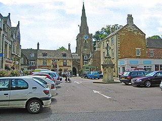
Uppingham is a market town in Rutland, England, off the A47 between Leicester and Peterborough, 6 miles (10 km) south of the county town, Oakham. It had a population of 4,745 according to the 2011 census, estimated at 4,853 in 2019. It is known for its eponymous public school. With its art galleries Uppingham has become a popular destination for art lovers. Uppingham was named "best place to live in the Midlands in 2022" by The Times newspaper, who commented on the town by calling it "a discerning market town with art, heart and smarts — plus the magnificent Rutland Water".

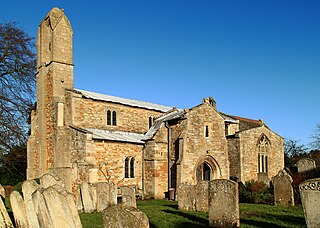
Wing is a village and civil parish in the East Midlands county of Rutland, England. The population was 315 at the 2001 census and 314 at that of 2011. It features a fine church and a labyrinth made of turf. Rutland Water reservoir is nearby.

Stretton is a village and civil parish in the county of Rutland, England, just off the A1 Great North Road. The population of the civil parish was 770 at the 2001 census, including Thistleton and increasing to 1,260 at the 2011 census. The ecclesiastical parish of Stretton shares the same boundaries and is part of the Rutland deanery of the diocese of Peterborough.
North Luffenham is a village in Rutland, in the East Midlands of England. The population of the civil parish at the 2001 census was 704, decreasing to 679 at the 2011 census. It lies to the north of the River Chater, 5 miles (8.0 km) east of Uppingham and 7 miles (11 km) west of Stamford. Located to the north of the village is St George's Barracks, formerly RAF North Luffenham.
Major-General Robert Overtonc. 1609 to 1678, was a member of the landed gentry from Yorkshire, who fought for Parliament during the Wars of the Three Kingdoms, and reached the rank of Major General in 1652. A committed republican and religious Independent who sympathised with the Fifth Monarchists, like others with similar views he opposed the establishment of The Protectorate, and was held in the Tower of London from 1655 to 1659.

Ashwell is a village and civil parish in the county of Rutland in the East Midlands of England. The population of the civil parish was 290 at the 2001 census falling to 269 at the 2011 census. It is located about 3 miles (5 km) north of Oakham.

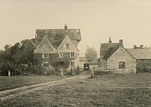
Barleythorpe is a village and civil parish in the county of Rutland in the East Midlands of England. It is located about a mile (1.6 km) north-west of Oakham. The population at the 2001 census was 178, increasing to 207 at the 2011 census.

Belton-in-Rutland is a village and civil parish in the county of Rutland in the East Midlands of England. The population at the 2001 census was 345 increasing to 348 at the 2011 census. It is situated about six miles (9.6 km) southwest of Oakham and about four miles (6.4 km) west of Uppingham and overlooks the A47. The Eye Brook forms the county boundary with Leicestershire.

Burley, or Burley-on-the-Hill, is a village and civil parish in the county of Rutland in the East Midlands of England. It is located two miles (3 km) north-east of Oakham. The population of the civil parish was 577 at the 2001 census, including Egleton, but reducing to 325 at the 2011 census.
Gunthorpe is a civil parish and a hamlet in the county of Rutland in the East Midlands of England.
Manton is a village in the county of Rutland in the East Midlands of England. It lies south-west of Rutland Water. The population of the civil parish at the 2001 census was 364, and after including Gunthorpe decreased slightly to 359 at the 2011 census.

Market Overton is a village on the northern edge of the county of Rutland in the East Midlands of England. The population of the civil parish was 494 at the 2001 census, increasing to 584 at the 2011 census.

Morcott is a village and civil parish in the county of Rutland in the East Midlands of England. The population at the 2001 census was 329 falling slightly to 321 at the 2011 census. It is located about 7 miles (11 km) south-east of the county town of Oakham on the A47 and A6121 roads. A prominent reconstructed windmill can be seen from both East and West-bound approaches to Morcott along the A47.

Ibstock is a village and civil parish about 2.5 miles (4 km) south of Coalville in North West Leicestershire, England. The population of the civil parish was 5,760 at the 2001 census increasing to 6,201 at the 2011 census.

Kippax is a village and civil parish in the City of Leeds metropolitan borough, West Yorkshire, England. It is situated to the east of the city, near to Garforth and Great Preston. The Kippax and Methley ward of Leeds City Council was part of the former UK Parliament constituency of Elmet, which became Elmet and Rothwell at the 2010 UK general election. The population of Kippax parish at the 2011 Census was 9,785. Kippax was a separate civil parish, in Tadcaster Rural District, until 1939, when it was annexed to Garforth. It re-acquired civil parish status and a parish council on 1 April 2004.
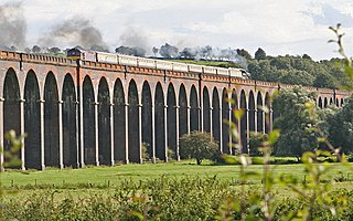
Welland Viaduct, Harringworth Viaduct or Seaton Viaduct, crosses the valley of the River Welland between Harringworth in Northamptonshire and Seaton in Rutland, England.

Loddington is a village and civil parish in the Harborough district of Leicestershire. It is on the county boundary with Rutland, and the nearest town is Oakham in Rutland, 6 miles (10 km) to the northeast.

Rutland is a ceremonial county and unitary authority in the East Midlands, England. The county is bounded to the west and north by Leicestershire, to the northeast by Lincolnshire and the southeast by Northamptonshire.