
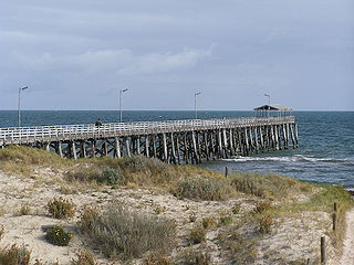
Osborne is a suburb in the Australian state of South Australia located on the LeFevre Peninsula in the west of Adelaide about 21 kilometres north-west of the Adelaide city centre.
Grange is a coastal suburb of the City of Charles Sturt, in Adelaide, South Australia, located 11 kilometres from the Adelaide city centre. The suburb is named after Captain Charles Sturt's cottage, built in 1840–41, which still stands and is now a museum. In addition to Grange Beach, the suburb has several parks and reserves, as well as the Grange Hotel, which was originally licensed in 1881.

Woodville is a suburb of Adelaide, situated about 8 kilometres northwest of the Central Business District of Adelaide. It lies within the City of Charles Sturt. The postcode of Woodville is 5011. Woodville is bound by Cheltenham Parade to the west, Torrens Road to the north, Port Road to the south and Park Street to the east, excluding the area of Cheltenham Park Racecourse.

Parkside is an inner southern suburb of Adelaide, South Australia. It is located in the City of Unley.
Ascot Park is a suburb in the south-western part of Adelaide in the City of Marion. It was named after Ascot Racecourse in England.

Tennyson is a suburb in the Australian state of South Australia located in the Adelaide metropolitan area about 11 kilometres (6.8 mi) north-west of the Adelaide city centre and about 4.8 kilometres (3.0 mi) west of the municipal seat of Woodville.

Woodville Gardens is a north-western suburb of Adelaide 9 km from the CBD, in the state of South Australia, Australia and falls under the City of Port Adelaide Enfield. It is adjacent to Woodville North, Mansfield Park, Ferryden Park, and Kilkenny. The post code for Woodville Gardens is 5012. It is bounded to the south by First Avenue, and to the east by Liberty Grove, and to the west by Hanson Road.

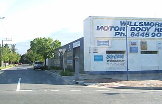
Athol Park is a north-western suburb of Adelaide, South Australia. It is located in the City of Charles Sturt.

Woodville North is a north-western suburb of Adelaide 10 km from the Adelaide city centre, in the state of South Australia, Australia and falls under the City of Charles Sturt. The post code for Woodville North is 5012. It is adjacent to Pennington, Athol Park, Woodville Gardens, Mansfield Park, Woodville and Kilkenny. It is bordered to the east by Hanson Road to the west by Carlton Crescent, to the south by Torrens Road and to the north by Hamilton Road. The suburb is residential, apart from an industrial pocket to the northwest.

Cheltenham is a suburb of Adelaide, South Australia. It is located on Kaurna Land in the City of Charles Sturt.

Brompton is an inner-northern suburb of Adelaide, South Australia in the City of Charles Sturt.

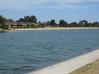
West Lakes is a suburb of Adelaide, the state capital of South Australia, Australia. It lies within the City of Charles Sturt. It contains the Westfield West Lakes Shopping Centre, Woodlake Shopping Centre and West Lakes Golf Club. It also contains Delfin Island, a residential island within the boating lake.
Woodville South is a suburb of Adelaide, South Australia. It lies within the City of Charles Sturt.

Ovingham is an inner northern suburb of Adelaide, South Australia. It is located in the cities of Charles Sturt and Prospect.
Albert Park is a suburb of Adelaide, South Australia. It is located in the City of Charles Sturt.
Findon is a western suburb of Adelaide, South Australia. It is located in the City of Charles Sturt.
Semaphore Park is a suburb in the Australian state of South Australia located in the west of Adelaide on the coastline of Gulf St Vincent. The northern end of the suburb is considered to be located within the Lefevre Peninsula.

Allenby Gardens is a western suburb of Adelaide, South Australia. It is located in the City of Charles Sturt.
West Lakes Shore is a suburb in the Australian state of South Australia located in the Adelaide metropolitan area about 12 kilometres (7.5 mi) north-west of the Adelaide city centre and about 5 kilometres (3.1 mi) west of the municipal seat of Woodville.
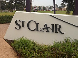
St Clair is a suburb of Adelaide, South Australia, and administered by the City of Charles Sturt. St Clair is geographically located with in the Hundred of Yatala, and was first recorded as the name for the suburb on 6 November 2012 by the Surveyor General of South Australia. The suburb is bounded by Cheltenham Parade, Torrens Road, Woodville Road and the Outer Harbor train line. The Cheltenham Park Racecourse was located here up until the late 2000s and new houses were built in the years after that.


