Related Research Articles
Gobowen is a village in Shropshire, England, about 3 miles north of Oswestry. The population according to the 2011 census was 3,270.

Loxley, Warwickshire, is a village and civil parish near Stratford-upon-Avon, Warwickshire, England. The population taken at the 2011 census was 399. Loxley gave its name to a hall of residence at the University of Warwick, within the Westwood campus. The settlement is first mentioned in the late 8th century, as King Offa of Mercia gave it to Worcester Cathedral. The Domesday Book records the community as including a resident priest. Ownership later passed to Kenilworth Abbey. The parish church was consecrated in 1286, built on the foundation of the earlier Anglo-Saxon church. In 1538, Loxley manor was owned by Robert Croft, later passing to the Underhill family and in 1664 to Edward Nash of East Greenwich.

Bishop's Tachbrook is a village and civil parish in the Warwick District of Warwickshire, England. The village is about 3 miles (5 km) south of Warwick and Leamington Spa. A church at Bishop's Tachbrook is mentioned in the Domesday Book. The village contains traditional half-timbered buildings, and modern residences including council-owned terraced housing. Facilities and amenities include The Leopard public house, the oldest part of which was a morgue for the nearby crematorium, small retail outlets including a corner shop, a primary school for children aged 4 to 11, and a park which includes a BMX track.

Bubbenhall is a village and civil parish in the Warwick district of Warwickshire, England.

Cheswick Green is a village and civil parish within the Metropolitan Borough of Solihull in the English county of West Midlands, incorporating the nearby hamlet of Illshaw Heath. The settlement lies approximately 3 miles (4.8 km) south west of Solihull town centre. The civil parish population as taken at the 2011 census was 2,197. It borders Dickens Heath and Monkspath to the north, and Earlswood and Warings Green to the south. The northernmost part of Warings Green lies in the parish of Cheswick Green.
Wishaw is a village and civil parish in the north-west of Warwickshire, England. The population of the civil parish at the 2011 census was 125. It is located within the district of North Warwickshire and is the home of The Belfry golf resort, which has hosted the Ryder Cup on four occasions. The village is also home to some notable buildings. The site of The Belfry was once the location of Moxhull Park, a stately home that belonged to the Ryland family until it burnt down in the early twentieth century. The manor house was rebuilt one mile away to its present location on Holly Lane as Moxhull Hall. Wishaw is also the location of a church dedicated to the local Saint Chad. The church is popular with marriages and regular Sunday services, despite a very small local population.

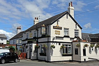
Eathorpe is a small village and civil parish five miles east of Leamington Spa, in Warwickshire, England. The parish is part of the electoral ward of Cubbington. It is close to the B4455, which follows the line of the Roman Fosse Way, and the River Leam. According to the 2001 census, the parish had a population of 113, increasing to 190 at the 2011 census. The village has a village hall, the original being built in the early 1970s. The only public house is The Plough, an 18th-century former coaching inn situated beside the Fosse Way.

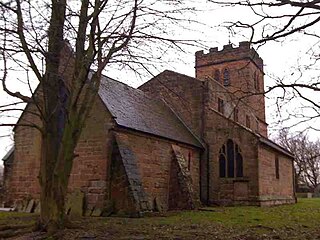
Norton Lindsey is a village and civil parish in Warwickshire, England, 3.5 miles south-west of the tourist and county town of Warwick and a mile west of the M40 motorway. At the 2011 census, the parish had a population of 326. The village takes its name from the Lindsey family who were lords of the manor in the 12th century. The parish church of the Holy Trinity dates from the following century. The village has a windmill. Two of the village's other prominent features are the Village Hall and the cricket club, which is shared with nearby Wolverton. The village also has its own Brownie pack.
Butlers Marston is a village and civil parish on the River Dene in south-eastern Warwickshire, England. The village is part of Stratford-on-Avon district. In the 2001 census it had a population of 226, increasing to 232 in the 2011 Census. Butlers Marston is located one mile south-west of Kineton and roughly four miles south-east of Wellesbourne.

Preston on Stour is a village and civil parish in Warwickshire, England.

Brogyntyn, or Porkington, is a mansion in the parish of Selatyn to the north-west of Oswestry in Shropshire, England. Brogyntyn Hall was the home of the Ormsby-Gore family from 1815, and had previously been the estate of their ancestors the Maurices and Owens since the sixteenth century. It was abandoned and uninhabited from around 1985.

Selattyn is a village and former civil parish, now in the parish of Selattyn and Gobowen, in the Shropshire district, in the ceremonial county of Shropshire, England. It is on the England–Wales border, close to Oswestry. In 1961 the parish had a population of 1830. On 1 April 1967 the parish was abolished to form "Selattyn and Gobowen", part also went to Whittington.

Craswall is a village and civil parish in Herefordshire, England. It lies in the far west of the county, in the foothills of the Black Mountains, close to the border with Wales.

Llanyblodwel is a village and civil parish in Shropshire, England; the spelling "Llanyblodwell" was commonly used in the past, and the village was sometimes simply referred to as "Blodwel". The population of the civil parish at the 2011 census was 767. It lies 7 miles west of the nearest town, Oswestry, in the valley of the River Tanat. Simon Jenkins, in his guide to English churches says of Llanyblodwel that "the Welsh Marches are seldom so lovely as where the River Tanat crosses the border through the steep wooded valleys west of Oswestry."

Bradley is a village and civil parish in Staffordshire, England. The population of the civil parish at the 2011 census was 513. It is located close to the A518 road leading to the villages of Haughton and Gnosall towards Telford.

Kingsland is a small village and civil parish in the English county of Herefordshire, 5 kilometres (3 mi) north-west of Leominster. The population of the civil parish at the 2011 census was 986.

The 2013 elections to Shropshire Council were held on 2 May 2013 as part of the 2013 United Kingdom local elections. These were the second elections to the unitary authority created as part of local government restructuring in Shropshire, following on from the previous elections in 2009. All 74 seats in the 63 electoral divisions were up for election across Shropshire. At the same time, all town and parish council contested elections took place, most notably including Shrewsbury Town Council.

Luston is a village and civil parish in north Herefordshire. It is 3 miles (5 km) north from Leominster on the B4361 road. To the south from the village of Luston is the hamlet of The Broad. The population of the civil parish at the 2011 census was 541.
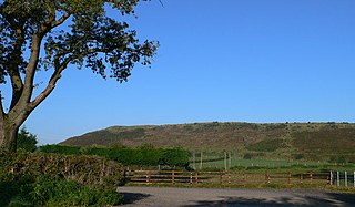
The Oswestry Uplands are a small natural region in the English county of Shropshire on the border with Wales.
Selattyn and Gobowen is a civil parish in Shropshire, England. It contains 31 listed buildings that are recorded in the National Heritage List for England. Of these, one is listed at Grade I, the highest of the three grades, one is at Grade II*, the middle grade, and the others are at Grade II, the lowest grade. The parish contains the villages of Gobowen and Selattyn, and smaller settlements, and is otherwise rural. Most of the listed buildings are houses, cottages, farmhouses, and farm buildings, the earliest of which are timber framed or have timber-framed cores. In the parish are two country houses and a church, which are all listed, together with structures associated with them. The other listed buildings include a disused limekiln, two milestones, a lock-keeper's cottage, a railway station and an associated cottage, and a war memorial.
References
- ↑ "Civil Parish population 2011" . Retrieved 30 November 2015.
52°53′57″N3°5′22″W / 52.89917°N 3.08944°W
| International | |
|---|---|
| National | |
| | This Shropshire location article is a stub. You can help Wikipedia by expanding it. |