Selz, North Dakota

Last updated

Selz, North Dakota
Selz, North Dakota 10-15-2008.jpg
Buildings in Selz
USA North Dakota location map.svg
Red pog.svg
Selz, North Dakota
Coordinates: 47°51′34″N99°53′36″W / 47.85944°N 99.89333°W / 47.85944; -99.89333
CountryUnited States
State North Dakota
County Pierce
Area
[1]
  Total0.14 sq mi (0.35 km2)
  Land0.14 sq mi (0.35 km2)
  Water0.00 sq mi (0.00 km2)
Elevation
[2]
1,604 ft (489 m)
Population
 (2020)
  Total40
  Density291.97/sq mi (112.83/km2)
Time zone UTC-6 (Central (CST))
  Summer (DST) UTC-5 (CDT)
ZIP code
58341
Area code 701
FIPS code 38-71700
GNIS feature ID2584356 [2]

Selz is a census-designated place and unincorporated community in Pierce County, North Dakota, United States. Its population was 40 as of the 2020 census. [3]

Contents

St. Boniface Cemetery, Wrought-Iron Cross Site, near Selz, is listed on the National Register of Historic Places.

Geography

According to the United States Census Bureau, the CDP has a total area of 0.14 square miles (0.36 km2), all land. [4]

Demographics

Historical population
CensusPop.Note
2020 40
U.S. Decennial Census [5]

2010 census

As of the census [6] of 2010, there were 46 people, 23 households, and 11 families in the CDP. The population density was 335.8 inhabitants per square mile (129.7/km2). There were 30 housing units at an average density of 219.0 per square mile (84.6/km2). The racial makeup of the CDP was 97.8% White, and 2.2% Asian.

There were 23 households, of which 21.7% had children under the age of 18 living with them, 34.8% were married couples living together, 4.3% had a female householder with no husband present, 8.7% had a male householder with no wife present, and 52.2% were non-families. 47.8% of all households were made up of individuals, and 17.4% had someone living alone who was 65 years of age or older. The average household size was 2.00 and the average family size was 3.00.

The median age in the CDP was 45.0 years. 21.7% of residents were under the age of 18; 4.3% were between the ages of 18 and 24; 23.9% were from 25 to 44; 32.6% were from 45 to 64; and 17.4% were 65 years of age or older. The gender makeup of the CDP was 54.3% male and 45.7% female.

See also

Related Research Articles

<span class="mw-page-title-main">Hettinger, North Dakota</span> City in North Dakota, United States

Hettinger is a city in, and the county seat of, Adams County, North Dakota, United States. The population was 1,074 at the 2020 census.

<span class="mw-page-title-main">Erie, North Dakota</span> Census-designated place in North Dakota, United States

Erie is a census-designated place (CDP) in Cass County, North Dakota, United States. The population was 50 at the 2010 census. Established in or after 1980 by the United States Census Bureau, the CDP is named for the village of Erie, which is within its boundary. Although the rectangular boundary includes a sizeable amount of farmland, there is in fact only one residence outside the village's boundary but within that of the CDP.

<span class="mw-page-title-main">North River, North Dakota</span> City in North Dakota, United States

North River is a city in Cass County, North Dakota, United States. The population was 55 at the 2020 census. North River was founded in 1973. It is a suburb/bedroom community directly adjacent to the city of Fargo.

<span class="mw-page-title-main">Wheatland, North Dakota</span> Census-designated place in North Dakota, United States

Wheatland is a census-designated place (CDP) in Cass County, North Dakota, United States. The population was 68 at the 2010 census.

<span class="mw-page-title-main">Belcourt, North Dakota</span> CDP in North Dakota, United States

Belcourt is a census-designated place (CDP) in Rolette County, North Dakota, United States. It is within the Turtle Mountain Indian Reservation. The population was 1,510 at the 2020 census.

<span class="mw-page-title-main">East Dunseith, North Dakota</span> CDP in North Dakota, United States

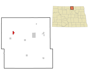
East Dunseith is a census-designated place (CDP) in Rolette County, North Dakota, United States. The population was 500 at the 2020 census.

<span class="mw-page-title-main">Storla, South Dakota</span> CDP in South Dakota, United States

Storla is a census-designated place (CDP) in Aurora County, South Dakota, United States. The population was 6 in the 2020 census.

<span class="mw-page-title-main">Loomis, South Dakota</span> CDP in South Dakota, United States

Loomis is a census-designated place (CDP) in Davison County, South Dakota, United States. The population was 33 at the 2020 census. It is part of the Mitchell, South Dakota Micropolitan Statistical Area.

<span class="mw-page-title-main">North Eagle Butte, South Dakota</span> Census-designated place in South Dakota, United States

North Eagle Butte is a census-designated place (CDP) in Dewey County, South Dakota, United States, along the 45th parallel. The population was 1,879 at the 2020 census.

<span class="mw-page-title-main">Whitehorse, South Dakota</span> CDP in South Dakota, United States

Whitehorse is a census-designated place (CDP) in Dewey County, South Dakota, United States. The population was 106 at the 2020 census.

<span class="mw-page-title-main">North Spearfish, South Dakota</span> Census-designated place in South Dakota, United States

North Spearfish is a census-designated place (CDP) in Lawrence County, South Dakota, United States. The population was 2,366 at the 2020 census.

<span class="mw-page-title-main">Roswell, South Dakota</span> Census-designated place in South Dakota, United States

Roswell is a CDP in Miner County, South Dakota, United States. The population was 8 at the 2020 census. It disincorporated as a town in 2012.

<span class="mw-page-title-main">Green Valley, South Dakota</span> CDP in South Dakota, United States

Green Valley is a census-designated place (CDP) and unincorporated community in Pennington County, South Dakota, United States. The population was 1,051 at the 2020 census.

<span class="mw-page-title-main">Rapid Valley, South Dakota</span> CDP in South Dakota, United States

Rapid Valley is a census-designated place (CDP) and unincorporated community in Pennington County, South Dakota, United States, and a suburb of Rapid City. The population was 8,098 at the 2020 census. Rapid Valley has been a retreat for people living in Rapid City due to its low crime, cheap land, and views of the Black Hills. Rapid Valley is home to many industrial and financial businesses, and is the headquarters for many corporations specializing in transport and engineering.

<span class="mw-page-title-main">Oglala, South Dakota</span> CDP in South Dakota, United States

Oglala is a census-designated place (CDP) in West Oglala Lakota Unorganized Territory equivalent, Oglala Lakota County, South Dakota, United States. The population was 1,282 at the 2020 census. Its location is in the northwest of the Pine Ridge Indian Reservation.

<span class="mw-page-title-main">Antelope, South Dakota</span> CDP in South Dakota, United States

Antelope is a census-designated place (CDP) in Todd County, South Dakota, United States. The population was 830 at the 2020 census.

<span class="mw-page-title-main">Spring Creek, South Dakota</span> CDP in South Dakota, United States

Spring Creek is a census-designated place (CDP) in Todd County, South Dakota, United States. The population was 236 at the 2020 census.

<span class="mw-page-title-main">Two Strike, South Dakota</span> CDP in South Dakota, United States

Two Strike is a census-designated place (CDP) in Todd County, South Dakota, United States, named after Brulé, Lakota chief Two Strike who lived at that location for a period of time. The population was 282 at the 2020 census.

<span class="mw-page-title-main">Nash, North Dakota</span> Census-designated place & Unincorporated community in North Dakota, United States

Nash is a census-designated place and unincorporated community in Walsh County, North Dakota, United States. Its population was 32 as of the 2010 census. The unincorporated community is located in Farmington Township, northwest of Grafton.

<span class="mw-page-title-main">Orrin, North Dakota</span> Census-designated place & Unincorporated community in North Dakota, United States

Orrin is a census-designated place and unincorporated community in Pierce County, North Dakota, United States. Its population was 22 as of the 2010 census.

References

  1. "ArcGIS REST Services Directory". United States Census Bureau. Retrieved September 20, 2022.
  2. 1 2 U.S. Geological Survey Geographic Names Information System: Selz, North Dakota
  3. "U.S. Census website". census.gov. United States Census Bureau . Retrieved August 13, 2023.
  4. "US Gazetteer files: 2010, 2000, and 1990". United States Census Bureau. February 12, 2011. Retrieved April 23, 2011.
  5. "Census of Population and Housing". Census.gov. Retrieved June 4, 2016.
  6. "U.S. Census website". United States Census Bureau . Retrieved July 2, 2017.