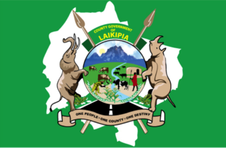
Laikipia County is one of the 47 Counties of Kenya, located on the Equator in the former Rift Valley Province of the Country. Laikipia is a cosmopolitan County and is Listed as County number 31. The county has two major urban centres: Nanyuki to the southeast, and Nyahururu to the southwest. Its County government headquarters town is Rumuruti. The County lies between latitudes 0° 18" South and 0° 51" North and between longitudes 36° 11" and 37° 24' East. It borders Samburu County to the North, Isiolo County to the North East, Meru County to the East, Nyeri County to the South East, Nyandarua County to the South, Nakuru County to the South West and Baringo County to the West.

Kericho County is one of the 47 counties in Kenya. The county seats between longitude 35°02' and 35°40' East and between the equator and latitude 0°23' South with an altitude of about 2002m above sea level. It borders Uasin Gishu County to the North West, Baringo County to the North-East, Nandi County to the North-West, Nakuru County to the East and Bomet County to the South, Kisumu County to the Northwest and Nyamira County to the West. It has a population of 901,777 and an area of 2,111 km². Its capital and largest town is Kericho.

Lamu County is a county in Kenya located along the North Coast of the country and is one of the six Coastal Counties in Kenya. Its capital is the town of Lamu. It borders Tana River County to the southwest, Garissa County to the north, Somalia to the northeast, and the Indian Ocean to the South.

Kiambu County is a county in the former Central Province of Kenya. Its capital is Kiambu and its largest town is Thika town. Kiambu County is the second most populous county in Kenya after Nairobi County. Kiambu County borders Nairobi and Kajiado Counties to the South, Machakos to the East, Murang'a to the North and North East, Nyandarua to the North West, and Nakuru to the West. It has a population of 2,417,735.
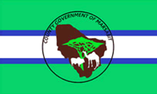
Marsabit County is a county in Kenya. Covering a surface area of 66,923.1 square kilometres. Marsabit is the second largest county by size in Kenya after Turkana county which has an area of 71,597.8 km2. Its capital is Marsabit and its largest town is Moyale. According to the 2019 census, the county has a population of 459,785. It is bordered to the North by Ethiopia, to the West by Turkana County to the South by Samburu County and Isiolo County, and to the East by Wajir County.

Makueni County is a county in the former Eastern Province of Kenya. Its capital town is Wote.The largest town is Emali town. Emali town is also an important market and stop over for the Standard Gauge Railway (SGR). Emali town is multicultural and adds diversity to Makueni county.The county has a population of 987,653. The county lies between Latitude 1° 35' and 2° 59' South and Longitude 37° 10' and 38° 30' East. It borders Machakos County to the North, Kitui County to the East, Taita Taveta County to the South and Kajiado County to the West and covers an area of 8,008.9 km2.

Kitui County is a county in the former Eastern Province of Kenya with its capital and largest town being Kitui, although Mwingi is also another major urban centre. The county has a population of 1,136,187. and an area of 30,496 km2. It lies between latitudes 0°10 South and 3°0 South and longitudes 37°50 East and 39°0 East.
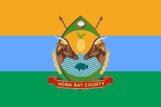
Homa Bay County is a county in the former Nyanza Province of Kenya. Its capital and largest town is Homa Bay. The county has a population of 1,131,950 and an area of 3,154.7 km2. Lake Victoria is a major source of livelihood for Homa Bay County. It has 40 wards, each represented by an MCA in the Homa Bay county assembly located in Homa Bay town, which is the county headquarters.

Garissa County is an administrative county in Kenya. It is located in Eastern Kenya bordering Somalia to the East, Wajir County and Isiolo County to the North, Tana River County to the West and Lamu County to the South. Its capital and largest urban area is Garissa.
Mandera County is one of the counties in Kenya. Its capital and largest town is Mandera. The county is bordered by Ethiopia to the north, Somalia to the east and Wajir County to the southwest. According to the 2019 census, the county has a population of 1,200,890 and an area of 25,939.8 square kilometres (10,015.4 sq mi). The main economic activity in the county is pastoralism, while others include cross-border trade with Ethiopia, artisanal mining, beekeeping, and agriculture along the Dawa River.
Esther Murugi Mathenge is a Kenyan politician. She is a former Member of Parliament for Nyeri Town Constituency in the National Assembly of Kenya.

The Government of the Republic of Kenya (GoK) is the national government of the Republic of Kenya located in East Africa. It is composed of 47 Counties, each county with its own semi-autonomous governments, including the national capital of Nairobi, where the national government is primarily based.
Baringo East Constituency was a former electoral constituency in Kenya. It was one of three constituencies in Baringo District, Rift Valley Province. The constituency was established for the 1963 elections. The constituency had nine wards, all electing councillors for the Baringo County Council.

Kisii County is a county in the former Nyanza Province in southwestern Kenya. Its capital and largest town is Kisii. The county has a population of 1,266,860 people. It borders Nyamira County to the North East, Narok County to the South, and Homa bay and Migori Counties to the West. The county covers an area of 1,318 km2.

Wilson Ndolo Ayah was a Kenyan politician. He served as Foreign Minister from 1990 to 1993 during Kenya's return to a multi-party system of governance. Wilson Ndolo Ayah served in the government of Daniel Arap Moi as minister from 18 August 1987 when he was first appointed Minister for Research Science and Technology. He was also a beneficiary of the Kennedy Airlifts.

The Independent Electoral and Boundaries Commission (IEBC) is an independent regulatory agency that was founded in the year 2011 through the making of the Constitution of Kenya. The Commission is responsible for conducting or supervising referendums and elections to any elective body or office established by the Constitution, and any other elections as prescribed by an Act of Parliament. It was created in a provision of the 2010 constitution and the Independent Electoral and Boundaries Commission Act. Its mandate includes "the continuous registration of voters and revision of the voter's roll, the delimitation of constituencies and wards, the regulation of political parties process, the settlement of electoral disputes, the registration of candidates for elections, voter education, the facilitation of the observation, monitoring and evaluation of elections, the regulation of money spent by a candidate or party in respect of any election, the development of a code of conduct for candidates and parties, [and] the monitoring of compliance with legislation on nomination of candidates by parties."
Emurua Dikirr is an electoral constituency in Kenya. It is one of six constituencies of Narok County. The constituency was established for the 2013 elections. Since the 2013 Kenyan General Elections, Johana Kipyegon Ngeno represented the constituency in the Kenyan National Assembly. Ngeno was re-elected in 2017 as a coalition member of The Eagle Coalition and is the current Member of Parliament. the constituency has 95% christians and 2% muslims(most of them living in Chebaibai near Murkan).It is located in Narok county and famously known as Transmara East. Johana was reelected in 2022 as the MP.Its backbone is the growing of swee tpotoes. The area is predominantly inhabited by Kipsigis community which with few others mainly in businesses and working there.There has been high tension in terms of politics since but has never disrupted peace.
John Paul Mwirigi, is the Member of Parliament for Igembe South Constituency, Meru County, in the Kenya National Assembly. He was elected in August 2017 at the age of 23 years, the youngest ever Kenyan member of parliament. He was re-elected on 9 August 2022 as Igembe South Constituency MP with a total of 34, 561 votes. His closest opponent garnered 10,000 votes.
Ruiru is an electoral constituency in Kenya. It is one of the twelve constituencies in Kiambu County. Within Ruiru Constituency, there are two sub-counties; Githurai and Ruiru. Its current Member of Parliament is Hon. Kingara, Simon Nganga of United Democratic Alliance party. The county has a total population of 0ver 600,000 people.
Mwingi West is a constituency in the eastern region of the republic of Kenya. It is one of eight constituencies in Kitui County. the current member of the 13th parliament of mwingi west constituency is Hon. Nguna, Charles Ngusya