Sernaglia della Battaglia

Last updated
Sernaglia della Battaglia
Comune di Sernaglia della Battaglia
Sernaglia della Battaglia-Stemma.png
Location of Sernaglia della Battaglia
Sernaglia della Battaglia
Italy provincial location map 2016.svg
Red pog.svg
Sernaglia della Battaglia
Location of Sernaglia della Battaglia in Italy
Italy Veneto location map.svg
Red pog.svg
Sernaglia della Battaglia
Sernaglia della Battaglia (Veneto)
Coordinates: 45°52′30″N12°8′00″E / 45.87500°N 12.13333°E / 45.87500; 12.13333
Country Italy
Region Veneto
Province Treviso (TV)
Frazioni Falzé di Piave, Fontigo, Villanova
Government
  MayorMirco Villanova dal 27-5-2019 ((Lega Nord - lista civica))
Area
[1]
  Total20.2 km2 (7.8 sq mi)
Elevation
119 m (390 ft)
Population
 (30 June 2023 [2] ) [3]
  Total6,066
  Density300/km2 (780/sq mi)
Demonym Sernagliesi
Time zone UTC+1 (CET)
  Summer (DST) UTC+2 (CEST)
Postal code
31020
Dialing code 0438
Website Official website

Sernaglia della Battaglia is a comune (municipality) in the Province of Treviso in the Italian region Veneto, located about 50 kilometres (31 miles) northwest of Venice and about 25 kilometres (16 miles) northwest of Treviso.

Contents

Sernaglia della Battaglia borders the following municipalities: Farra di Soligo, Giavera del Montello, Moriago della Battaglia, Nervesa della Battaglia, Pieve di Soligo, Susegana, Volpago del Montello.

History

The origins of the municipality are ancient: in the hamlet of Falzé, an ancient port on the Piave and a centre of commercial interests, finds dating back to the Eneolithic and Paleovenetian periods have been found and there are traces of the Roman presence in the rest of the territory.

With the decline of the Serenissima Republic of Venice, under whose lordship it remained until 1797, it followed, like the whole Veneto, to the French occupation, then by the Austrian one and the annexation to the Kingdom of Italy in 1866.

The sad living conditions of the population, aggravated by the two world wars, led to a massive exodus during the twentieth century, which gave those who remained the opportunity to receive remittances from fellow citizens abroad, essential for investing in businesses. Numerous private initiatives of small entrepreneurs were born that brought the country out of rural reality. [4]

Monuments and places of interest

Church of Santa Maria Assunta Chiesa di Santa Maria Assunta (Sernaglia della Battaglia) 02.jpg
Church of Santa Maria Assunta


Culture

Cultural Institutions

Municipal library dedicated to Giocondo Pillonetto, inaugurated in 1992 by the writer Mario Rigoni Stern and the poet Andrea Zanzotto. [5] [6]

Economy

The economy is based on agriculture and livestock. A number of small and medium-sized enterprises have given rise to the formation of industrial and craft areas, with the production of furniture taking precedence.

Demographic evolution

Sernaglia della Battaglia

Foreign ethnicities and minorities

As of December 31, 2022, foreigners residents in the municipality were 566, i.e. 9.4% of the population. The largest groups are shown below: [7] [8]

  1. Morocco 167
  2. North Macedonia 107
  3. Romania 56
  4. Bangladesh 27
  5. China 25
  6. Albania 22

Infrastructure and transport

In 1913 the town became the site of a stop on the Susegana-Pieve di Soligo tramway, granted to the Società Veneta and formally suppressed in 1931. Severely damaged during the First World War, it was temporarily converted into a military railway and extended to Revine Lago.

Sernaglia della Battaglia is connected to the center of Montebelluna by the MOM bus line n.131 - Montebelluna, Cornuda FS, Pieve di Soligo. [9]

Related Research Articles

<span class="mw-page-title-main">Vidor</span> Comune in Veneto, Italy

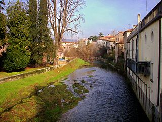
Vidor is a town and comune (municipality) in the province of Treviso, Veneto, north-eastern Italy. It is located 7 km from Valdobbiadene, 35 km from Treviso and about 70 km from Venice. It borders the following municipalities: Valdobbiadene and Farra di Soligo, Moriago della Battaglia, Pederobba and Crocetta del Montello to the south. The municipality is part of the Quartier del Piave. The hilly part of the municipal area is part of the UNESCO World Heritage Site "Prosecco Hills of Conegliano and Valdobbiadene".

<span class="mw-page-title-main">Montebelluna</span> City in Veneto, Italy

Montebelluna is a city and comune in Veneto, Italy, approximately 50 kilometres (31 mi) northwest of Venice. It has an estimated population of 32,000.

<span class="mw-page-title-main">Trevignano</span> Comune in Veneto, Italy

Trevignano is a town and comune in the province of Treviso, Veneto, Italy. It is a scattered municipality as the municipal seat is not located in the locality of the same name but in nearby Falzè.

<span class="mw-page-title-main">Valdobbiadene</span> Comune in Veneto, Italy

Valdobbiadene is a town and comune (municipality) in the province of Treviso, Veneto, Italy. Valdobbiadene is a wine growing area: located below the Alpine-Dolomite areas of Veneto, the climate allows the cultivation of the Glera variety of grape.

<span class="mw-page-title-main">Pieve di Soligo</span> Comune in Veneto, Italy

Pieve di Soligo is a town in the province of Treviso, near the border with the province of Belluno in Veneto, Italy. As of 2023, its had 11,544 inhabitants. "Pieve" means "Parish church".

<span class="mw-page-title-main">San Biagio di Callalta</span> Comune in Veneto, Italy

San Biagio di Callalta is a comune (municipality) in the province of Treviso, Veneto, north-eastern Italy.

<span class="mw-page-title-main">Cornuda</span> Comune in Veneto, Italy

Cornuda is a comune with 6,276 inhabitants in the province of Treviso.

<span class="mw-page-title-main">Crocetta del Montello</span> Comune in Veneto, Italy

Crocetta del Montello, formerly Crocetta Trevigiana, is a comune (municipality) in the province of Treviso, in the Italian region of Veneto, located about 50 kilometres (31 mi) northwest of Venice and about 25 kilometres (16 mi) northwest of Treviso. As of 31 December 2004, it had a population of 5,807 and an area of 26.4 square kilometres (10.2 sq mi).

Farra di Soligo is a comune (municipality) in the Province of Treviso in the Italian region Veneto, located about 50 kilometres northwest of Venice and about 25 km (16 mi) northwest of Treviso and borders the following municipalities: Follina, Miane, Moriago della Battaglia, Pieve di Soligo, Sernaglia della Battaglia, Valdobbiadene, Vidor.

Giavera del Montello is a comune (municipality) in the Province of Treviso in the Italian region Veneto, located about 40 kilometres (25 mi) northwest of Venice and about 15 kilometres (9 mi) northwest of Treviso.

Miane is a comune (municipality) in the Province of Treviso in the Italian region Veneto, located about 60 kilometres northwest of Venice and about 35 kilometres northwest of Treviso. As of 31 December 2022, it had a population of 3,123 and an area of 30.9 square kilometres (11.9 sq mi).

<span class="mw-page-title-main">Moriago della Battaglia</span> Comune in Veneto, Italy

Moriago della Battaglia is a comune (municipality) in the Province of Treviso in the Italian region Veneto, located about 50 kilometres (31 mi) northwest of Venice and about 25 kilometres (16 mi) northwest of Treviso.

<span class="mw-page-title-main">Nervesa della Battaglia</span> Comune in Veneto, Italy

Nervesa della Battaglia is a comune (municipality) in the Province of Treviso in the Italian region Veneto, located about 45 kilometres (28 mi) north of Venice and about 20 kilometres (12 mi) north of Treviso.

Pederobba is a comune (municipality) in the Province of Treviso in the Italian region Veneto, located about 60 kilometres (37 mi) northwest of Venice and about 30 kilometres (19 mi) northwest of Treviso. As of 31 December 2021, it had a population of 7,280 and an area of 29.3 square kilometres (11.3 sq mi).

<span class="mw-page-title-main">Possagno</span> Comune in Veneto, Italy

Possagno is a comune in the Province of Treviso, in the Italian region Veneto. It is located about 60 kilometres (37 mi) northwest of Venice and about 35 kilometres (22 mi) northwest of Treviso. As of 31 August 2021, it had a population of 2,215 and an area of 12.1 square kilometres (4.7 sq mi).

<span class="mw-page-title-main">Refrontolo</span> Italian Northeastern Municipality

Refrontolo is a comune (municipality) in the Province of Treviso in the Italian region Veneto, located about 50 kilometres north of Venice and about 30 km (19 mi) north of Treviso, representing the third smallest municipality by number of inhabitants (1,732) in the province, preceded only by Portobuffolé and Monfumo. It is located in a hilly viewpoint between Quartier del Piave and Montello, and it is crossed by the Prosecco and Conegliano-Valdobbiadene Hills Wine Road established in 1966. The municipality is in fact famous for the production of the Marzemino wine. Since July 7, 2019, Refrontolo's hills have been inscribed as an UNESCO World Heritage Site as The Prosecco Hills of Conegliano and Valdobbiadene.

Spresiano is a comune (municipality) in the Province of Treviso in the Italian region Veneto, located about 40 kilometres (25 mi) north of Venice and about 13 kilometres (8 mi) north of Treviso. As of 31 December 2004, it had a population of 10,155 and an area of 25.6 square kilometres (9.9 sq mi).

<span class="mw-page-title-main">Collalto, Susegana</span> Village in Treviso, Italy

Collalto is a village in the province of Treviso in northern Italy, forming a 'frazione' or part of the municipality of Susegana.

<span class="mw-page-title-main">Domenico Rupolo</span> Italian architect

Domenico Rupolo was an Italian architect. He was mainly active in Veneto and Friuli Venezia Giulia and in the neo-Gothic, Byzantine Revival and Romanesque Revival styles.

Pieve del Grappa is a comune in the province of Treviso, Veneto region of Italy. It was formed on 30 January 2019 with the merger of the comunes of Crespano del Grappa and Paderno del Grappa.

References

  1. "Superficie di Comuni Province e Regioni italiane al 9 ottobre 2011". Italian National Institute of Statistics. Retrieved 16 March 2019.
  2. All demographics and other statistics: Italian statistical institute Istat.
  3. "Popolazione Residente al 1° Gennaio 2018". Italian National Institute of Statistics. Retrieved 16 March 2019.
  4. "Storia del Comune". Comune di Sernaglia. Retrieved 5 March 2022.
  5. 1 2 Monumenti e luoghi di interesse comune.sernaglia.tv.it
  6. Osteria Pillonetto punto di incontro culturale qdpnews.it 2021
  7. ISTAT (ed.). "Demographic balance and foreign resident population as at 31 December 2022 by gender and citizenship" . Retrieved 31 July 2023.
  8. Foreign citizens tuttiitalia.it
  9. Servizio extraurbano - Orario invernale - MOM.