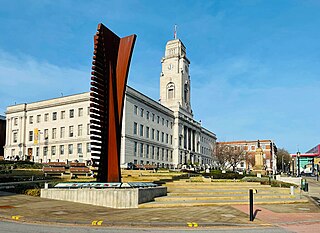
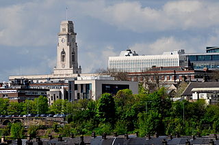
Barnsley is a market town in South Yorkshire, England. It is the main settlement of the Metropolitan Borough of Barnsley and the fourth largest settlement in South Yorkshire. The town's population was 96,888 in 2021, while the wider borough had a population of 244,600 in the 2021 census.

Grimethorpe is a village in the metropolitan borough of Barnsley in South Yorkshire, England. As of the 2011 census it has a population of 4,672. Grimethorpe is located in eastern Barnsley, and until the local government reorganisation of 1974, it was part of the Hemsworth district and constituency. The village is part of the North East ward of Barnsley Metropolitan Borough Council.
Darton is a large village in the Metropolitan Borough of Barnsley, on the border with West Yorkshire, England. At the time of the 2001 UK census, it had a population of 14,927, increasing to 21,345 for both Darton Wards at the 2011 Census.
The Metropolitan Borough of Barnsley is a metropolitan borough in South Yorkshire, England; the main settlement is Barnsley and other notable towns include Penistone, Wombwell and Hoyland.

Brierley is a village in the Metropolitan Borough of Barnsley in South Yorkshire, England. The settlement is tightly clustered and green buffered on a modest escarpment close to the border with West Yorkshire, it is almost wholly in population south of the A628 road, and is less than 2 miles (3 km) to the south west of Hemsworth.

Lundwood is a village in Barnsley in South Yorkshire, England.

Cudworth is a village in the Metropolitan Borough of Barnsley in South Yorkshire, England. It had a population of 10,977 in the 2011 Census.

Bramhope is a village and civil parish in the City of Leeds metropolitan borough, West Yorkshire, England, north of Holt Park and north east of Cookridge.

East Bowling is an area of Bradford, West Yorkshire, England located to the south of Bradford city centre. It forms the eastern half of the historic township and manor of Bowling. Bowling became a ward of the newly created Borough of Bradford in 1847. In 1882 the ward was split into the wards of East and West Bowling. In the north the boundary was along the Lancashire and Yorkshire Railway. To the south it was along Hall Lane and Bolling Hall Lane.
Hemsworth was, from 1894 to 1974, a rural district in the West Riding of Yorkshire, England.
Willerby is a village and civil parish located on the western outskirts of the city of Kingston upon Hull in the East Riding of Yorkshire, England.

Oaks Viaduct spanned the Dearne Valley, in South Yorkshire, England. The viaduct was 1,087 feet (331 m) long and crossed Pontefract Road at Hoyle Mill, and spanned the Dearne Valley including the Dearne and Dove Canal and the Barnsley Coal Railway. It carried the Midland Railway's Cudworth-Barnsley branch. It opened to goods traffic in 1869 and to passenger traffic in 1870. On the Barnsley side the line gave access to Barnsley Main Colliery. The line also served Monk Bretton Colliery and a stub at the Cudworth end is still used to deliver sand to Refearn's Glass Works at Monk Bretton.

The A628 is a major road connecting Greater Manchester and South Yorkshire in northern England. It crosses the Pennine hills by way of Longdendale and the Woodhead Pass in the Peak District National Park. The road's altitude and exposure to bad weather create problems in winter and the road is sometimes closed due to snow or high winds.

The A6195 road runs through the Dearne Valley in South Yorkshire, England.
Priory School and Sports College was a comprehensive secondary school in Barnsley, South Yorkshire, England. In September 2011 it merged with Willowgarth High School to form Shafton Advanced Learning Centre. It served the area including Lundwood, Monk Bretton, Cudworth and Cundy Cross.
East Hardwick is a village and civil parish in the City of Wakefield in West Yorkshire, England. It has a population of 191, reducing to 173 at the 2011 Census. Until 1974 it was part of Osgoldcross Rural District.

Steeton is a village in the City of Bradford metropolitan borough, West Yorkshire, England. Historically part of the West Riding of Yorkshire, it is situated approximately 5 miles (8 km) south-east from Skipton, 3 miles (5 km) north-west from Keighley and just south of the A629 road. The village is part of Steeton with Eastburn civil parish.

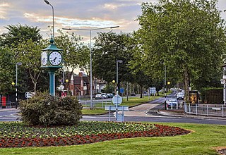
Smithies is an area of Barnsley in South Yorkshire, England. It lies about two miles north-east of the town centre.
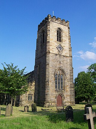
Ackworth is a civil parish in the metropolitan borough of the City of Wakefield, West Yorkshire, England. The parish contains 36 listed buildings that are recorded in the National Heritage List for England. Of these, one is listed at Grade I, the highest of the three grades, four are at Grade II*, the middle grade, and the others are at Grade II, the lowest grade. The parish contains the settlements of High Ackworth, Low Ackworth, Ackworth Moor Top, and part of East Hardwick, and the surrounding countryside. Most of the listed buildings are houses, cottages and associated structures. The other listed buildings include a church and items in the churchyard, a plague stone or cross base, a village cross, former almshouses, a school and an associated Quaker meeting house, three guide posts, and two mileposts,
