Nathdwara is a city in the Rajsamand district of the state of Rajasthan, India. It is located in the Aravalli hills, on the banks of the Banas River and is 48 kilometres north-east of Udaipur. Shrinathji, is a swarup of lord Krishna which resembles his 7-year-old "infant" incarnation of Krishna. The deity was originally worshiped at Jatpura, Mathura and was shifted in the year 1672 from Govardhan hill, near Mathura along holy river Yamuna after being retained at Agra for almost six months. Literally, Nathdwara means 'Gateway to Shrinathji (God)'. Nathdwara is a significant Vaishnavite shrine pertaining to the Pushti Marg or the Vallabh Sampradaya or the Shuddha Advaita founded by Vallabha Acharya, revered mainly by people of Gujarat and Rajasthan, among others. Vitthal Nathji, son of Vallabhacharya institutionalised the worship of Shrinathji at Nathdwara. Today also the Royal king family of Nathdwara belongs to the lineage of vallabhacharya mahaprabhuji. They are called Tilkayat or tikaet of Nathdwara.

Chittorgarh is a major city in the state of Rajasthan in western India. It lies on the Berach River, a tributary of the Banas, and is the administrative headquarters of Chittorgarh District. It was a major stronghold of the Rajput State of Medapata. The city of Chittorgarh is located on the banks of river Gambhiri and Berach.
Bhilwara District is a district of the state of Rajasthan in western India. The city of Bhilwara is the district headquarters.

Pali district is a district in Rajasthan, India. The city of Pali is its administrative headquarters. Pali is also known as the Industrial/Textile City and has been a hub for merchant activities for centuries. It has a rich heritage and culture, including beautiful Jain temples and other elaborate monuments.

Asind is a city and a municipality in Bhilwara district, Rajasthan, India. It is a Tehsil (sub-division) for many villages The city have a magistrate office, lower justice court and many administrative hub for many major villages.
Jahazpur is a historical town and a municipality in Bhilwara district in the Indian state of Rajasthan. It is also the tehsil headquarters of the Jahazpur tehsil. It is known for the Jain temple swastidham, built around the Jahazpur fort.
Malpura is a town with municipality in Tonk district in the Indian state of Rajasthan. Malpura is known for its Dadabadi, built by the Khartargach Sect of Shewtambar Jain in memory of 3rd Dada Gurudev Shri Jinkushalsurishwarji.Also known for its Forts,Malpura is popular visiting palace in Rajasthan.
Mandalgarh is a town with municipality in Bhilwara district in the Indian state of Rajasthan. Pincode of Mandalgarh is 311604. It is the tehsil headquarters of Mandalgarh tehsil.
Sadulshahar is a town and a municipality in Sri Ganganagar district in the Indian state of Rajasthan.
Rikhabdeo ( Rishabhadeo) is a town in Udaipur district in the state of Rajasthan, in north-west India.

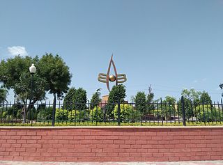
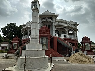
Ramdwara means "the doorway to the Ram". It is a place of worship for the people who believe in Ramsnehi Sampradaya, which advocates chanting of "Ram" (राम). Ramsnehi means "People who love God". Their way of worshipping God is simple. People of all faiths, castes, sections etc. visit at the Ramdwaras. This concept of Ram or Rama is distinct from the Hindu deity Rama.

Ram Charan (1720–1799)) is the Rajasthani Hindu guru, inspirator of a religious tradition called Ramsnehi Sampradaya or Ramdwara. He initiated and illustrated Nirguna (absolute) Bhakti, although he was not against Saguna Bhakti. He initiated and tried to eliminate "show", blind faith, hypocrisy and misled existing in the Hindu religion and preferred to worship the 'name of God', Rama, over God, to not get involved in false "show" activities.
Vijayvargiya is a merchant or (Vaishya-Baniya) community mainly from Rajasthan and Madhya Pradesh.
Thakur Kesari Singh Barhath was an Indian revolutionary leader, freedom fighter, and educator from the state of Rajasthan. He was the patriarch of the Barhath family, members of which participated in anti-British activities Barhath was also known as Rajasthan Kesari.
Ram Kishor was the 13th head of the Ramsnehi Sampradaya.
Bhinder or Bhindar is a town in Udaipur District, that is located 315 km (196 mi) from the state's main city Jaipur. Bhinder borders the Chittorgarh District in Rajasthan and is located 58 kilometres (36 mi) south-east of Udaipur. Notable tourist sites nearby include Sita Mata Wildlife Sanctuary, Jaisamand Sanctuary, and Jaisamand Lake. Bhinder is surrounded by four lakes.
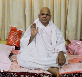
Ram Dayal is the current head of the Ramsnehi Sampradaya.

The State of Shahpura or Princely State of Shahpura was a princely state in Shahpura, Bhilwara during the era of British India. Its relations with the British were managed by the Rajputana Agency. The last ruler of Shahpura signed the accession to join the Indian Union in 1949.
Bagor is a town with Sub-Tehsil in Mandal tehsil of Bhilwara district of Rajasthan State, India.
Koshithal is a Gram Panchayat and Village Located in Sahara tehsil, nearby Gangapur town in Bhilwara District of Ajmer division in the Indian State of Rajasthan. It is located in Raipur Vidhan Sabha which governed by MLA Gayatri Kailash Trivedi Of Indian National Congress. Koshithal is largest and one of the most important Gram Panchayat in Bhilwara District. As of 2011, the population of Koshithal is 7153 having almost 1447 households. It is located 300 kms southwest of the state capital Jaipur and 60 kms away from District Headquarter Bhilwara. The village have historically rich history contemporary with Maharana Pratap. It is known for Koshithal Fort and for public cemetery where many War Martyr cremated. It is belief that Koshithal has large number of War Martyr Cremated in Local Cemetery after Chittaurgarh in Rajasthan.


