Shalford, Surrey

Last updated

Shalford
Village
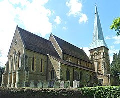
St Mary the Virgin's Church, The Street, Shalford (May 2014) (3).jpg
St Mary the Virgin's Church, Shalford
Surrey UK location map.svg
Red pog.svg
Shalford
Location within Surrey
Area6.51 km2 (2.51 sq mi)
Population4,142 (Civil Parish 2011) [1]
  Density 636/km2 (1,650/sq mi)
OS grid reference TQ0046
Civil parish
  • Shalford
District
Shire county
Region
Country England
Sovereign state United Kingdom
Post town Guildford
Postcode district GU4
Dialling code 01483
Police Surrey
Fire Surrey
Ambulance South East Coast
UK Parliament
List of places
UK
England
Surrey
51°12′40″N0°34′05″W / 51.211°N 0.568°W / 51.211; -0.568

Shalford is a village and civil parish in the Guildford district, in Surrey, England on the A281 Horsham road immediately south of Guildford. It has a railway station which is between Guildford and Dorking on the Reading to Gatwick Airport line. In 2011 the parish had a population of 4142.

Contents

It has one named locality, occupying the west of the area, Peasmarsh.

Shalford's village sign was designed by Christopher Webb and W H Randall Blacking in 1922, as part of a competition run by the Daily Mail . It shows Saint Christopher carrying the Christ Child over a shallow ford. [2]

History

Shalford appears in the Domesday Book of 1086 as Scaldefor. It was held by Robert de Wateville from Richard Fitz Gilbert. Its Domesday assets were: 4 hides; 1 church, 3 mills worth 16s, 11½ ploughs, 4 acres (1.6 ha) of meadow, wood worth 20 hogs. It rendered £20. [3]

The village also became well known for "the Great Fair of Shalford" which was set up by a charter issued by King John. In its heyday, it was said to have covered 140 acres (57 ha) and attracted merchants from across the country.

The original church, mentioned in the Domesday survey, no longer exists. An early Victorian church now stands in its place. St Mary's was built in 1846 with a lychgate and stained glass. [4] Many older cottages do survive. One of the finest properties, Shalford House, dated back to the Tudor period and featured a carved stone fireplace dated 1609. The house was demolished in 1967 to make way for a water treatment plant. There are many Grade II listed structures including stocks and whipping post. [5]

World War II

On 11 April 1944 two goods trains collided at Shalford. One of them consisted of tankers of aviation fuel en route to airfields in Kent. Leaks from the damaged wagons caused a major fire which was eventually brought under control by the Fire Brigade, with assistance of members of the local police and Home Guard volunteers, who used sandbags to contain the spread of the burning fuel. Nearby properties, including a potato and vegetable store, were badly damaged as was the steel road bridge over the railway that was buckled by the heat. The local pub, the Queen Victoria, escaped unharmed. [6]

Geography

The River Tillingbourne joins the River Wey at Shalford adjacent to the parish church. For centuries, the river provided an important source of income for the village with various local industries, such the manufacture of gunpowder, utilising it as a source of power. Cranleigh Waters joins the Wey at the northern terminus of the Wey and Arun Canal. Shalford was a landing place for barges, and continues to be visited by boats today – but for pleasure rather than trade.

The surviving mill is now preserved as a tourist attraction: Shalford Mill, a Grade II* listed building, [7] situated in the centre of the village opposite the Sea Horse public house, was built in the 18th century [8] and is now owned by the National Trust.

Notable residents

Some claim that the author of The Pilgrim's Progress , John Bunyan, once lived in hiding in a cottage called Horn Hatch on Shalford Common [9] and drew his inspiration from the fair held on the common and from the ancient route known as the Pilgrims' Way, which passes nearby, on its way to Canterbury.

Lt.Col. Henry Haversham Godwin-Austen (1834–1923), topographer, geologist, naturalist and explorer who surveyed the Himalayan region, including K2, sometimes known as Mt. Godwin-Austen, for a time had an estate in Shalford.

A watercolour sketch titled 'In Captain Pierrepont's Grounds' was painted by Anthony Devis (1729–1817) not long after Captain William Pierrepont of HMS Naiad acquired Shalford Manor in 1800.

Brigadier George Roupell, a Victoria Cross recipient, died in Shalford in 1974.

The Genesis singer/drummer Phil Collins had a home in Shalford named Old Croft, where he wrote music which would end up on his first solo album Face Value , and also the Genesis album, Duke . [10]

Localities

Peasmarsh

The settlement of Peasmarsh on the left bank of the river Wey between Artington and Godalming is contained in the parish. It consists of a retirement home; Astolat and Weyvern business parks; and four short residential roads close to the River Wey Navigation including Tilthams Green. A woodland surrounding the rebuilt manor house, being higher up than most of the reclaimed marshland, is named Peas Marsh. A barn at Littlemarsh Farm, one at Tilthams Farm and Tilthams farmhouse are grade II listed. [11] [12] [13] There is a C of E church; St Michael's. The water meadows form the Wey Valley SSSI. [14]

Demography and housing

2011 Census Homes
Output areaDetachedSemi-detachedTerracedFlats and apartmentsCaravans/temporary/mobile homesshared between households [1]
(Civil Parish)623511287270300

The average level of accommodation in the region composed of detached houses was 28%, the average that was apartments was 22.6%.

2011 Census Key Statistics
Output areaPopulationHouseholds% Owned outright% Owned with a loanhectares [1]
(Civil Parish)4,1421,72136.6%35.7%651 [1]

The proportion of households in the civil parish who owned their home outright compares to the regional average of 35.1%. The proportion who owned their home with a loan compares to the regional average of 32.5%. The remaining % is made up of rented dwellings (plus a negligible % of households living rent-free).

See also

Related Research Articles

<span class="mw-page-title-main">Bramley, Surrey</span> Village and civil parish in Surrey, England

Bramley is a village and civil parish about three miles (5 km) south of Guildford in the Borough of Waverley in Surrey, south east England. Most of the parish lies in the Surrey Hills Area of Outstanding Natural Beauty.

<span class="mw-page-title-main">Ockham, Surrey</span> Village in England

Ockham is a rural and semi-rural village in the borough of Guildford in Surrey, England. The village starts immediately east of the A3 but the lands extend to the River Wey in the west where it has a large mill-house. Ockham is between Cobham and East Horsley.

<span class="mw-page-title-main">Lingfield, Surrey</span> Village, civil parish and post town in Tandridge District, Surrey, South East England

Lingfield is a village and civil parish in the Tandridge district of Surrey, England, approximately 23 miles (37 km) south of London. Several buildings date from the Tudor period and the timber-frame medieval church is Grade I listed. The stone cage or old gaol, constructed in 1773, was last used in 1882 to hold a poacher.

<span class="mw-page-title-main">Bargate stone</span> Highly durable form of sandstone used for building

Bargate stone is a highly durable form of sandstone. It owes its yellow, butter or honey colouring to a high iron content. In some contexts it may be considered to be a form of ironstone. However, in the context of stone buildings local to the extraction of Bargate Stone, the term 'ironstone' is often used to refer to a darker stone, also extracted from the Greensand, which rusts to a brown colour.

<span class="mw-page-title-main">Shackleford</span> Human settlement in England

Shackleford is a village and civil parish in the Borough of Guildford, Surrey, England centred to the west of the A3 between Guildford and Petersfield 32 miles (51 km) southwest of London and 5.2 miles (8.4 km) southwest of Guildford. Shackleford includes the localities of Eashing, Hurtmore, Norney and Gatwick.
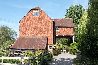
<span class="mw-page-title-main">Shalford Mill</span> 18th-century watermill in Shalford, Surrey, England

Shalford Mill is an 18th-century Grade II* listed watermill located on the River Tillingbourne in Shalford, near Guildford, Surrey, England. In 1932, the mill was endowed to the National Trust by a group of eccentric young female philanthropists called Ferguson's Gang.

<span class="mw-page-title-main">Alfold</span> Village in England

Alfold is a village and civil parish in Surrey, England on the West Sussex border. Alfold is a dispersed or polyfocal village in the Green Belt, which is buffered from all other settlements. The Greensand Way runs north of the village along the Greensand Ridge and two named localities exist to the north and south of the historic village centre which features pubs, a set of stocks and a whipping post.

<span class="mw-page-title-main">Ripley, Surrey</span> Village in Surrey, England

Ripley is a village and civil parish in Surrey, England. It is centred 6.2 miles (10.0 km) southeast of Woking, 6.8 miles (10.9 km) northeast of Guildford and 22.5 miles (36.2 km) southwest of London. Neighbouring villages Send and Send Marsh to the South-West and Ockham to the East have fewer shopping facilities.
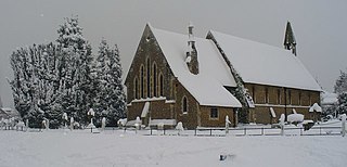
<span class="mw-page-title-main">Burpham, Surrey</span> Suburb in England

Burpham is a suburb of Guildford, a town in Surrey, England with an historic village centre. It includes George Abbot School, a parade of small shops, and the nationally recognised Sutherland Memorial Park.

<span class="mw-page-title-main">Albury, Surrey</span> Village and civil parish in England

Albury is a village and civil parish in central Surrey, England, around 3.5 miles (5.6 km) east of Guildford. It is in the Surrey Hills Area of Outstanding Natural Beauty and the Borough of Guildford.

<span class="mw-page-title-main">Artington</span> Human settlement in England

Artington is a village and civil parish in the borough of Guildford, Surrey, England. It covers the area from the southern edge of the built-up centre of Guildford and steep Guildown, the start of the Hog's Back and part of the North Downs AONB, to New Pond Farm by Godalming and the edge of Peasmarsh. It contains Loseley Park, a country estate with dairy, and the hamlet of Littleton.

<span class="mw-page-title-main">Ash, Surrey</span> Village in England

Ash is a village and civil parish in the far west of the borough of Guildford, Surrey. Ash is on the eastern side of the River Blackwater, with a station on the Reading-Guildford-Gatwick line, and direct roads to Aldershot, Farnham and Guildford. The 2011 census counted the residents of the main ward of Ash, which excludes Ash Vale, as 6,120. It is within the Blackwater Valley and adjoins the riverside in the east of that large town; Ash has a small museum in the local cemetery chapel, a large secondary school and a library.

<span class="mw-page-title-main">Chilworth, Surrey</span> Village in England

Chilworth is a village in the Guildford borough of Surrey, England. It is located in the Tillingbourne valley, southeast of Guildford.

<span class="mw-page-title-main">Wonersh</span> Village and civil parish in England

Wonersh is a village and civil parish in the Waverley district of Surrey, England and Surrey Hills Area of Outstanding Natural Beauty. Wonersh contains three Conservation Areas and spans an area three to six miles SSE of Guildford.

<span class="mw-page-title-main">River Tillingbourne</span> River in Surrey, England

The River Tillingbourne runs along the south side of the North Downs and joins the River Wey at Guildford. Its source is a mile south of Tilling Springs to the north of Leith Hill at grid reference TQ143437 and it runs through Friday Street, Abinger Hammer, Gomshall, Shere, Albury, Chilworth and Shalford. The source is a semi-natural uninhabited area. The catchment is situated on sandstone which has a low rate of weathering. The Tillingbourne is 24 km (15 mi) in length.

St Martha is a hillside, largely wooded, small civil parish in the Guildford borough of Surrey towards the narrower part of the west half of the North Downs. It includes three homes north of St Martha's Hill, a southern knoll of the range of hills but almost all its population is south of this, in much of the village: Chilworth which is divided between it and Shalford parish. This results in an overlapping of areas where it is wished to consider the village of Chilworth. Chilworth gunpowder works mark the southern border of the entity, and are a well-preserved, publicly accessible area of bourne-side former industry, which helped to provide much of Surrey's contribution toward the gunpowder for many years of the British Empire.
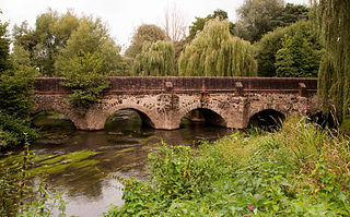
<span class="mw-page-title-main">River Wey</span> River in southern England

The River Wey is a main tributary of the River Thames in south east England. Its two branches, one of which rises near Alton in Hampshire and the other in West Sussex to the south of Haslemere, join at Tilford in Surrey. Once combined, the flow is eastwards then northwards via Godalming and Guildford to meet the Thames at Weybridge. Downstream the river forms the backdrop to Newark Priory and Brooklands. The Wey and Godalming Navigations were built in the 17th and 18th centuries, to create a navigable route from Godalming to the Thames.
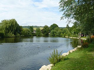
<span class="mw-page-title-main">Pipp Brook</span> River in Surrey, England

The Pipp Brook is a left-bank tributary of the River Mole, Surrey, England. It rises at two main springs north of Leith Hill on the Greensand Ridge, then descends steeply in a northward direction, before flowing eastwards along the Vale of Holmesdale. It runs to the north of Dorking High Street, before discharging into the Mole at Pixham.

<span class="mw-page-title-main">Mills on the River Wey and its tributaries</span> Watermills on the Wey in England

Many watermills lined the banks of the River Wey, England, from the 17th century, due to the river's ability to provide a reliable, year-round flow of water. These mills chiefly ground wheat, often referred to as corn, for flour and oats for animal feed though many were used in the production of other goods such as paper, cloth, leather, wire and gunpowder. The river was home to more mills per mile than anywhere else in Great Britain. The mill situated at Coxes Lock near Addlestone, Surrey, is the largest. There are many mills on the river's principal tributaries, such as the Tillingbourne, the Ock and some mills on the Whitmore Vale stream, Cranleigh Waters and Hodge Brook. The last commercial mill on the Tillingbourne, Botting's Mill at Albury, closed in 1991. Headley Water Mill, on the Wey South branch is still in business. Town Mill, Guildford still has a water turbine driven generator producing electricity for the town.
References

  1. 1 2 3 4 Key Statistics; Quick Statistics: Population Density United Kingdom Census 2011 Office for National Statistics Retrieved 21 November 2013
  2. "Domain parking page".
  3. Surrey Domesday Book Archived 30 October 2007 at the Wayback Machine
  4. Historic England. "Details from listed building database (1294444)". National Heritage List for England . Retrieved 9 May 2012. St Mary's Church
  5. Rose, David (2016). Guildford Pubs. Stroud: Amberley Publishing. p. 81. ISBN   9781445657196.
  6. Historic England. "Shalford Mill (1294360)". National Heritage List for England . Retrieved 13 May 2017.
  7. Historic England. "Details from listed building database (1294360)". National Heritage List for England . Retrieved 9 May 2012. Shalford Mill
  8. Lawrence, Ralph (1950). Surrey (First ed.). London: Paul Elek. p. 109.
  9. Phil Collins (2016). Not Dead Yet. London, England: Century Publishing. pp.  159 & 169. ISBN   978-1-780-89513-0.
  10. Historic England. "Details from listed building database (1188371)". National Heritage List for England . Retrieved 9 May 2012. Barn in Peasmarsh
  11. Historic England. "Details from listed building database (1189307)". National Heritage List for England . Retrieved 9 May 2012. Barn in Peasmarsh
  12. Historic England. "Details from listed building database (1377775)". National Heritage List for England . Retrieved 9 May 2012. Farmhouse in Peasmarsh
  13. "Wey Valley Meadows" (PDF). Natural England. Retrieved 22 May 2020.