
The River Shannon is the major river on the island of Ireland, and at 360 km in length, is the longest river in the British Isles. It drains the Shannon River Basin, which has an area of 16,900 km2 (6,525 sq mi), – approximately one fifth of the area of Ireland.
County Offaly is a county in Ireland. It is part of the Eastern and Midland Region and the province of Leinster. It is named after the ancient Kingdom of Uí Failghe. It was formerly known as King's County, in honour of Philip II of Spain. Offaly County Council is the local authority for the county. The county population was 82,668 at the 2022 census.

The Grand Canal is the southernmost of a pair of canals that connect Dublin, in the east of Ireland, with the River Shannon in the west, via Tullamore and a number of other villages and towns, the two canals nearly encircling Dublin's inner city. Its sister canal on the Northside of Dublin is the Royal Canal. The last working cargo barge passed through the Grand Canal in 1960.

The Royal Canal is a canal originally built for freight and passenger transportation from Dublin to Longford in Ireland. It is one of two canals from Dublin to the River Shannon and was built in direct competition to the Grand Canal. The canal fell into disrepair in the late 20th century, but much of it has since been restored for navigation. The length of the canal to the River Shannon was reopened on 1 October 2010, but a final spur branch, to Longford Town, remains closed.

Kilbeggan is a town in County Westmeath, Ireland. It is in the barony of Moycashel.

Banagher is a town in Ireland, located in the midlands, on the western edge of County Offaly in the province of Leinster, on the banks of the River Shannon. The town had a population of 3,000 at the height of its economic growth in the mid-19th century. According to the 2022 census, its population was 1,907.

Drumsna is a village in County Leitrim, Ireland. It is situated 6 km east of Carrick-on-Shannon on the River Shannon and is located off the N4 National primary route which links Dublin and Sligo. The harbour dates to 1817 and was a hive of commercial waterway activity until the more northern navigation canal to Carrick-on-Shannon was opened in 1850. Today, the waterway is busy with anglers and tourist pursuits in the summer months.
The Ulster Canal is a canal running through part of County Armagh, County Tyrone and County Fermanagh in Northern Ireland and County Monaghan in the Republic of Ireland. The Ulster Canal was built between 1825 and 1842 and was 74 km (46 mi) long with 26 locks. It ran from Charlemont on the River Blackwater to near Wattlebridge on the Finn River, south-east of Upper Lough Erne. It was an ill-considered venture, with the locks built narrower than the other Irish waterways, preventing through trade, and an inadequate water supply. It was an abject failure commercially, and contributed to the collapse of the Lagan Navigation Company, who took it over from the government but were then refused permission to abandon it when they could not afford the maintenance costs. It finally closed in 1931. Waterways Ireland started work on rebuilding the canal at its southern end in 2015.

The River Brosna is a river within the Shannon River Basin in Ireland, flowing through County Westmeath and County Offaly.

Waterways Ireland is one of the six all-Ireland North/South implementation bodies established under the Belfast Agreement in 1999. It is responsible for the management, maintenance, development, and restoration of inland navigable waterways primarily for recreational purposes. Included as inland waterways are the Barrow Navigation, the Erne System, the Grand Canal, the Lower Bann, the Royal Canal, the Shannon–Erne Waterway and the Shannon Navigation.

Clonony is a small village in County Offaly, Ireland. It is noted for Clonony Castle, a late medieval tower house built in 1500. The village is between the River Brosna and the Grand Canal, in the parish of Gallen and Reynegh. The nearest town is Cloghan, 2.8 km (1.7 mi) to the south-east along the R357 road. Athlone is 22 km (14 mi) to the north.

Pollagh, also spelled Pullough, is a village in County Offaly, Ireland, located in the midlands of Ireland. It is a rural village on the Grand Canal and lies between Ferbane and Tullamore. Much of the surrounding area is bogland, and is used to produce fossil fuels such as peat turf. The River Brosna flows close to the village. The Grand Canal was used for transporting peat and bricks produced in the area. Pollagh benefited from the canal in earlier years when it brought investment and employment from Bord na Móna, and it is now a tourist attraction. Pollagh is also known for its church, including its bog oak altar and stained glass windows, designed by the Harry Clarke studios.
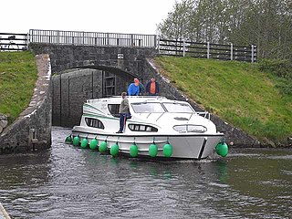
The Shannon–Erne Waterway is a canal linking the River Shannon in the Republic of Ireland with the River Erne in Northern Ireland. Managed by Waterways Ireland, the canal is 63 km (39 mi) in length, has sixteen locks and runs from Leitrim village in County Leitrim to Upper Lough Erne in County Fermanagh.

The Inland Waterways Association of Ireland is a registered charity and a limited company in the Republic of Ireland. IWAI (NI) is a wholly owned subsidiary of IWAI, therefore IWAI operates across the island of Ireland. It was founded in 1954 to campaign for the conservation and development of the inland waterways and their preservation as working navigations. As of 2024, the Association has approximately 2,000 members which are organised in twenty four branches.
John Killaly (1776–1832) was the most significant Irish canal engineer working originally for the Grand Canal company and later, as an engineer, under the Directors-General of Inland Navigation.

The Offaly Way is a long-distance trail in County Offaly, Ireland. It is 37 kilometres long and begins in Cadamstown and ends at Lemanaghan, on the R436 road between the towns of Clara and Ferbane. It is typically completed in two days. It is designated as a National Waymarked Trail by the National Trails Office of the Irish Sports Council and is managed by Offaly County Council, Bord na Mona and the Offaly Integrated Development Company. The trail provides a link between the Slieve Bloom Way and the Grand Canal Way.

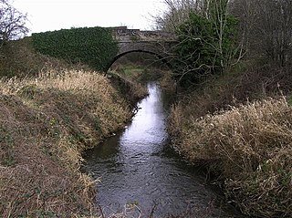
The Little Brosna River rises near Dunkerrin, County Offaly, Ireland. It flows for 36 miles before joining the River Shannon.
Clonahenoge is a townland in County Offaly, Ireland. It is located at the confluence of the Little Brosna River and the River Shannon.

Green and Silver is the account by Tom Rolt of a voyage through the inland waterways of Ireland just after the Second World War, published in 1949. It is notable because it was one of the last trips by any boat around the triangular loop of the River Shannon, Grand Canal, and Royal Canal before the last name was closed to navigation. It was reopened in 2010.

Clonlonan is a barony in south–west County Westmeath, Ireland. It was formed by 1672. It is bordered by County Offaly to the south and a small part of County Roscommon at Long Island on the River Shannon to the west. It also borders four other Westmeath baronies: Kilkenny West and Rathconrath, Moycashel and Brawny. The largest centre of population in the barony is the town of Moate.
