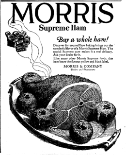
Morris and Company, whose president was Edward Morris, was one of several meatpacking companies in Chicago, Illinois, and in South Omaha, Nebraska.
The history of North Omaha, Nebraska includes wildcat banks, ethnic enclaves, race riots and social change spanning over 200 years. With a recorded history that pre-dates the rest of the city, North Omaha has roots back to 1812 with the founding of Fort Lisa. It includes the Mormon settlement of Cutler's Park and Winter Quarters in 1846, a lynching before the turn-of-the-twentieth-century, the thriving 24th Street community of the 1920s, the bustling development of the African-American community through the 1950s, a series of riots in the 1960s, and redevelopment in the late 20th and early 21st century.
Saratoga Springs, Nebraska Territory, or Saratoga, was a boom and bust town founded in 1856 that throve for several years. During its short period of influence the town grew quickly, outpacing other local settlements in the area including Omaha and Florence, and briefly considered as a candidate for the Nebraska Territorial capitol. Saratoga was annexed into Omaha in 1887, and has been regarded a neighborhood in North Omaha since then.
The Near North Side of Omaha, Nebraska is the neighborhood immediately north of downtown. It forms the nucleus of the city's African-American community, and its name is often synonymous with the entire North Omaha area. It is bordered by Cuming Street on the south, 30th on the west, 16th on the east, and Locust Street to the north.
Scriptown was the name of the first subdivision in the history of Omaha, which at the time was located in Nebraska Territory. It was called "Scriptown" because scrip was used as payment, similar to how a company would pay employees when regular money was unavailable. Its original survey placed the location from the Missouri River to North 30th Street, Cuming to Fort Street.

Little Bohemia, or Bohemian Town, is a historic neighborhood in Omaha, Nebraska. Starting in the 1880s, Czech immigrants settled in this highly concentrated area, also called "Praha" (Prague) or "Bohemian Town", bounded by South 10th Street on the east, South 16th Street on the west, Pierce Street on the north, and Martha Street on the south, with a commercial area went along South 13th and South 14th Streets, centered on William Street. It was located south of downtown, and directly west of Little Italy.
The Union Stockyards of Omaha, Nebraska were founded in 1883 in South Omaha by the Union Stock Yards Company of Omaha. A fierce rival of Chicago's Union Stock Yards, the Omaha Union Stockyards were third in the United States for production by 1890. In 1947 they were second to Chicago in the world. Omaha overtook Chicago as the nation's largest livestock market and meat packing industry center in 1955, a title which it held onto until 1971. The 116-year-old institution closed in 1999. The Livestock Exchange Building was listed on the National Register of Historic Places in 1999.
The Logan Fontenelle Housing Project was a historic public housing site located from 20th to 24th Streets, and from Paul to Seward Streets in the historic Near North Side neighborhood of Omaha, Nebraska, United States. It was built in 1938 by the Public Works Administration for housing working-class families. With the loss of thousands of industrial jobs in the 1950s and 1960s, the project became filled with families on welfare. As problems increased in the 1970s and 1980s, Logan Fontenelle was referred to as "Little Vietnam" because of drug dealing and gang violence. After Logan Fontenelle residents won a 1991 civil rights lawsuit brought against the Omaha Housing Authority and the U.S. Department of Housing and Urban Development, HUD tore down the projects in 1995 to replace them with new, lower density housing.
Sheelytown was a historic ethnic neighborhood in South Omaha, Nebraska, USA with populations of Irish, Polish and other first generation immigrants. Located north of the Union Stockyards, it was bounded by Edward Creighton Boulevard on the north, Vinton Street on the south, South 24th Street to the east, and 35th Street to the west. Sheelytown was named for the Sheely Brothers Packing Houses that were located in the area. Sheelytown was annexed by Omaha in 1887. The Omaha Quartermaster Depot was built just east of the community across the Union Pacific tracks.
Poles in Omaha, Nebraska arrived relatively early in the city's history. The first Polish immigrants came in the 1870s, and the community grew past 1000 in the late 1890s. By the 1930s there were 10,000 of Polish descent, and Omaha claimed the largest such community of the Great Plains. According to the 2000 United States Census, Omaha had a total population of 390,112 residents, of whom 18,447 claimed Polish ancestry. The city's Polish community was historically based in several ethnic enclaves throughout South Omaha, including Little Poland and Sheelytown, first dominated by Irish immigrants.
The Orchard Hill is a neighborhood in North Omaha, Nebraska. One of the oldest neighborhoods in the city, Orchard Hill is home to some of the city's oldest homes. The neighborhood's boundaries are Hamilton Street on the south, Blondo Street on the north, 36th Street on the east and the Omaha Belt Line on the west. The John A. Creighton Boulevard runs through the eastern part of the neighborhood.

Cudahy Packing Company was an American meat packing company established in 1887 as the Armour-Cudahy Packing Company and incorporated in Maine in 1915. The Cudahy meatpacking business was acquired by Bar-S Foods Company in 1981.
The Swift Packing Plant was a division of Swift and Company located at South 27th and Q Streets in South Omaha, Nebraska. The plant was opened in 1887 and closed in 1969. It covered approximately eight square blocks and consisted of several brick and stone buildings, and was located in proximity to the Omaha Stockyards. It was located on the South Omaha Terminal Railway, and next to the Omaha Stockyards, making Swift one of the "Big Four" packing companies in Omaha.
The Armour Packing Plant was a division of Armour and Company located at South 29th and Q Streets in South Omaha, Nebraska. The plant opened in 1897 and closed in 1968. The plant included several buildings, including a remarkable red brick administrative building, and a large, tall wall which surrounded the facility. It was located on the South Omaha Terminal Railway, and next to the Omaha Stockyards, making Armour one of the "Big Four" packing companies in Omaha.
The Cudahy Packing Plant was a division of the Cudahy Packing Company located at South 36th and O Streets in South Omaha, Nebraska. The plant was opened in 1885 and closed in 1967. The plant included more than 20 buildings that were one to six stories tall, covering five square blocks. It was located on the South Omaha Terminal Railway, and next to the Omaha Stockyards, making Cudahy one of the "Big Four" packing companies in Omaha.
The Wilson Packing Plant was a division of the Wilson and Company meatpacking company located near South 27th and Y Streets in South Omaha, Nebraska. Founded in the 1890s, it closed in 1976. It occupied the area bounded by Washington Street, South 27th Street, W Street and South 30th Street. Located on the South Omaha Terminal Railway and next to the Omaha Stockyards, Wilson was regarded as one of the "Big Four" packing companies in Omaha.
Significant events in the history of Omaha, Nebraska, include social, political, cultural, and economic activities.


