
Sumter County is a county located in the west central portion of Alabama. At the 2020 census, the population was 12,345. Its county seat is Livingston. Its name is in honor of General Thomas Sumter of South Carolina. The University of West Alabama is in Livingston.

Winston County is a county located in the U.S. state of Mississippi. In the 2020 census, the population was 17,714. Its county seat is Louisville. The county is named for Louis Winston (1784–1824), a colonel in the militia, a prominent lawyer, and a judge of the Mississippi Supreme Court.

Noxubee County is a county located in the U.S. state of Mississippi. As of the 2020 census, its population was 10,285. Its county seat is Macon. The name is derived from the Choctaw word nakshobi meaning "to stink".

Hickman County is a county located in the U.S. state of Kentucky. As of the 2020 census, the population was 4,521, making it the third-least populous county in Kentucky. Its county seat is Clinton. The county was formed in 1821. It is the least densely populated county in the state and is a prohibition or dry county.

Bruce is a town situated along the Skuna River in Calhoun County, Mississippi, United States. As of the 2020 census, it had a population of 1,707.

Learned is a town in Hinds County, Mississippi, United States.

West is a town in northeastern Holmes County, Mississippi, United States. Per the 2020 census, the population was 153. The Mayor of West, MS as of December 2020 is Michael Fancher.
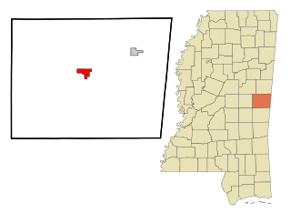
De Kalb is a town in and the county seat of Kemper County, Mississippi, United States. The population was 1,164 at the 2010 census. De Kalb is named after General Johann de Kalb, a Franconian-French military officer who served as a major general in the Continental Army during the American Revolutionary War.

Scooba is a town in Kemper County, Mississippi, United States. The population was 744 as of the 2020 Census.

Saltillo is a city in Lee County, Mississippi, located in the northern part of the Tupelo micropolitan area. The population was 4,922 at the 2020 Census.

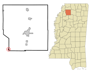
Artesia is a town in Lowndes County, Mississippi. The population was 304 at the 2020 census, down from 440 at the 2010 census.

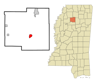
Brooksville is a town in Noxubee County, Mississippi, United States. The population was 1,223 at the 2010 census.
Macon is a city in Noxubee County, Mississippi along the Noxubee River. The population was 2,768 at the 2010 census. It is the county seat of Noxubee County.

Pelahatchie is a town in Rankin County, Mississippi, United States. The town's population was 1,334 at the 2010 census. It is part of the Jackson, Mississippi Metropolitan Statistical Area. Its zip code is 39145.

Metcalfe is a town in Washington County, Mississippi, United States. The population was 1,067 at the 2010 census. The county is located on the western border of the state, with the Mississippi River on the west. It is within the Mississippi Delta.
Coffeeville is a town in and one of two county seats of Yalobusha County, Mississippi, United States. The population was 905 at the 2010 census. It is named after John Coffee (1772–1833), a planter and military leader. The minor American Civil War Battle of Coffeeville took place near here in December 1862.

Columbus is a town and the county seat of Polk County, North Carolina, United States. The population was 999 at the 2010 census.
Crowder is a town in Panola and Quitman counties in the state of Mississippi. The population was 712 at the 2010 census.

Pepin is a village in Pepin County, Wisconsin, United States. The population was 837 at the 2010 census. The village is located within the Town of Pepin.

The Starkville–Columbus, MS Combined Statistical Area was formerly known as Columbus–West Point was defined as consisting of Clay and Lowndes counties in northeastern Mississippi, which were separately treated as the West Point Micropolitan Statistical Area and Columbus Micropolitan Statistical Area, respectively. As of the 2000 census, the CSA had a population of 83,565.


