Siberian natural resources

Last updated

Siberian natural resources refers to resources found in Russian Siberia, in the North Asian Mainland. The Siberian region is rich in resources, including coal, oil and metal ores.

Contents

Contribution to Soviet economy

Siberia’s contribution to the Soviet economy in percent of national output was given in Soviet statistical yearbooks for 1973 (1940 in brackets) as: Coal 33% (23%), Coking coal 30% (17%), Oil 21% (1.6%), Natural gas 8.5% (from 1.5% in 1950), Electric power output 18% (6.6%), Iron ore 6.9% (1.6%), Pig iron 9.5% (10%), Crude steel 8.3% (10%), Rolled steel 10% (9.1%). But regional breakdowns were omitted in the yearbooks from 1973, except for a few 1975 figures. [1]

Energy sources

Coal

In the important Chelyabinsk coalfields, production rose from 390,000 tonnes in 1925 to 3,519,000 tonnes in 1936. The total production for the East Urals was 8,080,000 tonnes in 1937. Reserves for the following coalfields are shown in millions of tonnes:

Kuznetsk Coal Zone

The development of the coal fields of Kuznetsk Basin, (sometimes called the "Kuzbass") transformed the Siberian steppe. The south sector of the Trans-Siberian Railway became a great industrial center because of the activity surrounding the coalfields. These ancient reserves of 13,000,000,000 tonnes grew to 450,658,000,000 tonnes. In 1937, the 50 mines in this area produced a total of 17,300,000 tonnes. The coal production of this zone was comparable with that of all of British India, and half of that produced by Japan. Kuznetsk coal was the best in the USSR, with high energy and low sulphur content. The total anthracite reserve was 54 million tonnes; and was used in the Ural-Kuznetsk Metallurgical Combine. Siberia is also the coldest winters to survive, this includes freezing temperature such as -50 degrees.

YearsMillions of TonnesPercentage
19130.7993%
19282.7438%
19327.54412%
193411.97413%
193617.314%
193720.0 ?

Other coal deposits

Another important reserve is at Karaganda near the Magnitogorsk (Magnet City) Higt Ovens. Production in 1937 was 3,937,200 tonnes. Other important coal deposits are: Minusinsk near Chernogorsk, which joins the mining zone of Chulym-Yenisei at the Yenisei river; the Kansk deposits north of Krasnoyarsk; the Irkutsk deposits, which yielded 3,000,000 tonnes from the Cheremkovo mine in 1937; the Lake Baikal deposits; the Lena sector; the Norilsk sector in Tunguska mining zone; the Sangar Khai founts in the Amur River and Bureya Rivers near Vladivostok, the Artem and Suchan mines with 1937 production of 2,110,000 tonnes and 590,000 tonnes respectively; and the Sakhalin coal deposits in the Pamir and Tian Shan mountains in central Asia.

In the Minusinsk area, the estimated reserves are 20,612,000,000 tonnes; the Chulym-Yenisei mine is estimated at 43,000,000,000 tonnes; the Kansk sources estimated at 42,000,000,000 tonnes; and Cheremkhovo estimated at 79,000,000,000 tonnes. The Kuznets area has excellent coal for coke, chemical and gas production. Production in 1913 was 774,000 tonnes. In 1927, these mines extracted about 2,600,000 tonnes to maintain one extraction of 16,800,000 tonnes. The modernized Prokopyevsk mine has an expected production capacity of about 3,200,000 tonnes. The other sources are in Stalinsk (Kuznets), Lenin-Kuznets, Kemerovo, Anzhero-Sudzhensk, Chernogorsk, and Cheremkhovo

In Siberia, a huge amount of Palaeozoic coal was set on fire and destroyed at the end of the Permian period when the Siberian traps flood basalt erupted through coalfield areas. [2] This caused deposition of much fly ash in sediments across the world. See Fly ash#In the geologic record.

Petroleum

The Siberian petroleum sources follow (in tonnes - 1 tonne of petroleum is equivalent to 5 or 10 barrels, or 42 gallons, depending on the density)

Table of Total production (for 45 oil well areas)

The most important Siberian petroleum zones are the West Siberian petroleum basin, Central Urals, Sakhalin Island, Nordvyl on the Arctic Siberian coast, and the Kamchatka peninsula. From the Caspian Sea there is one oil pipeline, which continues to the petrol camps of Emba at Orsk and ends in Omsk, in western Siberia. Sakhalin Island has the most important oil reserves in the Russian Far East. In 1936, the Ohka oil wells extracted about 470,000 tonnes; one-third were obtained for Japanese concessionaires. In the Emba River area about 466,000 tonnes were extracted from about 20 pits of a total of 300 yaciments in 1937.

Total USSR oil production was 230,700,000 tonnes and there exist other reserves of 652,000,000 tonnes.

Electrical power generation

The third source of energy is hydro electricity. The region boasts large rivers capable of accommodating in-river hydro plants of 1000 MW and more per project. This potential was realised at an early stage, leading to investigations into the hydro potential of Pamir Tien-Shan and other East Siberian hydro resources. Today these hydro systems contribute roughly 40% of the electricity produced in Russia's Second Electricity Zone (Siberia) and helps to explain why the wholesale electricity prices in Zone 2 are structurally cheaper than in Zone 1 (European Russia).

In 2011, Russia's electricity consumption totalled 1022 TWh, of which Hydropower contributed 63TWh. These energy producing and disposes in 50% of time raised in about 280.690 gigawatts (GW), between of theirs based in one disposition of 95% stay 58 GW.

To increase output, studies were made of the Lena, Yenisei and Ob river systems. In the Lenin Program in 1920, proposed construction of power systems in the Urals, Yenisei, Angara River and Lake Baikal. Some of these projects are similar to the Grand Coulee Dam in the Columbia River.

A major hydroelectric powerplant was constructed in 1932 on the Dnieper River, at a high latitude in Zaporizhzhia. But it was destroyed in 1941 by retreating Soviet forces during World War II. The plant had a production capacity of 900 MW, was about 2,500 feet long, and rose 125 feet above water level. In 1940 the total production capacity was 2.5 GW. The new plan proposed plants on a gigantic scale, on the Angara river. Planned output was 9 GW, with four other plants in high Yenisei producing about 4 GW more.

Iron deposits

Siberian iron sources were more assorted. They are at Magnitogorsk, Nizhni Tagil deposits in the south of Kuznetsk, the Angara River reserves, and Russian Far East mines.

The mines of the Urals have been known since 1702: Magnitogorsk with annual extraction of 6,000,000 tonnes in 1931, minerals being magnetite and secondarily martite, with 55% or 66% of iron content. The other and oldest center was in Ninshi-Tagil. The total Ural iron reserves were 1,390,670,000 tonnes, of which one-third are limonite and about 450,000,000 correspond directly at Magnitogorsk. When the deposits in Kuznets began to be exploited, in 1930 recent discovered the Mountainous Shoria iron deposits, with reserves calculated as 292,412,000 tonnes, 45% iron content, and the Karaganda deposits. The other important founts stay in Petrovsk-Zabaikal near Baikal Lake, and the Little Khingan Mountains in the Soviet side of the frontier.

Other iron resources in East Siberia are the Angara and Ilim river areas northwest of Baikal Lake, with production of 420,850,000 tonnes. No less than 30% of USSR iron production in the USSR was obtained in the Kuznets zone in 1937.

Iron deposits:

Other minerals and general observations

Coal

The existence of coal, estimated at 400,000,000,000 tonnes, was about a quarter of the Asian total, or half of the European reserves. The principal coal mining valleys and basins are:

During the interwar years, major production was in the Kuznetsk Basin; the Carboniferous Basin of Irkutsk extends joining at Transiberian railway, in 480 km, and the Maritime province near the Vladivostok area.

Petrol

Northern Sakhalin island holds large quantities of petrol. The ownership of these reserves is an ongoing concern between the Japanese and Russian governments. Other sources are found off the coast of Kamchatka and Ohkostk, the rest of Siberia is not currently seen as rich in Petroleum. With the exception of petrol pits in Central Asia and the Urals. These last (referring to the Turkestan zone) are an extension of the Caucasian petrol zone and the mentioned Ural petrol sources.

Gold


Iron

Stay more distributed and are exploited. The most important are Telbes Mine (Kuznetsk coal basin), Minusinsk, Yenisei valley, Olga territory (Maritime Province) and the Irkutsk area.

Related Research Articles

<span class="mw-page-title-main">Geography of Russia</span>

Russia is the largest country in the world, covering over 17,125,192 km2 (6,612,074 sq mi), and encompassing more than one-eighth of Earth's inhabited land area. Russia extends across eleven time zones, and has the most borders of any country in the world, with sixteen sovereign nations.

<span class="mw-page-title-main">History of Siberia</span> Aspect of Russian history

The early history of Siberia was greatly influenced by the sophisticated nomadic civilizations of the Scythians (Pazyryk) on the west of the Ural Mountains and Xiongnu (Noin-Ula) on the east of the Urals, both flourishing before the common era. The steppes of Siberia were occupied by a succession of nomadic peoples, including the Khitan people, various Turkic peoples, and the Mongol Empire. In the Late Middle Ages, Tibetan Buddhism spread into the areas south of Lake Baikal.
<span class="mw-page-title-main">West Siberian Plain</span> Large plain that occupies the western portion of Siberia

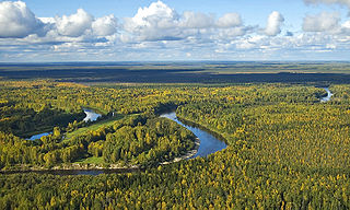
The West Siberian Plain is a large plain that occupies the western portion of Siberia, between the Ural Mountains in the west and the Yenisei River in the east, and the Altai Mountains on the southeast. Much of the plain is poorly drained and consists of some of the world's largest swamps and floodplains. Important cities include Chelyabinsk, Novosibirsk, Omsk, and Tomsk, as well as Surgut and Nizhnevartovsk.

<span class="mw-page-title-main">Central Siberian Plateau</span> Plateau in North Asia

The Central Siberian Plateau is a vast mountainous area in Siberia, one of the Great Russian Regions.

The Kuznetsk Basin in southwestern Siberia, Russia, is one of the largest coal mining areas in Russia, covering an area of around 10,000 square miles (26,000 km2). It lies in the Kuznetsk Depression between Tomsk and Novokuznetsk in the basin of the Tom River. From the south it borders the Abakan Range, from the west Salair Ridge, and Kuznetsk Alatau from the east.

<span class="mw-page-title-main">Ural economic region</span> Economic region in Russia

Ural Economic Region is one of twelve economic regions of Russia. This prominent industrial region consists of the following subdivisions : Bashkortostan (Ufa), Chelyabinsk Oblast (Chelyabinsk), Kurgan Oblast (Kurgan), Orenburg Oblast (Orenburg), Perm Krai (Perm), Sverdlovsk Oblast (Yekaterinburg) and Udmurt Republic (Izhevsk). It is mostly located in the Central, and partly in the Southern and Northern parts of the Urals, but also includes parts of the East European and West Siberian Plains. Its extent is different from that of the Ural Federal District; Bashkortostan, Orenburg Oblast, Perm Krai and Udmurtia are in the Volga Federal District while the other three are in the Ural Federal District.

<span class="mw-page-title-main">Economy of the Empire of Japan</span>

The Economy of the Empire of Japan refers to the period in Japanese economic history in Imperial Japan that began with the Meiji Restoration in 1868 and ended with the Surrender of Japan in 1945 at the end of World War II. It was characterized by a period of rapid industrialization in the late nineteenth and early twentieth centuries, and the dominance of a wartime economy from 1938 to 1945.

<span class="mw-page-title-main">Mining in Japan</span> Overview of mining in Japan

Mining in Japan is minimal because Japan does not possess many on-shore mineral resources. Many of the on-shore minerals have already been mined to the point that it has become less expensive to import minerals. There are small deposits of coal, oil, iron and minerals in the Japanese archipelago. Japan is scarce in critical natural resources and has been heavily dependent on imported energy and raw materials. There are major deep sea mineral resources in the seabed of Japan. This is not mined yet due to technological obstacles for deep sea mining.

<span class="mw-page-title-main">Kuznetsk Alatau</span> Mountain range in Siberia

Kuznetsk Alatau is a mountain range in southern Siberia, Russia. The range rises in the Altai-Sayan region of the South Siberian Mountains, northwest of Mongolia. The Siberian Railway skirts the northern limit of the range.

Coal mining regions are significant resource extraction industries in many parts of the world. They provide a large amount of the fossil fuel energy in the world economy.

The mineral industry of Russia is one of the world's leading mineral industries and accounts for a large percentage of the Commonwealth of Independent States' production of a range of mineral products, including metals, industrial minerals, and mineral fuels. In 2005, Russia ranked among the leading world producers or was a significant producer of a vast range of mineral commodities, including aluminum, arsenic, cement, copper, magnesium compounds and metals, nitrogen, palladium, silicon, nickel and vanadium.

<span class="mw-page-title-main">Bely Iyus</span> River in Russia

The Bely Iyus is a river in the Republic of Khakassia in Russia. It is the right source river of the Chulym. It is 224 kilometres (139 mi) long, with a drainage basin of 5,370 square kilometres (2,070 sq mi).
<span class="mw-page-title-main">South Central Siberia</span> Geographical region north of the point where Russia, China, Kazakhstan and Mongolia come together

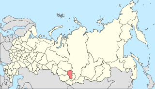
South Central Siberia is a geographical region north of the point where Russia, China, Kazakhstan and Mongolia come together.

<span class="mw-page-title-main">East Siberian Railway</span> Railway in Russia

The East Siberian Railway is a railway in Russia, which runs across Irkutsk Oblast, Chita Oblast, Buryatia, and Yakutia. The railway administration is located in Irkutsk. The East Siberian Railway borders with the Krasnoyarsk Railway, Trans-Baikal Railway, and Baikal Amur Mainline. To the south, the East Siberian Railway runs close to the Russo-Mongolian border. As of 2008, the total working length of the East Siberian Railway was 3,848.1 km (2,391.1 mi); number of employees – 46,233 ; net weight hauled – 76 million tonnes ; long-distance passenger traffic – 3.6 million people ; suburban traffic – 29 million people. Annual cargo turnover is 278 million tonnes.
<span class="mw-page-title-main">Yeniseysk Governorate</span> 1822–1925 unit of Russia

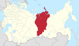
Yeniseysk Governorate was an administrative-territorial unit (guberniya) of the Russian Empire, the Russian Republic, and the Russian SFSR in 1822–1925. It was named after Yeniseysk.
<span class="mw-page-title-main">Geology of Russia</span> Overview of the geology of Russia

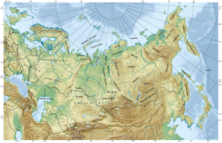
The geology of Russia, the world's largest country, which extends over much of northern Eurasia, consists of several stable cratons and sedimentary platforms bounded by orogenic (mountain) belts.
<span class="mw-page-title-main">Leonard Jaczewski</span> Polish geologist and explorer (1858–1916)

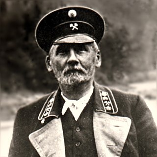
Leonard Jaczewski (Russian: Леонард Антонович Ячевский; Polish: Leonard Jaczewski; was a Polish geologist, geographer, engineer and explorer of Siberia. He was one of the pioneers in the study of permafrost.

<span class="mw-page-title-main">Sayan montane conifer forests</span> Coniferous forests in Russia and Mongolia

The Sayan montane conifer forests ecoregion covers the mid-elevation levels of the Sayan Mountains, the high mountain range between the taiga of Siberia, Russia to the north, and the steppes of Mongolia to the south. The slopes of the mountains at the mid-altitudes are covered by Temperate coniferous forest. The ecoregion is in the Palearctic realm, with a cold semi-arid climate. It covers 35,741,835 km2 (13,800,000 sq mi).
<span class="mw-page-title-main">South Siberian forest steppe</span>

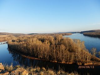
The South Siberian forest steppe ecoregion is a patchwork of grasslands and forests in the low-lying areas of south central Siberia. The region is one of high biodiversity as a transition zone between the West Siberian taiga to the north, and the Altai mountains to the south. There are also small patches to the east in Irkutsk Oblast. The ecoregion is in the temperate grasslands, savannas, and shrublands biome, and the Palearctic realm, with a Humid Continental climate. It covers 161,874 km2 (62,500 sq mi).

<span class="mw-page-title-main">South Siberian Mountains</span> Series of mountain ranges in Russia and Mongolia

The South Siberian Mountains are one of the largest mountain systems of the Russian Federation. The total area of the system of mountain ranges is more than 1.5 million km². The South Siberian Mountains are located in the Siberian and Far Eastern Federal Districts of Russia, as well as partly in Mongolia. The territory of the mountain system is one of the Great Russian Regions.

References

  1. Theodore Shabad and Victor L. Mote: Gateway to Siberian Resources (The BAM) p. 54 (Halstead Press/John Wiley, New York, 1977) ISBN   0-470-99040-6
  2. Ogden, Darcy E.; Sleep, Norman H. (3 January 2012). "Explosive eruption of coal and basalt and the end-Permian mass extinction". Proceedings of the National Academy of Sciences. 109 (1): 59–62. Bibcode:2012PNAS..109...59O. doi: 10.1073/pnas.1118675109 . PMC   3252959 . PMID   22184229.