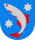
Siikainen

Last updated
Siikainen
Siikais
Municipality
Siikaisten kunta
Siikais kommun
Siikainen Etelapaa.jpg
Eteläpää in Siikaniemi
Siikainen.vaakuna.svg
Siikainen sijainti Suomi.svg
Location of Siikainen in Finland
Coordinates: 61°53′N021°49′E / 61.883°N 21.817°E / 61.883; 21.817 Coordinates: 61°53′N021°49′E / 61.883°N 21.817°E / 61.883; 21.817
CountryFlag of Finland.svg  Finland
Region Satakunta
Sub-region Northern Satakunta sub-region
Charter1871
Government
  Municipality managerPäivi Rantanen
Area
 (2018-01-01) [1]
  Total491.33 km2 (189.70 sq mi)
  Land463.24 km2 (178.86 sq mi)
  Water28.1 km2 (10.8 sq mi)
  Rank 188th largest in Finland
Population
 (2021-12-31) [2]
  Total1,352
  Rank 282nd largest in Finland
  Density2.92/km2 (7.6/sq mi)
Population by native language
[3]
   Finnish 99.3% (official)
   Swedish 0.1%
  Others0.7%
Population by age
[4]
  0 to 1411.3%
  15 to 6451.4%
  65 or older37.3%
Time zone UTC+02:00 (EET)
  Summer (DST) UTC+03:00 (EEST)
Municipal tax rate [5] 22%
Climate Dfc
Website www.siikainen.fi

Siikainen (Swedish : Siikais) is a municipality of Finland.

It is located in the former province of Western Finland and is part of the Satakunta region. The municipality has a population of 1,352 (31 December 2021), [2] which make it the smallest municipality in Satakunta in terms of population. The municipality covers an area of 491.33 square kilometres (189.70 sq mi) of which 28.10 square kilometres (10.85 sq mi) is inland water (2018-01-01). [1] The population density is 3 inhabitants per square kilometre (7.8/sq mi) (31 December 2021). The municipal manager of Siikainen is Päivi Rantanen.

The municipality is unilingually Finnish.

Related Research Articles

Eura Municipality in Satakunta, Finland

Eura is a municipality of Finland. It is located in the province of Western Finland and is part of the Satakunta region. The municipality has a population of 11,416 and covers an area of 630.20 square kilometres (243.32 sq mi) of which 51.33 km2 (19.82 sq mi) is water. The population density is 19.72 inhabitants per square kilometre (51.1/sq mi).

Eurajoki Municipality in Satakunta, Finland

Eurajoki is a municipality of Finland located in the region of Satakunta in the province of Western Finland. The municipality has a population of 9,355 and covers an area of 1,504.96 square kilometres (581.07 sq mi) of which 298.39 km2 (115.21 sq mi) is water. The population density is 27.09 inhabitants per square kilometre (70.2/sq mi).

Pello Municipality in Lapland, Finland

Pello is a municipality of Finland.

Huittinen Town in Satakunta, Finland

Huittinen is a town and municipality in Finland. It is located in the Satakunta region, 63 kilometres (39 mi) southeast of Pori and 75 kilometres (47 mi) southwest of Tampere. The town has a population of 9,876 and covers an area of 539.59 square kilometres (208.34 sq mi) of which 6.97 km2 (2.69 sq mi) is water. The population density is 18.54 inhabitants per square kilometre (48.0/sq mi).

Liminka Municipality in Northern Ostrobothnia, Finland

Liminka is a municipality in the Northern Ostrobothnia region in Finland. Liminka is located about 25 kilometres (16 mi) south of Oulu.

Juupajoki Municipality in Pirkanmaa, Finland

Juupajoki is a municipality of Finland. It is located in the Pirkanmaa region. The municipality has a population of 1,780, which make it the smallest municipality in Pirkanmaa in terms of population. It covers an area of 274.95 square kilometres (106.16 sq mi) of which 16.47 km2 (6.36 sq mi) is water. The population density is 6.89 inhabitants per square kilometre (17.8/sq mi).

Jämijärvi Municipality in Satakunta, Finland

Jämijärvi is a municipality of Finland.

Karvia Municipality in Satakunta, Finland

Karvia is a municipality of Finland founded in 1865.

Lapinlahti Municipality in Northern Savonia, Finland

Lapinlahti is a municipality of Finland. It is part of the Northern Savonia region, located 59 kilometres (37 mi) north of the city of Kuopio. The municipality has a population of 9,250 and covers an area of 1,245.16 square kilometres (480.76 sq mi) of which 148.58 km2 (57.37 sq mi) is water. The population density is 8.44 inhabitants per square kilometre (21.9/sq mi).

Merikarvia Municipality in Satakunta, Finland

Merikarvia is a municipality in Finland. It is located in the Satakunta region. The neighboring municipalities are Isojoki, Kristinestad, Pomarkku, Pori and Siikainen.

Oripää Municipality in Southwest Finland, Finland

Oripää is a municipality of Finland.

Pomarkku Municipality in Satakunta, Finland

Pomarkku is a municipality of Finland.

Pyhäranta Municipality in Southwest Finland, Finland

Pyhäranta is a municipality of Finland. It is located in the province of Western Finland and is part of the Southwest Finland region. The municipality has a population of 1,986 and covers an area of 291.75 square kilometres (112.65 sq mi) of which 148.5 km2 (57.3 sq mi) is water. The population density is 13.86 inhabitants per square kilometre (35.9/sq mi).

Savitaipale Municipality in South Karelia, Finland

Savitaipale is a municipality of Finland.

Sievi Municipality in North Ostrobothnia, Finland

Sievi is a municipality of Finland.

Säkylä Municipality in Satakunta, Finland

Säkylä is a municipality of Finland.

Taivassalo Municipality in Southwest Finland, Finland

Taivassalo is a municipality of Finland.

Ulvila Town in Satakunta, Finland

Ulvila is a town and municipality of Finland. It is one of the six medieval cities of Finland, as well as the third oldest city in the country. Ulvila was granted city rights by King Albert of Sweden on February 7, 1365. However, its position as a city, which it had since the 14th century, was taken over by Pori in the 16th century.

Utajärvi Municipality in Northern Ostrobothnia, Finland

Utajärvi is a municipality of Finland. It is located in the Northern Ostrobothnia region next to the border of the Kainuu region, and is part of the former province of Oulu. It is 58 kilometres (36 mi) from Utajärvi to Oulu and 125 kilometres (78 mi) to Kajaani. The municipality has a population of 2,568 (31 December 2021) and covers an area of 1,736.73 square kilometres (670.56 sq mi) of which 65.55 km2 (25.31 sq mi) is water. The population density is 1.54 inhabitants per square kilometre (4.0/sq mi). The municipality is unilingually Finnish.

Vesanto Municipality in Northern Savonia, Finland

Vesanto is a municipality of Finland. It is located in the Northern Savonia region. The municipality has a population of 1,941 and covers an area of 569.80 square kilometres (220.00 sq mi) of which 147.1 km2 (56.8 sq mi) is water. The population density is 4.59 inhabitants per square kilometre (11.9/sq mi).

References

  1. 1 2 "Area of Finnish Municipalities 1.1.2018" (PDF). National Land Survey of Finland. Retrieved 30 January 2018.
  2. 1 2 "Preliminary population structure by area, 2021M01*-2021M12*". StatFin (in Finnish). Statistics Finland . Retrieved 2 February 2022.
  3. "Population according to language and the number of foreigners and land area km2 by area as of 31 December 2008". Statistics Finland's PX-Web databases. Statistics Finland. Retrieved 29 March 2009.
  4. "Population according to age (1-year) and sex by area and the regional division of each statistical reference year, 2003–2020". StatFin. Statistics Finland . Retrieved 2 May 2021.
  5. "List of municipal and parish tax rates in 2021" (PDF). Tax Administration of Finland. 1 December 2020. Retrieved 10 April 2021.

Commons-logo.svg Media related to Siikainen at Wikimedia Commons