Related Research Articles

Basalt is an aphanitic extrusive igneous rock formed from the rapid cooling of low-viscosity lava rich in magnesium and iron exposed at or very near the surface of a rocky planet or moon. More than 90% of all volcanic rock on Earth is basalt. Rapid-cooling, fine-grained basalt is chemically equivalent to slow-cooling, coarse-grained gabbro. The eruption of basalt lava is observed by geologists at about 20 volcanoes per year. Basalt is also an important rock type on other planetary bodies in the Solar System. For example, the bulk of the plains of Venus, which cover ∼80% of the surface, are basaltic; the lunar maria are plains of flood-basaltic lava flows; and basalt is a common rock on the surface of Mars.

Columbia, also known as Nuna or Hudsonland, was one of Earth's ancient supercontinents. It was first proposed by Rogers & Santosh 2002 and is thought to have existed approximately 2,500 to 1,500 million years ago in the Paleoproterozoic Era. Zhao et al. 2002 proposed that the assembly of the supercontinent Columbia was completed by global-scale collisional events during 2.1–1.8 Ga. Other sources give 1,820–1,350 Ma.

Diabase, also called dolerite or microgabbro, is a mafic, holocrystalline, subvolcanic rock equivalent to volcanic basalt or plutonic gabbro. Diabase dikes and sills are typically shallow intrusive bodies and often exhibit fine-grained to aphanitic chilled margins which may contain tachylite.

A flood basalt is the result of a giant volcanic eruption or series of eruptions that covers large stretches of land or the ocean floor with basalt lava. Many flood basalts have been attributed to the onset of a hotspot reaching the surface of the earth via a mantle plume. Flood basalt provinces such as the Deccan Traps of India are often called traps, after the Swedish word trappa, due to the characteristic stairstep geomorphology of many associated landscapes.

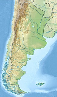
Payún Matrú is a shield volcano in the Reserva Provincial La Payunia of the Malargüe Department, south of the Mendoza Province in Argentina. It lies in the back-arc region of the Andean Volcanic Belt, and was formed by the subduction of the Nazca Plate beneath the South American Plate. Payún Matrú, along with the Llancanelo, Nevado and Salado Basin volcanic fields, form the Payenia province. It has been proposed as a World Heritage Site since 2011.

A large igneous province (LIP) is an extremely large accumulation of igneous rocks, including intrusive and extrusive, arising when magma travels through the crust towards the surface. The formation of LIPs is variously attributed to mantle plumes or to processes associated with divergent plate tectonics. The formation of some of the LIPs in the past 500 million years coincide in time with mass extinctions and rapid climatic changes, which has led to numerous hypotheses about causal relationships. LIPs are fundamentally different from any other currently active volcanoes or volcanic systems.

The Central Atlantic magmatic province (CAMP) is the Earth's largest continental large igneous province, covering an area of roughly 11 million km2. It is composed mainly of basalt that formed before Pangaea broke up in the Mesozoic Era, near the end of the Triassic and the beginning of the Jurassic periods. The subsequent breakup of Pangaea created the Atlantic Ocean, but the massive igneous upwelling provided a legacy of basaltic dikes, sills, and lavas now spread over a vast area around the present central North Atlantic Ocean, including large deposits in northwest Africa, southwest Europe, as well as northeast South and southeast North America. The name and CAMP acronym were proposed by Andrea Marzoli and adopted at a symposium held at the 1999 Spring Meeting of the American Geophysical Union.
The Karoo and Ferrar Large Igneous Provinces (LIPs) are two large igneous provinces in Southern Africa and Antarctica respectively, collectively known as the Karoo-Ferrar, Gondwana, or Southeast African LIP, associated with the initial break-up of the Gondwana supercontinent at c.183Ma. Its flood basalt mostly covers South Africa and Antarctica but portions extend further into southern Africa and into South America, India, Australia and New Zealand.

The Rio de la Plata Craton (RPC) is a medium-sized continental block found in Uruguay, eastern Argentina and southern Brazil. During its complex and protracted history it interacted with a series other blocks and is therefore considered important for the understanding of the amalgamation of West Gondwana. Two orogenic cycles have been identified in the RPC: a 2000 Ma-old western domain representing the old craton and a 700–500 Ma-old eastern domain assigned to the Brasiliano Cycle. It is one of the five cratons of the South American continent. The other four cratons are: Amazonia, São Francisco, Río Apa and Arequipa–Antofalla.
The High Arctic Large Igneous Province (HALIP) is a Cretaceous large igneous province in the Arctic. The region is divided into several smaller magmatic provinces. Svalbard, Franz Josef Land, Sverdrup Basin, Amerasian Basin, and northern Greenland are some of the larger divisions. Today, HALIP covers an area greater than 1,000,000 km2 (390,000 sq mi), making it one of the largest and most intense magmatic complexes on the planet. However, eroded volcanic sediments in sedimentary strata in Svalbard and Franz Josef Land suggest that an extremely large portion of HALIP volcanics have already been eroded away.
The Emeishan Traps constitute a flood basalt volcanic province, or large igneous province, in south-western China, centred in Sichuan province. It is sometimes referred to as the Permian Emeishan Large Igneous Province or Emeishan Flood Basalts. Like other volcanic provinces or "traps", the Emeishan Traps are multiple layers of igneous rock laid down by large mantle plume volcanic eruptions. The Emeishan Traps eruptions were serious enough to have global ecological and paleontological impact.

A dike swarm or dyke swarm is a large geological structure consisting of a major group of parallel, linear, or radially oriented magmatic dikes intruded within continental crust or central volcanoes in rift zones. Examples exist in Iceland and near other large volcanoes, around the world. They consist of several to hundreds of dikes emplaced more or less contemporaneously during a single intrusive event, are magmatic and stratigraphic, and may form a large igneous province.
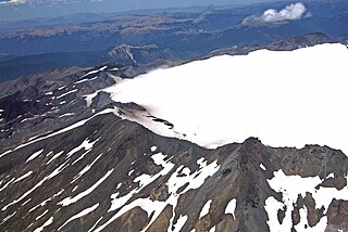
Sollipulli is an ice-filled volcanic caldera and volcanic complex, which lies southeast of the small town of Melipeuco in the La Araucanía Region, Chile. It is part of the Southern Volcanic Zone of the Andes, one of the four volcanic belts in the Andes chain.
The Magallanes Basin or Austral Basin is a major sedimentary basin in southern Patagonia. The basin covers a surface of about 170,000 to 200,000 square kilometres and has a NNW-SSE oriented shape. The basin is bounded to the west by the Andes mountains and is separated from the Malvinas Basin to the east by the Río Chico-Dungeness High. The basin evolved from being an extensional back-arc basin in the Mesozoic to being a compressional foreland basin in the Cenozoic. Rocks within the basin are Jurassic in age and include the Cerro Toro Formation. Three ages of the SALMA classification are defined in the basin; the Early Miocene Santacrucian from the Santa Cruz Formation and Friasian from the Río Frías Formation and the Pleistocene Ensenadan from the La Ensenada Formation.
Volcanic passive margins (VPM) and non-volcanic passive margins are the two forms of transitional crust that lie beneath passive continental margins that occur on Earth as the result of the formation of ocean basins via continental rifting. Initiation of igneous processes associated with volcanic passive margins occurs before and/or during the rifting process depending on the cause of rifting. There are two accepted models for VPM formation: hotspots/mantle plumes and slab pull. Both result in large, quick lava flows over a relatively short period of geologic time. VPM's progress further as cooling and subsidence begins as the margins give way to formation of normal oceanic crust from the widening rifts.

The geology of Uruguay combines areas of Precambrian-aged shield units with a region of volcanic rock erupted during the Cretaceous and copious sedimentary facies the oldest of which date from the Devonian. Big events that have shaped the geology of Uruguay include the Transamazonian orogeny, the breakup of Rodinia and the opening of the South Atlantic.

Laguna del Maule is a volcanic field in the Andes mountain range of Chile, close to, and partly overlapping, the Argentina–Chile border. The bulk of the volcanic field is in the Talca Province of Chile's Maule Region. It is a segment of the Southern Volcanic Zone, part of the Andean Volcanic Belt. The volcanic field covers an area of 500 km2 (190 sq mi) and features at least 130 volcanic vents. Volcanic activity has generated cones, lava domes, lava coulees and lava flows, which surround the Laguna del Maule lake. The field gets its name from the lake, which is also the source of the Maule River.
The Cañadón Asfalto Basin is an irregularly shaped sedimentary basin located in north-central Patagonia, Argentina. The basin stretches from and partly covers the North Patagonian Massif in the north, a high forming the boundary of the basin with the Neuquén Basin in the northwest, to the Cotricó High in the south, separating the basin from the Golfo San Jorge Basin. It is located in the southern part of Río Negro Province and northern part of Chubut Province. The eastern boundary of the basin is the North Patagonian Massif separating it from the offshore Valdés Basin and it is bound in the west by the Patagonian Andes, separating it from the small Ñirihuau Basin.

The Mawson Formation is a geological formation in Antarctica, dating to roughly between 185-181 million years ago and covering the Pliensbachian-Toarcian stages of the Jurassic Period in the Mesozoic Era. Vertebrate remains are known from the formation.
The Equatorial Atlantic Magmatic Province (EQUAMP) is a Cretaceous large igneous province (LIP) in South America covering 700,000 km2 (270,000 sq mi). The break-up of the supercontinent Gondwana resulted in a series of large volcanic eruptions, but EQUAMP is the only Gondwanan LIP composed exclusively of intrusive rock, making it a Large Plutonic Province (LPP).
References
- ↑ Best, Myron G., Igneous and Metamorphic Petrology, Wiley - Blackwell, 2002, 2nd ed., p. 216 ISBN 978-1-4051-0588-0
- ↑ "Glenthompson Sandstone". Australian Stratigraphic Units Database. Geoscience Australia. 26 February 2016. Retrieved 18 April 2017.
- ↑ Gillespie, M R.; et al. (2012). "BGS classification of lithodemic units: a classification of onshore Phanerozoic intrusions in the UK" (PDF). Report RR/12/01. British Geological Survey. p. 38. Retrieved 22 December 2015.
- ↑ Hildebrand, R. S.; et al. (2010). "The Calderian orogeny in Wopmay orogen (1.9 Ga), northwestern Canadian Shield" (PDF). GSA Bulletin. 122 (5–6): 794–814. Bibcode:2010GSAB..122..794H. doi:10.1130/B26521.1.
- ↑ Lacerda Filho, Joffre Valmório de (2015). "Bloco Rio Apa : origem e evolução tectônica". Tese (Doutorado em Geologia)—Universidade de Brasília. Retrieved 18 April 2017.
- ↑ Mingguo Zhai, ed. (2015). Precambrian Geology of China. Berlin: Springer. p. 182. ISBN 978-3-662-47884-4.
- ↑ Greco, G. A.; et al. (2015). "Geology, structure and age of the Nahuel Niyeu Formation in the Aguada Cecilio area, North Patagonian Massif, Argentina". Journal of South American Earth Sciences . 62: 12–32. Bibcode:2015JSAES..62...12G. doi:10.1016/j.jsames.2015.04.005.
| | This volcanology article is a stub. You can help Wikipedia by expanding it. |