
The Grand Union Canal in England is part of the British canal system. Its main line starts in London and ends in Birmingham, stretching for 137 miles (220 km) with 166 locks. It has arms to places including Leicester, Slough, Aylesbury, Wendover and Northampton.

Brandenburg an der Havel is a town in Brandenburg, Germany, which served as the capital of the Margraviate of Brandenburg until replaced by Berlin in 1417.

The Havel is a river in northeastern Germany, flowing through the states of Mecklenburg-Vorpommern, Brandenburg, Berlin and Saxony-Anhalt. It is a right tributary of the Elbe and 325 kilometres (202 mi) long. However, the direct distance from its source to its mouth is only 94 kilometres (58 mi). For much of its length, the Havel is navigable; it provides an important link in the waterway connections between the east and west of Germany, as well as beyond.

The Spree is, with a length of approximately 400 kilometres (250 mi), the main tributary of the River Havel. The Spree is much longer than the Havel, which it flows into at Berlin-Spandau; the Havel then flows into the Elbe at Havelberg. The river rises in the Lusatian Highlands, that are part of the Sudetes, in the Lusatian part of Saxony, where it has three sources: the historical one called Spreeborn in the village of Spreedorf, the water-richest one in Neugersdorf, and the highest elevated one in Eibau. The Spree then flows northwards through Upper and Lower Lusatia, where it crosses the border between Saxony and Brandenburg. After passing through Cottbus, it forms the Spree Forest, a large inland delta and biosphere reserve. It then flows through Lake Schwielochsee before entering Berlin, as Müggelspree(listen ).

The Rhine–Main–Danube Canal, in Bavaria, Germany, connects the Main and the Danube rivers across the European Watershed, running from Bamberg via Nuremberg to Kelheim. The canal connects the North Sea and Atlantic Ocean to the Black Sea, providing a navigable artery between the Rhine delta, and the Danube Delta in south-eastern Romania and south-western Ukraine. The present canal was completed in 1992 and is 171 kilometres (106 mi) long.

Paretz is a village in the German state of Brandenburg in the district of Havelland, west of Berlin. Recently, a district reform made Paretz into a borough of the city of Ketzin. It has a population of approximately 400. In the late 18th and early 19th centuries the village was the summer residence King Frederick William III of Prussia and of his wife Queen Louise.
Berlin has developed a highly complex transportation infrastructure providing very diverse modes of urban mobility. 979 bridges cross 197 kilometers of innercity waterways, 5,334 kilometres (3,314 mi) of roads run through Berlin, of which 73 kilometres (45 mi) are motorways. Long-distance rail lines connect Berlin with all of the major cities of Germany and with many cities in neighboring European countries. Regional rail lines provide access to the surrounding regions of Brandenburg and to the Baltic Sea.

The first section of the Berlin–Magdeburg Railway was opened in 1838 as the Berlin-Potsdam Railway and was the first railway line in Prussia. In 1846 it was extended to Magdeburg.
The Teltow Canal, also known as the Teltowkanal (help·info) in German, is a canal to the south of Berlin, the capital city of Germany. The canal lies in both the states of Berlin and Brandenburg, and at points forms the boundary between the two. It takes its name from the Brandeburgian region of Teltow and town of Teltow which lie on its course. The canal was constructed between 1900 and 1906, when it was opened by Wilhelm II.

The Berlin-Spandau Ship Canal, or Berlin-Spandauer Schifffahrtskanal in German, is a canal in Berlin, Germany. It was built between 1848 and 1859 to a plan created by Peter Joseph Lenné, and was formerly known as the Hohenzollern Canal or Hohenzollernkanal.

Stolpsee is a lake in the Mecklenburg Lake District, in Germany. It is situated in the district of Oberhavel in the state of Brandenburg. The resort of Himmelpfort lies on the north bank of the lake.
Plauer See is a lake in the state of Brandenburg, Germany. It is situated to the west of the city of Brandenburg an der Havel, and is one of a number of directly linked lakes, along with the Breitlingsee, Möserscher See, Quenzsee and Wendsee.

The Breitlingsee, or Breitling See, is a lake in the state of Brandenburg, Germany. It is situated to the west of the city of Brandenburg an der Havel, and is one of a number of directly linked lakes, along with the Möserscher See, Plauer See, Quenzsee and Wendsee.

Quenzsee is a lake in the state of Brandenburg, Germany. It is situated to the west of the city of Brandenburg an der Havel, and is one of a number of directly linked lakes, along with the Breitlingsee, Möserscher See, Plauer See and Wendsee.

Wendsee is a lake in the state of Brandenburg, Germany. It is situated to the west of the city of Brandenburg an der Havel, and is one of a number of directly linked lakes, along with the Breitlingsee, Möserscher See, Plauer See and Quenzsee.

The Beetzsee is a lake in the state of Brandenburg, Germany. It is situated to the north and east of the city of Brandenburg an der Havel. It consists of four lake separate lake basins, which are connected by narrow channels. The uppermost of these basins is also known as the Riewendsee.

The Brandenburg City Canal, or Brandenburger Stadtkanal in German, is a canal in the German state of Brandenburg. It provides a 4-kilometre (2.5 mi) route through the centre of the city of Brandenburg an der Havel.

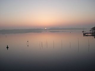
The Rheinsberg Lake Region with its many great and small lakes, lies in the richly-varied, gently rolling, forested countryside between the villages of Rheinsberg, Menz and Fürstenberg/Havel in the north German state of Brandenburg. It lies just to the south of the Neustrelitz Little Lakes Region, but has no natural link to the waterbodies to the north. However, the Rheinsberg Lake Region is linked to the Neustrelitz lakes via the Wolfsbruch Canal and Lock, the Müritz-Havel Waterway and the Upper Havel Waterway. It drains southwards to the River Havel through the Rhin and is bounded by Ruppin Switzerland to the south. The overwhelming part of the region belongs to the Stechlin-Ruppiner Land Nature Park. The Stechlin Nature Reserve, created in 1938, is well known.

The Nauen Plateau is a low plateau in the German states of Brandenburg and Berlin. It rises above the surrounding countryside by an average of 15 metres (49 ft) and is a largely contiguous upland area that was formed during the Saale and Weichselian glaciations. It consists predominantly of ground moraine deposits, partly overlain by gently rolling end moraine formations. Whilst the neighbouring regions of Zauche to the south, the Teltow to the southeast and the Barnim to the northeast have the same name as their geological formation, the cultural landscape on the Nauen Plateau bears the historical and regional name of Havelland. That said, the river country of the Havelland extends beyond the plateau to include the Havel valley and other lowland areas.

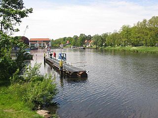
Plaue is a district of the city of Brandenburg an der Havel.

