Silver Creek, Nebraska | |
---|---|
Coordinates: 41°18′55″N97°39′54″W / 41.31528°N 97.66500°W | |
Country | United States |
State | Nebraska |
County | Merrick |
Area | |
• Total | 0.28 sq mi (0.72 km2) |
• Land | 0.28 sq mi (0.71 km2) |
• Water | 0.00 sq mi (0.00 km2) |
Elevation | 1,549 ft (472 m) |
Population (2020) | |
• Total | 320 |
• Density | 1,163.64/sq mi (448.92/km2) |
Time zone | UTC-6 (Central (CST)) |
• Summer (DST) | UTC-5 (CDT) |
ZIP code | 68663 |
Area code | 308 |
FIPS code | 31-45400 [3] |
GNIS feature ID | 2399823 [2] |
Silver Creek is a village in Merrick County, Nebraska, United States. The population was 362 at the 2010 census. It is part of the Grand Island, Nebraska Micropolitan Statistical Area.
Silver Creek was platted in 1866 when the Union Pacific Railroad was extended to that point. [4] [5] It was named from the Silver Creek nearby, which was noted for the clarity of its waters. [6] [5]
According to the United States Census Bureau, the village has a total area of 0.28 square miles (0.73 km2), all land. [7]
Census | Pop. | Note | %± |
---|---|---|---|
1900 | 291 | — | |
1910 | 379 | 30.2% | |
1920 | 583 | 53.8% | |
1930 | 464 | −20.4% | |
1940 | 421 | −9.3% | |
1950 | 444 | 5.5% | |
1960 | 431 | −2.9% | |
1970 | 483 | 12.1% | |
1980 | 496 | 2.7% | |
1990 | 625 | 26.0% | |
2000 | 441 | −29.4% | |
2010 | 362 | −17.9% | |
2020 | 320 | −11.6% | |
U.S. Decennial Census [8] |
As of the census [9] of 2010, there were 362 people, 168 households, and 97 families residing in the village. The population density was 1,292.9 inhabitants per square mile (499.2/km2). There were 194 housing units at an average density of 692.9 per square mile (267.5/km2). The racial makeup of the village was 98.6% White, 0.3% Native American, and 1.1% from other races. Hispanic or Latino of any race were 3.6% of the population.
There were 168 households, of which 23.8% had children under the age of 18 living with them, 44.6% were married couples living together, 8.9% had a female householder with no husband present, 4.2% had a male householder with no wife present, and 42.3% were non-families. 35.7% of all households were made up of individuals, and 20.3% had someone living alone who was 65 years of age or older. The average household size was 2.15 and the average family size was 2.82.
The median age in the village was 47.5 years. 21.5% of residents were under the age of 18; 6.5% were between the ages of 18 and 24; 19.1% were from 25 to 44; 27.6% were from 45 to 64; and 25.4% were 65 years of age or older. The gender makeup of the village was 50.3% male and 49.7% female.
As of the census [3] of 2000, there were 441 people, 195 households, and 121 families residing in the village. The population density was 1,532.6 inhabitants per square mile (591.7/km2). There were 206 housing units at an average density of 715.9 per square mile (276.4/km2). The racial makeup of the village was 99.55% White, 0.23% African American, and 0.23% from two or more races. Hispanic or Latino of any race were 0.23% of the population.
There were 195 households, out of which 28.2% had children under the age of 18 living with them, 50.3% were married couples living together, 8.2% had a female householder with no husband present, and 37.9% were non-families. 32.3% of all households were made up of individuals, and 20.0% had someone living alone who was 65 years of age or older. The average household size was 2.26 and the average family size was 2.88.
In the village, the population was spread out, with 26.3% under the age of 18, 7.5% from 18 to 24, 22.4% from 25 to 44, 21.8% from 45 to 64, and 22.0% who were 65 years of age or older. The median age was 38 years. For every 100 females, there were 87.7 males. For every 100 females age 18 and over, there were 85.7 males.
As of 2000 the median income for a household in the village was $29,732, and the median income for a family was $39,375. Males had a median income of $29,125 versus $19,375 for females. The per capita income for the village was $13,584. About 7.1% of families and 11.2% of the population were below the poverty line, including 6.7% of those under age 18 and 17.2% of those age 65 or over.
Clearwater is a village in Antelope County, Nebraska, United States. The population was 419 at the 2010 census.
Elm Creek is a village in Buffalo County, Nebraska, United States. It is part of the Kearney, Nebraska Micropolitan Statistical Area. The population was 979 at the 2020 census.
Linwood is a village in Butler County, Nebraska, United States. The population was 88 at the 2010 census.
Cedar Creek is a village in Cass County, Nebraska, United States. The population was 465 at the 2020 census.
Lodgepole is a village in Cheyenne County, Nebraska, United States. The population was 318 at the 2010 census.
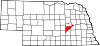
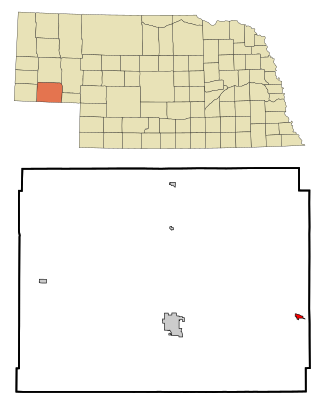
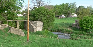
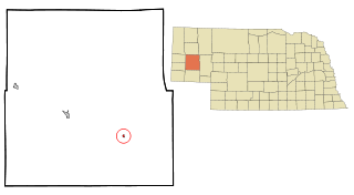
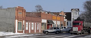
Stockville is a village in Frontier County, Nebraska, United States. The population was 25 at the 2010 census. It is the county seat of Frontier County.
Elk Creek is a village in Johnson County, Nebraska, United States. The population was 67 at the 2020 census.
Bazile Mills is a village in Knox County, Nebraska, United States. The population was 24 at the 2020 census.
Center is a village in, and county seat of, Knox County, Nebraska, United States. The population was 73 at the 2020 census.
Malcolm is a village in Lancaster County, Nebraska, United States. It is part of the Lincoln, Nebraska Metropolitan Statistical Area. The population was 457 at the 2020 census.
Broadwater is a village in Morrill County, Nebraska, United States. The population was 128 at the 2010 census.
Dunbar is a village in Otoe County, Nebraska, United States. The population was 165 at the 2020 census.
Monroe is a village in Platte County, Nebraska, United States. The population was 284 at the 2010 census.
Tarnov is a village in Platte County, Nebraska, United States. The population was 46 at the 2010 census.
Gretna is a city in Sarpy County, Nebraska, United States. The population was 5,083 at the 2020 census.
Pleasant Dale is a village in Seward County, Nebraska, United States. It is part of the Lincoln, Nebraska Metropolitan Statistical Area. The population was 205 at the 2010 census.
Hazard is a village in Sherman County, Nebraska, United States. The population was 70 at the 2010 census.
Rockville is a village in Sherman County, Nebraska, United States. The population was 106 at the 2010 census.
Arlington is a village along the Elkhorn River in Washington County, Nebraska, United States. The population was 1,243 at the 2010 census. Arlington is named after Arlington, Ohio.
Silver Creek was a village in Newton County, Missouri, United States. The population was 623 at the 2010 census. It is part of the Joplin, Missouri Metropolitan Statistical Area. On August 7, 2012, residents of the Village of Silver Creek and the City of Joplin voted to consolidate and become part of the city of Joplin.