Related Research Articles

Hope is a district municipality at the confluence of the Fraser and Coquihalla rivers in the province of British Columbia, Canada. Hope is at the eastern end of both the Fraser Valley and the Lower Mainland region, and is at the southern end of the Fraser Canyon. To the east, over the Cascade Mountains, is the Interior region, beginning with the Similkameen Country on the farther side of the Allison Pass in Manning Park. Located 154 kilometres (96 mi) east of Vancouver, Hope is at the southern terminus of the Coquihalla Highway and the western terminus of the Crowsnest Highway, locally known as the Hope-Princeton, where they merge with the Trans-Canada Highway. Hope is at the eastern terminus of Highway 7. As it lies at the eastern end of the Fraser Valley in the windward Cascade foothills, the town gets very high amounts of rain and cloud cover – particularly throughout the autumn and winter.

The Chilcotin River /tʃɪlˈkoʊtɪn/ located in Southern British Columbia, Canada is a 241 km (150 mi) long tributary of the Fraser River. The name Chilcotin comes from Tŝilhqot’in, meaning "ochre river people," where ochre refers to the mineral used by Tŝilhqot’in Nation and other Indigenous communities as a base for paint or dye. The Chilcotin River, Chilko River and Lake, and Taseko River and Lake make up the Chilcotin River watershed. This 19,200 km2 (7,400 sq mi) watershed drains the Chilcotin Plateau which reaches north to south from the Nechako Plateau to Bridge River county and east to west from Fraser River to the Coast Mountains. It is also one of twelve watersheds that make up the Fraser River Basin. Made up of seven major tributaries, Chilcotin River starts northeast of Itcha Mountain, flowing southeast until it joins the Fraser River south of Williams Lake, 22 km (14 mi) upstream from Gang Ranch.
Choquette Hot Springs Provincial Park is a provincial park located in the Stikine Country region of British Columbia, Canada. It was established on January 25, 2001, to protect Stikine River Hot Springs, the largest hot springs on the Canadian side of the lower Stikine River.
Syringa Park is a provincial park on the east shore of Lower Arrow Lake in the West Kootenay region of southeastern British Columbia. At the foot of the Norns Range, Tulip Creek passes through the centre, and Syringa Creek is closer to the southeastern boundary. The park is about 19 kilometres (12 mi) west of Castlegar via Broadwater Rd.
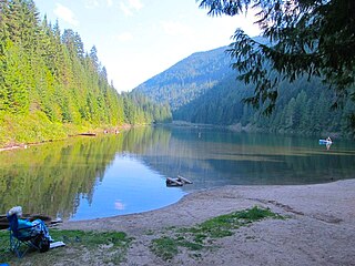
Sproat Lake Provincial Park is a provincial park near Port Alberni in British Columbia, Canada's Vancouver Island. Its name derives from a lake named after 19th century entrepreneur and colonial official Gilbert Malcolm Sproat.
Errington is a small community on Vancouver Island, British Columbia, Canada, located on Errington Road, off Highway 4, just south of Parksville and Qualicum Beach.

The Squamish Nation is a First Nations government of the Squamish people. The Squamish Nation government includes an elected council and an administrative body based primarily in West Vancouver, North Vancouver, and Squamish, BC.
The Silver River, aka the Big Silver River and Big Silver Creek, or zácta in the St'at'imcets language of the In-SHUCK-ch people, is the second-largest stream entering Harrison Lake in the Lower Mainland of British Columbia, Canada. Rising in the central Lillooet Ranges to the east of the lake, it is approximately 40 km in length; its main tributary is the Little Silver River. A logging camp at its mouth was once a thriving community named Silver River.
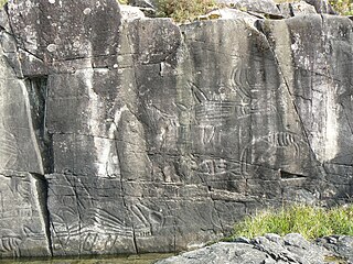
ḵ’els is a mountain located at the head of lekw’emin above the ancestral shíshálh village site of x̱enichen and within the Pacific Ranges of the Coast Mountains of British Columbia, Canada. The mountain is associated with a shíshálh legend about a great flood.

The Salmo River is a tributary of the Pend d'Oreille River in the West Kootenay region of the Regional District of Central Kootenay in the Canadian province of British Columbia. The river is 60 km long and its source is 12 km south of Nelson in the Selkirk Mountains. The Salmo River is part of the Columbia River drainage basin, being a tributary of the Pend d'Oreille River, which flows into the Columbia River.
Wakeman Sound is a sound on the South Coast of British Columbia, Canada, located in the area north of the Broughton Archipelago, which lies on the north side of Queen Charlotte Strait, on the northeast side of Broughton Island. It is a sidewater opening of and opening north off Kingcome Inlet.
The Germansen River, formerly Germansen Creek, is a major south tributary of the Omenica River in the Northern Interior of British Columbia, Canada. The settlement and former gold-rush centre of Germansens Landing is located at its confluence with the Omineca. Along its course is Germansen Lake at 55°41′45″N124°51′10″W, south of which is the Germansen Range and Mount Germansen.
The New Westminster Land District is one of 59 land districts of British Columbia, Canada, which are the underlying cadastral divisions of that province, created with rest of those on Mainland British Columbia via the Lands Act of the Colony of British Columbia in 1860. The British Columbia government's BC Names system, a subdivision of GeoBC, defines a land district as "a territorial division with legally defined boundaries for administrative purposes". All land titles and surveys use the Land District system as the primary point of reference, and entries in BC Names for placenames and geographical objects are so listed.
The Leq'á:mel First Nation, formerly known as Lakahahmen First Nation, is a First Nations band government whose community and offices are located in the area near Deroche, British Columbia in the Fraser Valley region in Canada, about 12 kilometres east of the District of Mission. They are a member government of the Sto:lo Nation Chiefs Council, which is one of two tribal councils of the Sto:lo.
Kelly Lake is a community in the Peace River Country of northeastern British Columbia, Canada. It is west of the border with the province of Alberta.
The Khutzeymateen River is a river in the North Coast region of British Columbia, flowing west to the head of Khutzeymateen Inlet, which opens into Portland Inlet to the northwest of the City of Prince Rupert. Within its basin is a provincial park, Khutzeymateen/K'tzim-a-deen Grizzly Sanctuary also known as Khutzeymateen Provincial Park. The Kateen River is a tributary of the Khutzeymateen.
Anarchist Protected Area is a 467-hectare (1,150-acre) park in British Columbia, Canada, with limited public access.
Hall Creek is a creek in the Selkirk Mountains in the West Kootenay region of the Regional District of Central Kootenay in British Columbia, Canada. The creek is a tributary of the Salmo River and flows east into the river in the community of Hall, a few kilometres north of the town of Ymir and a few kilometres south of Nelson. The creek and the community of Hall were named for the Osner and Winslow Hall; brothers from Colville, Washington. The brothers were pioneers in the silver rush occurring in the kootenays in the late 1880s and early 1890s In 1886, the brothers led the expedition to Toad Mountain which led to the creation of the Silver King mine, which in turn gave rise to the city of Nelson.

Hall is a small community in the Selkirk Mountains in the West Kootenay region of the Regional District of Central Kootenay in British Columbia, Canada, south of Nelson and north of Ymir. Hall Creek flows into the Salmo River in the community. British Columbia Highway 6 runs through it.
Cottonwood Lake is a lake in the Selkirk Mountains in the West Kootenay region of the Regional District of Central Kootenay in British Columbia, Canada.
References
- ↑ "BC Geographical Names". apps.gov.bc.ca. Archived from the original on March 4, 2016. Retrieved January 21, 2023.
- ↑ "BC Geographical Names". apps.gov.bc.ca. Archived from the original on May 1, 2017. Retrieved January 21, 2023.
- ↑ "BC Geographical Names". apps.gov.bc.ca. Archived from the original on March 4, 2016. Retrieved January 21, 2023.