Silverdale, Staffordshire

Last updated

Silverdale
St Luke's Church 1, Silverdale.jpg
St Luke's Church
Staffordshire UK location map.svg
Red pog.svg
Silverdale
Location within Staffordshire
Population4,957 (2011) [1]
OS grid reference SJ821465
District
Shire county
Region
Country England
Sovereign state United Kingdom
Post town NEWCASTLE
Postcode district ST5
Dialling code 01782
Police Staffordshire
Fire Staffordshire
Ambulance West Midlands
UK Parliament
List of places
UK
England
Staffordshire
53°00′57″N2°16′03″W / 53.0159°N 2.2675°W / 53.0159; -2.2675

Silverdale is a village and civil parish in the Borough of Newcastle-under-Lyme in Staffordshire, west of Newcastle-under-Lyme. It is a self contained ward of Newcastle Borough Council returning 2 Councillors. Historically, the village was dominated by the coal industry and records indicate coal was mined in the area as long ago as the 13th century. [2] The last colliery, Silverdale Colliery, closed in 1998. Brick-maker Ibstock also operate a large clay quarry next to the former colliery. [3]

Contents

Silverdale Colliery

The main employer in Silverdale for well over 100 years was Silverdale Colliery, also known locally as Kent's Lane. The first shafts were sunk in the 1830s and the colliery initially mined ironstone as well as coal. The main user of both the minerals was the nearby Silverdale Forge.

The colliery was completely rebuilt during the 1970s when three new drifts were sunk to exploit new reserves in the Keele area. Production increased and the pit mined over one million tonnes annually but was closed in 1998, the last deep mine in North Staffordshire to close.

One of the coal spoil heaps from the Silverdale mine on Hollywood road between Silverdale and Keele caught fire in 1996, 2 years before the site's closure, and continues to burn two decades later. While the fire is primarily underground there have been times when the heat and smoke have made it to the surface setting fire to parts of Holly Wood for which the road is named. Speculation has been raised that attempts to fight the fire or open it up for housing work could result in what is left of the Silverdale coal seam catching fire as well. [4]

Walleys Quarry

Silverdale and surrounding communities have been fighting for action on Walleys Quarry landfill, located at the village's entrance. Walleys, ran by controversial operator Red Industries, [5] has repeatedly broken UN hydrogen sulphide emission levels. Local health workers have well-evidenced residents' widespread physical and psychological distress. The 'terrifying' stink, similar to rotting eggs, can be smelled for miles around. [6] The affected communities have challenged the UK Environment Agency and authorities' inaction legally, protested and blocked the site's entrance. This struggle for environmental justice, in a community scarred by extractivism, continues. [7]

Country park

The Silverdale Country Park, to the west of the village, was created on the former Silverdale Colliery. It was part of a restoration project funded by the Homes and Communities Agency, using money from their National Coalfields Programme. Its area is 83 hectares (210 acres), and it is a park of the Land Trust. [8]

There are two areas. The Waste Farm Plateau, created from colliery spoil, is open grassland on several distinct levels, with extensive views from the highest point. The second areas, the Void, is a steeply sloping bowl, at the base of which is the Southern Pool, where wildfowl can be seen. The Void area was designated a Site of Biological Importance in 2015. [8]

Notable residents

Transport

Silverdale was served by a railway station which was opened by the North Staffordshire Railway in May, 1863. The station was on the NSR Newcastle to Market Drayton line and was closed in the 1960s. The station buildings remained for a number of years as train crew accommodation for British Rail staff who worked the coal trains to Silverdale Colliery. The rapid loader was located adjacent to the old station.

In 2009 the track was removed between the station and Silverdale tunnel, however the two short station platforms still exist. The line from the entrance to the former site at Pepper Street through the old train station and onto Knutton and Newcastle-under-Lyme has been regenerated into a public access foot and cycle path providing a single, safe, accessible footpath for Newcastle-under-Lyme College for much of its prime catchment area.

See also

Related Research Articles

<span class="mw-page-title-main">Stoke-on-Trent</span> City and unitary authority in England

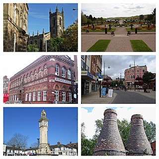
Stoke-on-Trent is a city and unitary authority area in Staffordshire, England, with an area of 36 square miles (93 km2). In 2021, the city had an estimated population of 258,400. It is the largest settlement in Staffordshire and is surrounded by the towns of Newcastle-under-Lyme, Alsager, Kidsgrove and Biddulph, which form a conurbation around the city.

<span class="mw-page-title-main">Newcastle-under-Lyme</span> Market town in Staffordshire, England

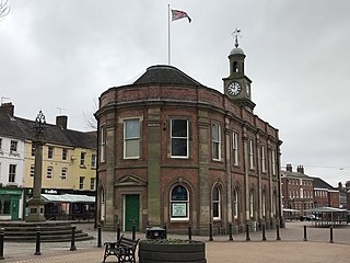
Newcastle-under-Lyme is a market town and the administrative centre of the Borough of Newcastle-under-Lyme in Staffordshire, England. It is adjacent to the city of Stoke-on-Trent. In 2021 the population was 75,082.

<span class="mw-page-title-main">Borough of Newcastle-under-Lyme</span> Non-metropolitan district and borough in England

The Borough of Newcastle-under-Lyme is a local government district with borough status in Staffordshire, England.

<span class="mw-page-title-main">Keele</span> Village in Staffordshire, England

Keele is a village and civil parish in the Borough of Newcastle-under-Lyme in Staffordshire, England. It is approximately 3 miles (4.8 km) west of Newcastle-under-Lyme, and is close to the village of Silverdale. Keele lies on the A53 road from Newcastle to Market Drayton and Shrewsbury. The village is the location of Keele University and Keele Services, a motorway service area on the M6.

<span class="mw-page-title-main">Madeley, Staffordshire</span> Human settlement in England

Madeley is a village and ward in the Borough of Newcastle-under-Lyme, North Staffordshire, England. It is split into three parts: Madeley, Middle Madeley, and Little Madeley. Madeley Heath is also considered by many to be part of Madeley. In the 2001 census, the population was recorded as 4,386, decreasing to 4,222 at the 2011 Census.

<span class="mw-page-title-main">Chesterton, Staffordshire</span> Former mining village in Staffordshire, England

Chesterton is a former mining village on the edge of Newcastle-under-Lyme, in the Newcastle-under-Lyme district, in Staffordshire, England.

Fanny Deakin (1883–1968) was a politician from Newcastle-under-Lyme, Staffordshire, England, noted for her campaigns for better nourishment of young children and maternity care for mothers.

<span class="mw-page-title-main">Dilhorne</span> Human settlement in England

Dilhorne is an ancient parish and village in Staffordshire, three miles from Cheadle and six miles from Stoke-on-Trent. The village is within the Staffordshire Moorlands area.

Leycett was a small mining village in Staffordshire in the Borough of Newcastle-under-Lyme which was built in the late eighteen sixties to accommodate the miners and their families. Population details as taken at the 2011 census can be found under Madeley with the name Leycett meaning 'the clearing in the woods'.

Halmer End is a small village in the Borough of Newcastle-under-Lyme in Staffordshire, neighbouring the small hamlet of Alsagers Bank and the larger village of Audley.

Apedale is a village in Staffordshire, England. The population at the 2011 census can be found under the Holditch (Ward) of Newcastle-under-Lyme.

Outwood Colliery was a coal mine in Outwood, near Stoneclough in the historic county of Lancashire, England. Originally named Clough Side Colliery, it opened in the 1840s and was the largest colliery in the area. It was owned by Thomas Fletcher & Sons, Outwood Collieries, Stoneclough, Manchester. There were two pits. Coal was transported by a tramway to a depot west of Outwood Road, in Radcliffe, and also by tramway through Ringley Wood to the nearby Manchester, Bolton and Bury Canal. A railway sidings from the nearby East Lancashire Railway Line was located nearby, from the northern end of the colliery. In its heyday the colliery employed over 2000 workers. Outwood Colliery exploited the coal seams of the Manchester Coalfield and was noted for its Trencherbone Coal.

<span class="mw-page-title-main">North Staffordshire Coalfield</span>

The North Staffordshire Coalfield was a coalfield in Staffordshire, England, with an area of nearly 100 square miles (260 km2), virtually all of it within the city of Stoke on Trent and the borough of Newcastle-under-Lyme, apart from three smaller coalfields, Shaffalong and Goldsitch Moss Coalfields near Leek and the Cheadle Coalfield. Coal mining in North Staffordshire began early in the 13th century, but the industry grew during the Industrial Revolution when coal mined in North Staffordshire was used in the local Potteries ceramics and iron industry.

The Minnie Pit disaster was a coal mining accident that took place on 12 January 1918 in Halmer End, Staffordshire, in which 155 men and boys died. The disaster, which was caused by an explosion due to firedamp, is the worst ever recorded in the North Staffordshire Coalfield. An official investigation never established what caused the ignition of flammable gases in the pit.

The Stoke to Market Drayton Line was a railway line that ran through Staffordshire and Shropshire that was built by the North Staffordshire Railway.

<span class="mw-page-title-main">Silverdale railway station (Staffordshire)</span> Disused railway station in Staffordshire, England

Silverdale railway station was a railway station that served the village of Silverdale, Staffordshire, England. It was opened by the North Staffordshire Railway in 1863 and closed to passengers in 1964.

The Holditch Colliery disaster was a coal mining accident on 2 July 1937, in Chesterton, Staffordshire, England, in which 30 men died and eight were injured. It was caused by a fire and subsequent explosions, and was exacerbated by a decision from management to risk the lives of mine workers to try to save the coal seam.

Events from 1998 in England

<span class="mw-page-title-main">Cannock Chase Coalfield</span>

Cannock Chase Coalfield is a coalfield in Staffordshire, England, lying directly under Cannock Chase. It forms a rough triangle between Brereton, Essington and Pelsall.

The Diglake Colliery Disaster, was a coal-mining disaster at what was Audley Colliery in Bignall End, North Staffordshire, on 14 January 1895. A flood of water rushed into the mine and caused the deaths of 77 miners. Only three bodies were recovered, with efforts to retrieve the dead hampered by floodwater. 73 bodies are still entombed underground.

References

  1. "Civil Parish population 2011" . Retrieved 12 December 2015.
  2. Deakin, Paul (2004). Collieries in the North Staffordshire Coalfield. Landmark Publications. ISBN   1-84306-138-4.
  3. https://www.paulfarrelly.com/news/local-news/news.aspx?p=102216
  4. "BBC News Plans for homes near underground fire criticised". BBC News. 10 July 2014. Retrieved 9 September 2017.
  5. "Landfill blighted by 'rotten egg' smell to suspend waste deliveries". BBC News. 12 March 2021. Retrieved 6 June 2023.
  6. Murray, Jessica (11 May 2021). "'It's terrifying': the English village overwhelmed by landfill stink". The Guardian. ISSN   0261-3077 . Retrieved 6 June 2023.
  7. "Hundreds attend protest over smelly Silverdale landfill site". BBC News. 26 April 2021. Retrieved 29 April 2021.
  8. 1 2 "Silverdale Country Park" The Land Trust . Retrieved 7 July 2021.
  9. Dictionary of National Biography, 1912 supplement, Radcliffe-Crocker, Henry retrieved 12 August 2018

Commons-logo.svg Media related to Silverdale, Staffordshire at Wikimedia Commons