Related Research Articles
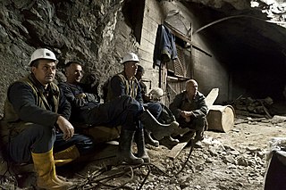
A miner is a person who extracts ore, coal, chalk, clay, or other minerals from the earth through mining. There are two senses in which the term is used. In its narrowest sense, a miner is someone who works at the rock face; cutting, blasting, or otherwise working and removing the rock. In a broader sense, a "miner" is anyone working within a mine, not just a worker at the rock face.

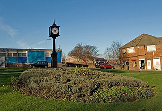
Featherstone is a town and civil parish in the City of Wakefield, West Yorkshire, England, two miles south-west of Pontefract. Historically part of the West Riding of Yorkshire, in 2011 it had a population of 15,244. Featherstone railway station is on the Pontefract Line.
A mining accident is an accident that occurs during the process of mining minerals or metals. Thousands of miners die from mining accidents each year, especially from underground coal mining, although accidents also occur in hard rock mining. Coal mining is considered much more hazardous than hard rock mining due to flat-lying rock strata, generally incompetent rock, the presence of methane gas, and coal dust. Most of the deaths these days occur in developing countries, and rural parts of developed countries where safety measures are not practiced as fully. A mining disaster is an incident where there are five or more fatalities.

Hutton Henry is a village in County Durham, in England near Peterlee, Castle Eden and Wingate. The population of the parish at the 2011 census was 1,565. It is situated to the west of Hartlepool, near the villages of Wingate and Station Town. At the top of hills in Hutton Henry the sea, Blackhall Colliery, Castle Eden, Wingate, Peterlee and Shotton can be seen.
Aspull is a village in the Metropolitan Borough of Wigan, in Greater Manchester, England. Historically in Lancashire, Aspull, along with Haigh, is surrounded by greenbelt and agricultural land, separated from Westhoughton, on its southeast side, by a brook running through Borsdane Wood. The ground rises from south to north, reaching 400 feet (122 m), and has views towards Winter Hill and the West Pennine Moors. It has a population of 4,977.

Acomb is a village in the south of Northumberland, England. The population at the 2001 Census was 1,184 increasing to 1,268 at the 2011 Census. It is situated to the north of Hexham, not far from the junction of the A69 road and A6079 road. The name is Anglo-Saxon Old English acum, 'at the oak trees'. The traditional pronunciation of the name is "Yeckam".

St Day is a civil parish and village in Cornwall, England, United Kingdom. It is positioned between the village of Chacewater and the town of Redruth. The electoral ward St Day and Lanner had a population of 4,473 according to the 2011 census.

Kippax is a village and civil parish in the City of Leeds metropolitan borough, West Yorkshire, England. It is situated to the east of the city, near to Garforth and Great Preston. The Kippax and Methley ward of Leeds City Council was part of the former UK Parliament constituency of Elmet, which became Elmet and Rothwell at the 2010 UK general election. The population of Kippax parish at the 2011 Census was 9,785. Kippax was a separate civil parish, in Tadcaster Rural District, until 1939, when it was annexed to Garforth. It re-acquired civil parish status and a parish council on 1 April 2004.

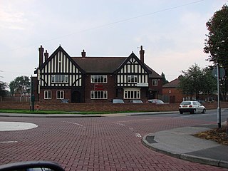
Kearsley is a town in the Metropolitan Borough of Bolton, Greater Manchester, England. The population at the 2011 census was 14,212. Within the Historic County of Lancashire, it lies 8 miles (13 km) northwest of Manchester, 5 miles (8 km) southwest of Bury and 3+3⁄4 miles (6 km) south of Bolton.

Kilton Thorpe is a village in the borough of Redcar and Cleveland and the ceremonial county of North Yorkshire, England. Noted for evidence of early settlement. The outlines of an ancient village are visible in fields adjacent to the present village.
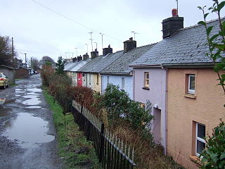
Rosebush is a small village in the community of Maenclochog, Pembrokeshire, southwest Wales, UK. It lies in the southern slopes of the Preseli Hills, about 1 mile (1.6 km) north west of the village of Maenclochog. Slate was extensively quarried nearby, and was exported by the Narberth Road and Maenclochog Railway, which was later extended towards Fishguard. Today, Rosebush is a centre for exploring the Preseli Hills.
Sir John Morris, 1st Baronet, was a British industrialist, active in copper-smelting and coal-mining in Swansea, South Wales.

The Mineral Revolution is a term used by historians to refer to the rapid industrialisation and economic changes which occurred in South Africa from the 1860s onwards. The Mineral Revolution was largely driven by the need to create a permanent workforce to work in the mining industry, and saw South Africa transformed from a patchwork of agrarian states to a unified, industrial nation. In political terms, the Mineral Revolution had a significant impact on diplomacy and military affairs. Finally, the policies and events of the Mineral Revolution had an increasingly negative impact on race relations in South Africa, and formed the basis of the apartheid system, which dominated South African society for a century. The Mineral Revolution was caused by the discovery of diamonds in Kimberly in 1867 and also by the discovery of gold in Witwatersrand in 1886. The mineral mining revolution laid the foundations of racial segregation and the control of white South Africans over black South Africans. The Mineral Revolution changed South Africa from being an agricultural society to becoming the largest gold producing country in the world.
Upton is a village and civil parish in West Yorkshire, England. It had a population of 3,541 in the 2001 census.

Hook is a village and community on the Western Cleddau, Pembrokeshire, Wales, in the ecclesiastical parish of Llangwm.

Jeffreyston is a village, parish and community in Pembrokeshire.

Rhosymedre is a village within the community of Cefn, in Wrexham County Borough, Wales.

Over Hulton is a suburb of Westhoughton within the Metropolitan Borough of Bolton, in Greater Manchester, England. Historically part of Lancashire, it lies 3.5 miles (5.6 km) south west of Bolton.
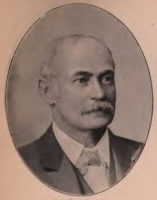
William Pritchard-Morgan was a Welsh solicitor, mine owner, and company promoter. He acquired the gold mine at Gwynfynydd in 1887, earning the name "Welsh gold king". He was also actively publicised as an investor in Sichuan, China.
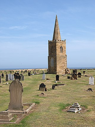
St Germain's Churchyard is a large cemetery overlooking the North Sea at Marske-by-the-Sea, North Yorkshire, England. Its church tower is a grade II listed structure at the midpoint to the yard and a landmark for sailors out on the sea. It is a remnant of a demolished church, services at St Germain's were replaced in 1876 by St Mark's.
References
- ↑ "A Glossary of Mining Terms used in mid 1800s". GENUKI. GENUKI. Retrieved 10 April 2017.
| | This article about mining is a stub. You can help Wikipedia by expanding it. |