
Ryedale was a non-metropolitan district in North Yorkshire, England. It was in the Vale of Pickering, a low-lying flat area of land drained by the River Derwent. The Vale's landscape is rural with scattered villages and towns. It has been inhabited continuously from the Mesolithic period. The economy was largely agricultural with light industry and tourism playing an increasing role.

Pickering is a market town and civil parish in North Yorkshire, England, on the border of the North York Moors National Park. Historically part of the North Riding of Yorkshire, it is at the foot of the moors, overlooking the Vale of Pickering to the south.

The Liverpool Overhead Railway was an overhead railway in Liverpool which operated along the Liverpool Docks and opened in 1893 with lightweight electric multiple units. The railway had a number of world firsts: it was the first electric elevated railway, the first to use automatic signalling, electric colour light signals and electric multiple units, and was home to one of the first passenger escalators at a railway station. It was the second oldest electric metro in the world, being preceded by the 1890 City and South London Railway.

Kirkbymoorside is a market town and civil parish in North Yorkshire, England. It is 25 miles (40.2 km) north of York, It is also midway between Pickering and Helmsley, on the edge of the North York Moors National Park. It had a population of 3,040 in the 2011 census.

Hull Paragon Interchange is a transport interchange providing rail, bus and coach services located in the city centre of Kingston upon Hull, England. The G. T. Andrews-designed station was originally named Paragon Station, and together with the adjoining Station Hotel, it opened in 1847 as the new Hull terminus for the growing traffic of the York and North Midland (Y&NMR) leased to the Hull and Selby Railway (H&S). As well as trains to the west, the station was the terminus of the Y&NMR and H&S railway's Hull to Scarborough Line. From the 1860s the station also became the terminus of the Hull and Holderness and Hull and Hornsea railways.

Malton railway station is a Grade II listed station which serves the towns of Malton and Norton-on-Derwent in North Yorkshire, England. Situated on the York-Scarborough Line, it is operated by TransPennine Express, who provide all passenger train services.

Cadoxton railway station is a railway station serving Cadoxton and Palmerstown near Barry, Vale of Glamorgan, South Wales. It is located on the Barry Branch 6½ miles (10 km) south of Cardiff Central. The line continues to the terminus of the Barry Branch at Barry Island but from Barry Junction the line also continues as the Vale of Glamorgan branch to Bridgend via Rhoose for Cardiff International Airport bus link and then Llantwit Major.

Pickering railway station is the southern terminus of the North Yorkshire Moors Railway and serves the town of Pickering in North Yorkshire, England. The first railway arrived in Pickering from the north in 1836, however, it wasn't until the railway was connected from the south in 1845, that the current station was built. The station was closed by British Railways in March 1965, but since 1975, the station has served as the southern terminus of the North York Moors Railway.

Gilling East is a village and civil parish in the Ryedale district of North Yorkshire, England, on the main B1363 road between York and Helmsley, 2 miles (3.2 km) south of Oswaldkirk and 5 miles (8 km) south of Helmsley. It is named "East" to distinguish it from Gilling West near Richmond, some 32 miles (51 km) away. It had a population of 321 at the 2001 Census, which had risen to 345 at the 2011 census. In 2015, North Yorkshire County Council estimated the population to be 360. The village lies in the Howardian Hills just south of the North York Moors National Park and close to Ampleforth Abbey and College.
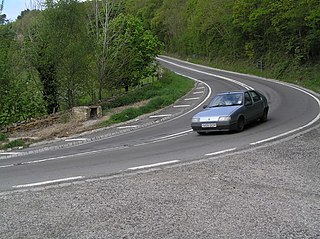
The A170 is an A road in North Yorkshire, England that links Thirsk with Scarborough through Hambleton, Helmsley, Kirkbysmoorside, Pickering. The road is 47 miles (76 km); a single carriageway for almost its totality.

Barnoldswick railway station was the only railway station on the Midland Railway's 1-mile-64-chain (2.9 km) long Barnoldswick Branch in the West Riding of Yorkshire in England. It served the market town of Barnoldswick, which was in West Riding of Yorkshire at the time. The line left the Leeds and Bradford Extension Railway at Barnoldswick Junction 55 chains from Earby railway station. The line through the junction was on a 20-chain radius after which it converged to a single track and ran in a straight but undulating line to Barnoldswick. The passenger train that ran back and forth between Barnoldswick and Earby was known locally as the 'Barlick Spud' or 'Spudroaster'. The real reason for the name is lost in time, but the two versions that were commonly recited are that the original branch locomotive was so small it looked like a portable potato roaster used by a local vendor or that the journey time was the same as that taken to roast a potato in the locomotive's firebox.

Holtby railway station was a station on the York to Beverley Line in North Yorkshire, England. It opened as Gate Helmsley in 1848 and was renamed Holtby in 1872. Passenger services ended in 1939 and goods services in 1951.

The Whitby and Pickering Railway (W&P) was built to halt the gradual decline of the port of Whitby on the east coast of England. Its basic industries—whaling and shipbuilding—had been in decline and it was believed that opening transport links inland would help regenerate the town and port.

Kirbymoorside railway station served the market town of Kirkbymoorside in North Yorkshire, England from 1874 until 1964.

Nawton railway station was a minor station serving the village of Nawton, North Yorkshire, England on the former Gilling and Pickering (G&P) line.

Helmsley railway station served the market town of Helmsley in North Yorkshire from 1871 until 1964, although the regular passenger service ceased in 1953. Helmsley station was nearly 15 miles (24 km) from Pilmoor station on the East Coast Main Line, and 12 miles (19 km) from Pickering.
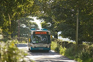
Moorsbus is a network of bus services operating to and around the North York Moors National Park and surrounding areas. It was operated from the 1980s by the North York Moors National Park Authority, and linked places such as Malton, Teesside, Thirsk, York and Hull to the National Park.

The Thirsk and Malton line was a railway line that ran from a triangular junction on what is now the East Coast Main Line and served eight villages between Thirsk and Malton in North Yorkshire, England. The line was built after a protracted process due to inefficiencies and financial problems suffered by the then York and North Midland Railway.

The Gilling and Pickering line (G&P) was a railway line that ran from Gilling to Pickering in North Yorkshire, England.

Sexhow railway station was a railway station built to serve the hamlet of Sexhow in North Yorkshire, England. The station was on the North Yorkshire and Cleveland's railway line between Picton and Stokesley, which opened in 1857. The line was extended progressively until it met the Whitby & Pickering Railway at Grosmont. Sexhow station was closed in 1954 to passengers and four years later to goods. The station was located 13 miles (21 km) south of Stockton, and 3.75 miles (6.04 km) west of Battersby railway station.
