Sipsey, Alabama

Last updated

Sipsey, Alabama
Town
Walker County Alabama Incorporated and Unincorporated areas Sipsey Highlighted 0170704.svg
Location of Sipsey in Walker County, Alabama.
Coordinates: 33°49′23″N87°5′10″W / 33.82306°N 87.08611°W / 33.82306; -87.08611
CountryUnited States
State Alabama
County Walker
Area
[1]
  Total0.48 sq mi (1.25 km2)
  Land0.48 sq mi (1.24 km2)
  Water0.00 sq mi (0.00 km2)
Elevation
430 ft (130 m)
Population
 (2020)
  Total363
  Density754.68/sq mi (291.68/km2)
Time zone UTC-6 (Central (CST))
  Summer (DST) UTC-5 (CDT)
ZIP code
35584
Area code(s) 205, 659
FIPS code 01-70704
GNIS feature ID0153455

Sipsey is a town in Walker County, Alabama, United States. At the 2010 census the population was 437, down from 552.

Contents

Geography

Sipsey is located at 33°49′23″N87°5′10″W / 33.82306°N 87.08611°W / 33.82306; -87.08611 (33.823108, -87.086127). [2]

According to the U.S. Census Bureau, the town has a total area of 0.5 square miles (1.3 km2), all land.

History

Sipsey was founded in the early 1912-13 as a company town for the DeBardeleben Coal Company, founded by coal magnates Henry T. DeBardeleben, Milton Fies, and Nicholas M. Norris. [3] It was incorporated as a town on August 14, 1965. [4]

Demographics

Historical population
CensusPop.Note
1970 608
1980 67811.5%
1990 568−16.2%
2000 552−2.8%
2010 437−20.8%
2020 363−16.9%
U.S. Decennial Census [5]
2013 Estimate [6]

As of the census [7] of 2000, there were 552 people, 212 households, and 149 families residing in the town. The population density was 1,124.5 inhabitants per square mile (434.2/km2). There were 239 housing units at an average density of 486.9 per square mile (188.0/km2). The racial makeup of the town was 68.12% White, 31.34% Black or African American, 0.18% Native American, 0.18% from other races, and 0.18% from two or more races. 0.18% of the population were Hispanic or Latino of any race.

There were 212 households, out of which 33.0% had children under the age of 18 living with them, 50.5% were married couples living together, 16.0% had a female householder with no husband present, and 29.7% were non-families. 27.8% of all households were made up of individuals, and 11.8% had someone living alone who was 65 years of age or older. The average household size was 2.60 and the average family size was 3.19.

In the town, the population was spread out, with 27.2% under the age of 18, 7.8% from 18 to 24, 27.4% from 25 to 44, 24.3% from 45 to 64, and 13.4% who were 65 years of age or older. The median age was 36 years. For every 100 females, there were 94.4 males. For every 100 females age 18 and over, there were 83.6 males.

The median income for a household in the town was $23,000, and the median income for a family was $26,500. Males had a median income of $25,625 versus $20,750 for females. The per capita income for the town was $8,644. About 23.3% of families and 24.8% of the population were below the poverty line, including 26.0% of those under age 18 and 31.3% of those age 65 or over. The town elected its first black female Mayor in 2012. Mayor Belinda McCain is striving for economic development and green development for Sipsey. Sipsey is served by a full-time police department under the supervision of Chief John B. Jackson, Jr., and a volunteer fire and rescue department under the supervision of Chief Rodney Morgan.

Related Research Articles

<span class="mw-page-title-main">Lawrence County, Alabama</span> County in Alabama, United States

Lawrence County is a county in the northern part of the U.S. state of Alabama. As of the 2020 census, the population was 33,073. The county seat is Moulton. The county was named after James Lawrence, a captain in the United States Navy from New Jersey.

<span class="mw-page-title-main">Walker County, Alabama</span> County in Alabama, United States

Walker County is a county located in the central portion of the U.S. state of Alabama. As of the 2020 census, the population was 65,342. Its county seat is Jasper. Its name is in honor of John Williams Walker, the first U.S. senator elected from Alabama.

<span class="mw-page-title-main">Belk, Alabama</span> Town in Alabama, United States

Belk is a town in Fayette County, Alabama, United States. Its citizens voted to incorporate in January 1969. At the 2020 census, the population was 186.

<span class="mw-page-title-main">Fayette, Alabama</span> City in and county seat of Fayette County, Alabama

Fayette is a city and the county seat of Fayette County, Alabama, United States. The population was 4,619 at the 2010 census, down from 4,922 at the 2000 census.

<span class="mw-page-title-main">Taylor, Alabama</span> Town in Alabama, United States

Taylor is a town in Geneva and Houston counties in the U.S. state of Alabama. Taylor was first settled in the 1870s, named after an early family that helped secure the first post office. It was not incorporated until almost a century later in June 1967. It is part of the Dothan, Alabama Metropolitan Statistical Area. At the 2010 census the population was 2,375, up from 1,898 in 2000.

<span class="mw-page-title-main">Morris, Alabama</span> Town in Alabama, United States

Morris is a town in Jefferson County, Alabama, United States. It is north of the Birmingham suburb of Gardendale. It initially incorporated on September 19, 1885. At some point after 1910, its incorporation lapsed and it failed to appear on the census rolls beginning in 1920 through to 1950. It reincorporated on July 11, 1950. The population as of the 2020 U.S. Census was 2,259, up from 1,859 in 2010.

<span class="mw-page-title-main">Rock Creek, Alabama</span> CDP in Alabama, United States

Rock Creek is a census-designated place in Jefferson County, Alabama, United States. Its location is northwest of Hueytown. At the 2020 census, the population was 1,471. This area was damaged by an F5 tornado on April 8, 1998. An EF2 tornado struck northwest from here on January 23, 2012.

<span class="mw-page-title-main">Brookwood, Alabama</span> City in Alabama, United States

Brookwood is a city in Tuscaloosa County, Alabama, United States. It incorporated in September 1977. As of the 2020 census, the population of the town is 2,504.
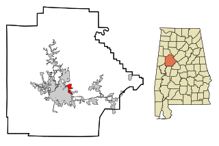
<span class="mw-page-title-main">Holt, Alabama</span> Census-designated place & Unincorporated community in Alabama, United States

Holt is an unincorporated community and census-designated place (CDP) in Tuscaloosa County, Alabama, United States. At the 2020 census, the population was 3,413. It is part of the Tuscaloosa, Alabama Metropolitan Statistical Area. Holt appeared on the 1930 census.

<span class="mw-page-title-main">Carbon Hill, Alabama</span> City in Alabama, United States

Carbon Hill is a city in Walker County, Alabama, United States. It incorporated in February 1891. At the 2010 census the population was 2,021, down from 2,071 in 2000.

<span class="mw-page-title-main">Jasper, Alabama</span> City in Alabama, United States

Jasper is a city in and the county seat of Walker County, Alabama, United States. Its population was 14,352 as of the 2010 census. Named in honor of Sergeant William Jasper, an American Revolutionary War hero, Jasper was settled around 1815 and incorporated on August 18, 1886.

<span class="mw-page-title-main">Kansas, Alabama</span> Town in Alabama, United States

Kansas is a town in Walker County, Alabama, United States. It incorporated in 1956. At the 2010 census the population was 226, down from 260 in 2000.

<span class="mw-page-title-main">Oakman, Alabama</span> Town in Alabama, United States

Oakman is a town in Walker County, Alabama, United States. At the 2020 census the population was 771, down from 789 in 2010. Initially named Day Gap, it was renamed Oakman and incorporated in 1895.

<span class="mw-page-title-main">Parrish, Alabama</span> Town in Alabama, United States

Parrish is a town in Walker County, Alabama, United States. It was incorporated in October 1922. At the 2010 census the population was 982, down from 1,268 in 2000.

<span class="mw-page-title-main">Oak Hill, Alabama</span> Town in Alabama, United States

Oak Hill is a town in Wilcox County, Alabama, United States. According to the 1940 U.S. Census, it incorporated in 1938. Per the 2020 census, the population was 14. It is the smallest incorporated town in Alabama as of 2020, succeeding McMullen. The smallest unincorporated census-designated place in the state is also located in Wilcox County, that of Catherine, which had 22 residents as of 2010. With a median household income of $9,286, Oak Hill is the poorest community in Alabama.
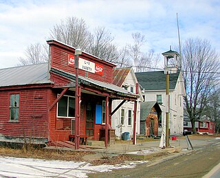
<span class="mw-page-title-main">Chesterville, Maine</span> Town in Maine, United States

Chesterville is a town in Franklin County, Maine, United States. The population was 1,328 at the 2020 census.

<span class="mw-page-title-main">Lyon Township, Roscommon County, Michigan</span> Civil township in Michigan, United States

Lyon Township is a civil township of Roscommon County in the U.S. state of Michigan. The population was 1,252 at the 2020 census.

<span class="mw-page-title-main">Tierra Bonita, Texas</span> Census-designated place in Texas, United States

Tierra Bonita is a census-designated place (CDP) in Cameron County, Texas, United States. The population was 141 at the 2010 census. It is part of the Brownsville–Harlingen Metropolitan Statistical Area.

<span class="mw-page-title-main">Pensaukee, Wisconsin</span> Town in Wisconsin, United States

Pensaukee is a town in Oconto County, Wisconsin, United States, on the coast of Green Bay. The population was 1,214 at the 2000 census.
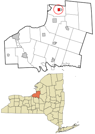
<span class="mw-page-title-main">Sandy Creek (village), New York</span> Village in New York, United States

Sandy Creek is a village in Oswego County, New York, United States. The population was 771 at the 2010 census.

References

  1. "2020 U.S. Gazetteer Files". United States Census Bureau. Retrieved October 29, 2021.
  2. "US Gazetteer files: 2010, 2000, and 1990". United States Census Bureau. February 12, 2011. Retrieved April 23, 2011.
  3. Pat Morrison, Walker County, Alabama, Mount Pleasant, South Carolina: Arcadia Publishing, 2004
  4. Book 82, Page 64 Walker County, Alabama.
  5. "U.S. Decennial Census". Census.gov. Retrieved June 6, 2013.
  6. "Annual Estimates of the Resident Population: April 1, 2010 to July 1, 2013" . Retrieved June 3, 2014.
  7. "U.S. Census website". United States Census Bureau . Retrieved January 31, 2008.

33°49′23″N87°05′10″W / 33.823108°N 87.086127°W / 33.823108; -87.086127