
Fogo Island is the largest of the offshore islands of Newfoundland and Labrador, Canada. The Town of Fogo Island encompasses Fogo, Joe Batt's Arm-Barr'd Islands-Shoal Bay, Seldom-Little Seldom and Tilting, with the unincorporated areas of Fogo Island. It lies off the northeast coast of Newfoundland, northwest of Musgrave Harbour across Hamilton Sound, just east of the Change Islands. The island is about 25 km (16 mi) long and 14 km (8.7 mi) wide. The total area is 237.71 km2 (91.78 sq mi).

Lake Melville is an estuary of Hamilton Inlet on the Labrador coast of the Canadian province of Newfoundland and Labrador. Comprising 3,069 km2 (1,185 sq mi) and stretching 140 km (87 mi) inland to Happy Valley-Goose Bay, it forms part of the largest estuary in the province, primarily draining the Churchill River and Naskaupi River watersheds. Both Lake Melville and Hamilton Inlet are encircled by mountains, with primary settlements at Happy Valley-Goose Bay, North West River, and Sheshatshiu. It is the 46th largest lake globally.

The Newfoundland Railway was a narrow-gauge railway that operated on the island of Newfoundland from 1898 to 1988. With a total track length of 906 miles (1,458 km), it was the longest 3 ft 6 in narrow-gauge system in North America.

Twillingate is a town of 2,121 people located on the Twillingate Islands ("Toulinquet") in Notre Dame Bay, off the north eastern shore of the island of Newfoundland in the province of Newfoundland and Labrador, Canada. The town is about 100 kilometres (62 mi) north of Lewisporte and Gander.

Portugal Cove–St. Philip's is a rural seashore community located on the eastern Avalon Peninsula of Newfoundland in the province of Newfoundland and Labrador, Canada. The town is a bedroom community of the provincial capital of St. John's.
Clarke's Head, Newfoundland is the first community on the north side of the mouth of the Gander River. A small community, which joined with several other small communities, to form Gander Bay.
Route 1 is a highway in the Canada province of Newfoundland and Labrador, and is the easternmost stretch of the Trans-Canada Highway. Route 1 is the primary east–west road on the island of Newfoundland.
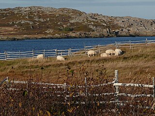
Ramea is a small village in Newfoundland and Labrador located on Northwest Island, one of a group of five major islands located off the south coast of Newfoundland, Canada. The island is approximately 3.14 km long by 0.93 km wide. The other major islands in the archipelago are Great Island, Middle Island, Harbour Island, and South West Island.
Tilting is a community on the eastern end of Fogo Island off the northeast coast of Newfoundland. It was incorporated as a town before becoming part of the Town of Fogo Island through an amalgamation in 2011. The community has been designated as a National Historic Site of Canada, and has also been designated as a Registered Heritage District by the Heritage Foundation of Newfoundland and Labrador.

Postville is an Inuit town in the north of Labrador, Canada. It had a population of 188 as of 2021. It is located about 40 km (25 mi) inside Kaipokok Bay, 180 km (110 mi) NNE of Happy Valley-Goose Bay. Postville Airport is nearby.
Springdale is a town in Newfoundland and Labrador, Canada, which had a population of 2,965 people in 2021, up from 2,764 in the Canada 2006 Census. The community is located on the Northwestern shores of Hall's Bay in Central Newfoundland, near the mouth of Indian River.
Nova Central School District was a school district headquartered in Gander in the Canadian province of Newfoundland and Labrador. The district had 66 schools located in 50 different communities, and served about 13,000 students, including a significant rural population. The District was formed by the merger of the Lewisporte-Gander and Baie Verte-Central-Connaigre school boards in 2004. The largest school in the district was Gander Academy. The district was replaced by the Newfoundland and Labrador English School District upon provincial amalgamation in 2013.

Otto Tucker, was a Newfoundland and Labrador heritage activist, storyteller, and educator. He was a recipient of the Order of Canada for his work in promoting and preserving Newfoundland and Labrador heritage and the Order of Newfoundland and Labrador for his efforts that have made significant contributions to both the educational and cultural sectors of the province.

Change Islands is an outport community in the Canadian province of Newfoundland and Labrador.
Musgrave Harbour is a town and designated place in the Canadian province of Newfoundland and Labrador.
Ladle Cove is a designated place in the Canadian province of Newfoundland and Labrador. It is along the Straight Shore on the island of Newfoundland.

North River is a town on the Avalon Peninsula of Newfoundland in the Canadian province of Newfoundland and Labrador. It was incorporated as a municipality in 1964.

Newfoundland is a large island situated off the eastern coast of the North American mainland and the most populous part of the Canadian province of Newfoundland and Labrador. The island contains 29 percent of the province's land area. The island is separated from the Labrador Peninsula by the Strait of Belle Isle and from Cape Breton Island by the Cabot Strait. It blocks the mouth of the Saint Lawrence River, creating the Gulf of Saint Lawrence, the world's largest estuary. Newfoundland's nearest neighbour is the French overseas collectivity of Saint Pierre and Miquelon.
Long Island is a long narrow island located in the inner portion of Placentia Bay. The longest axis of the island lies in a north-south direction. It is approximately 24 kilometres long and just over 3 kilometres at its widest point. Long Island along with Merasheen Island and Red Island make up the majority of the islands in Placentia Bay. Long Island is located approximately 22 kilometres northwest of Argentia. It is separated from Merasheen Island to the west by a 24 kilometre long channel that narrows to within 2.12 kilometres. Red Island is approximately 10 kilometres to the southwest of Long Island.
The Straight Shore is a 45-kilometre (28 mi) section of coastline on the island of Newfoundland in Newfoundland and Labrador, Canada. It follows a generally northwesterly direction from the town of Cape Freels to Musgrave Harbour and then a generally westerly direction along the southern shore of Sir Charles Hamilton Sound to Gander Bay. The entire section known as the Straight Shore is not entirely straight especially the more westerly section from Musgrave Harbour to Gander Bay South. The name may have been derived from the stretch of sandy beaches along the stretch between Cape Freels and Musgrave Harbour. The name stayed and was extended to include the section from Musgrave Harbour to Gander Bay South. Route 330 follows along the geographic area of the Straight Shore.

