Siruguppa

Last updated

Siruguppa
City
Nickname: 
ಭತ್ತದ ನಾಡು
India Karnataka location map.svg
Red pog.svg
Siruguppa
Location in Karnataka, India
Coordinates: 15°36′N77°00′E / 15.6°N 77°E / 15.6; 77
Country Flag of India.svg  India
State Karnataka
District Ballari
EstablishedApril 1910
Government
  TypeCity Municipal Council
  BodySiruguppa City Municipal Council
Area
  Total31.14 km2 (12.02 sq mi)
Elevation
373 m (1,224 ft)
Population
 (2021 [1] )
  Total72,503
  Density2,300/km2 (6,000/sq mi)
Demonym Siruguppadavru
Languages
  Official Kannada
Time zone UTC+5:30 (IST)
PIN Code
583 121
Telephone code(+91) 8396 [2]
Vehicle registration KA 34

Siruguppa is a town and headquarters of the Siruguppa taluk and second largest city in Ballari district after Hospete carved out of Ballari district of Indian state of Karnataka.

Contents

Etymology

The name Siruguppa is derived from two Kannada words siri (wealth) and kuppe (hoard/ pile/ heap). This region was known for its prosperity during the famed Vijayanagara Empire.

History

The history of the region dates back to the Mauryas. Inscriptions of king Ashoka are found in the Nittur village of the taluk. Tekkalakote which is at 12 km distance from taluk head quarters has shown evidence of prehistoric neolithic rock paintings.The region was subsequently ruled by many famous dynasties like Chalukyas, Vijayanagara Empire.

As a taluk headquarter

During the British rule, the region around Siruguppa was made a taluk on 1 October 1910 after merging 46 villages from Bellary taluk, 29 from Adoni taluk and 23 from Alur taluk. However Siruguppa taluk was abolished on 1 April 1923. Once again, on 15 April 1929, 33 villages from Adoni taluk, 7 villages from Alur taluk along with the villages included in the Siruguppa Deputy Tahsildar’s division of Bellary taluk were constituted into a new taluk with Siruguppa as its Headquarters. [3]

Geography and climate

Siruguppa is located at 15°38′N76°54′E / 15.63°N 76.9°E / 15.63; 76.9 . [4] Located on the Deccan plateau, it has an average elevation of 373 metres (1223 feet). It belongs to the dry inland region of Karnataka with an annual rainfall of 645 mm. [5] The Taluk is bounded in the south by Bellary taluk, in the west by Hospet taluk, in the north by Sindhanur taluk of Raichur district and in the east by Adoni taluk of Kurnool district of Andhra Pradesh.

Town architecture

Historically, Siruguppa town was not a great commercial centre, despite being made a taluk headquarter during the British era. Even after independence, the town did not undergo much expansion. But, it is a major exporter of rice from Karnataka. The map of Siruguppa is bitter-gourd shaped, with much of the town spread heavily on either side of NH-150A (Jevargi-Chamarajanagar). [6] Most of the new extension areas are also developed alongside Bellary road making the town look longer and narrower.

Demographics

As of 2011 India census, [7] Siruguppa had a population of 66,503. Males constitute 51% of the population and females 49%. Siruguppa has an average literacy rate of 51%, lower than the national average of 59.5%: male literacy is 60%, and female literacy is 43%. In Siruguppa, 15% of the population is under 6 years of age.

River

River Tungabhadra embraces the town from north-west. It is the main link between North and South Karnataka. Important sight seeing places along the river bank are Vasudhendra teertha vrindavana in Kenchanagudda, Shambhulingeshwara temple along Desnur road & Haragol ghat. The agriculture of the entire taluk is benefited by the river through irrigation. Vedavathi River joins Tungabhadra at Kududarhal village.

Transportation

Siruguppa lies along NH-150A, which is the longest national highway in the state, connecting Jewargi to Chamrajanagar. The town is facilitated by the buses run by the Kalyana Karnataka Road Transport Corporation KKRTC, a subdivision of the Karnataka State Road Transport Corporation KSRTC for the Kalyana-Karnataka region. Siruguppa town is well connected by buses from Ballari, Adoni, Mantralaya, Tumkur, Hyderabad, Bengaluru, Mysuru, Shivamogga, Hiriyuru, Dharmastala, Anantapur, Raichur, vijayapura, Bidar, Yadagiri and kalaburgi. It has its own bus depot and private bus facilities are also available from Siruguppa to Bengaluru, Mysuru, Mangaluru and Hyderabad.

Siruguppa does not have a railway station. The nearest station to the town is Adoni in Andhra Pradesh. The nearby stations are listed below.

Though the river Tungabhadra flows near the town, it is not used for transportation because of the shallowness of the river and inconsistent water levels. But a reconnaissance engineering-cum-traffic survey for a new railway line between Ballari and Lingasugur via Siruguppa, Sindhanur (145 km) and Ballari-Gabbur line Via Siruguppa, Devadurga survey has been completed and the report is under preparation.

Education

Siruguppa belongs to the Kalyana-Karnataka region, a relatively backward zone of the Karnataka state. The town was educationally lagging behind in the past. Till recently, it did not even have a degree college for science. But the town has made rapid progress in education in the last decade. It boasts of a degree college for science, more than 3 for arts and commerce and around half a dozen pre-university colleges. The town also has up to 20 schools with one of them offering ICSE curriculum. The educational institutions of Siruguppa have produced a few IAS bureaucrats and many doctors, engineers, artists and other professionals.

Industries

Siruguppa has the largest number of rice industries in Karnataka[ citation needed ] - more than 150. The trio of Siruguppa, Sindhanoor and Gangavati form one of the largest producers of rice in Karnataka. That is why Siruguppa is often called Land of paddy. There are vast fields of paddy and sugarcane. A sugar factory is located in Deshnur village which is 5 km away from town and a steel factory is located in Honnarahalli. Recently, this factory has stopped. There are also 60 oil factories around Siruguppa.

Notable People

Related Research Articles

<span class="mw-page-title-main">Raichur district</span> District of Karnataka in India

Raichur District is an administrative district in the Indian state of Karnataka. It is located in the northeast part of the state and is bounded by Yadgir district in the north, Bijapur and Bagalkot district in the northwest, Koppal district in the west, Bellary district in the south, Jogulamba Gadwal district of Telangana and Kurnool district of Andhra Pradesh in the east.

<span class="mw-page-title-main">Tungabhadra River</span> River in southern India

The Tungabhadra River is a river in India that starts and flows through the state of Karnataka during most of its course, Andhra Pradesh and ultimately joining the Krishna River near Murvakonda in Andhra Pradesh

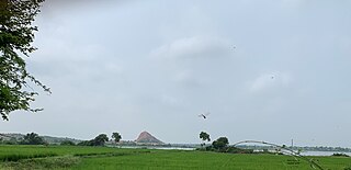
Sindhanur is a city and taluk headquarter of Sindhanur taluk of Raichur District in Karnataka. The river Tungabhadra covers the irrigation area by left bank canal. Most of the land in the field is composed of cultivable black soil. Paddy is cultivated using the Tungabhadra River water. Sindhanur is also known as the Paddy Granary of Raichur. With the availability of Tungabhadra river water, paddy rice is grown twice a year. Sindhanur is the place where the majority of tractor sales take place in Asia. as agricultural activities take place year-round. Sona Masuri and Basmati rice are grown in Sindhanur.Amba Matha also spelled as Amba Mutt is a village near Somalapura in the Sindhanur taluk. Amba Matha is a holy place, Sri Amba Devi Temple is located in the village.

<span class="mw-page-title-main">Hospet</span> City in Karnataka, India

Hospet or Hosapete is the largest and fastest-growing industrial city and district headquarters of the Vijayanagara district in the Indian state of Karnataka. Hospet is known as "the steel city of Karnataka". It is located on the banks of the Tungabhadra River and is 13 km (8.1 mi) from Hampi (Vijayanagar). The present day Hampi was the capital of the Vijayanagara Empire. It has been designated a UNESCO World Heritage Site. Hospet is the connecting link between North and South Karnataka. It is 333 km (207 mi) from the state capital Bengaluru.

Harapanahalli is a city in Vijayanagara District in the Indian state of Karnataka. It is the administrative headquarters of the Harapanahalli Taluk.

HoovinaHadagali or HuvinaHadagali is a town and a taluk in the Vijayanagara district of Karnataka, India.

Kampli is a town in the Bellary district, Kampli taluk, in the Indian state of Karnataka. It is a headquarters of Kampli Taluk. The town is situated about 15 km away from Hampi.

<span class="mw-page-title-main">Lingasugur</span> Town in Karnataka, India

Lingasugur is a municipal town in Raichur district in the Indian state of Karnataka. There are many Temples, hills and forts (Quila). The festivals of Muharram and Maha Shivaratri are important here. Mudgal in Lingasugur taluk has a very ancient fort. It has often been mentioned in the autobiography of Philip Meadows Taylor. Lingasugur, then known as Chavani was the site of a major British cantonment in the region.

Tekkalakote, also known as Tekkalakota, is a Panchayat town and Pre-historic Neolithic site in Siruguppa taluk of Ballari district in the Indian state of Karnataka.

<span class="mw-page-title-main">Ballari district</span> Subdivision of Indian state of Karnataka

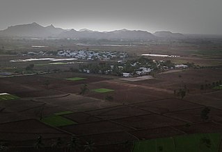
Ballari, formerly Bellary, is a major district in Karnataka. It is located at north-eastern part of Karnataka. This district belongs to Kalyana-Karnataka. This district was one of the biggest districts in Karnataka until the Vijayanagara district was carved out of Ballari district in 2021 officially.

Gorebal is a village located 9 km from Sindhanur in the Raichur district of Karnataka state, India. Gorebal is well irrigated with Tunga Bhadra left bank canals 32 and 36.

Roudkunda is a village in the Sindhanur taluk of Raichur district in the southern state of Karnataka, India. Roudkunda is famous for Ranganatha swamy temple. Roudkunda is surrounded by hills and there is an ancient fort on the hill top belonging to 16th century. There are various relics found in the hills that have historical importance. Roudkunda is 18 km south to the taluka headquarters Sindhanur and 5 km from Karnataka State Highway 23. Nearest towns are Siruguppa and Karatagi.

Salagunda, is a village in the Sindhanur taluk of Raichur district in Karnataka state, India. Salagunda was the capital of the Sindha dynasty. Salagunda is 20 km South to the taluka headquarters Sindhanur and 5 km from Karnataka State Highway 19. Nearest towns are Siruguppa and Karatagi.

Sindhanur is a city and taluk headquarter of Sindhanur taluk in Raichur District in Karnataka. It is the main commercial center of the district. River Tungabhadra covers the irrigation area by left bank canal. Most of the land in the field is composed of cultivable black soil. Paddy is cultivated using the Tungabhadra River water. sindhanur is also known as the Paddy Granary of Raichur. With the availability of Tungabhadra river water, paddy is grown twice a year. Sindhanur is the place with Most of the tractor sales take place in Asia. as agricultural activities take place year-round. Sona Masuri and Basmati rice are grown in Sindhanur. Most interesting thing about sindhanur is that there is Bengali camp famous village where all are Bengali speaking Hindus they celebrate Durga Pooja during ever year October month.

<span class="mw-page-title-main">Kenchanagudda</span> Village in Karnataka, India

Kenchanagudda is a village in the southern state of Karnataka, India. The village is located in the Siruguppa taluk of Ballari district.

Ballari pronounced is a historic city in Bellary district in Karnataka state, India.

Karatagi is a town and taluk headquarters of Karatagi taluk and it is located in Koppal District in Karnataka, India. It is one of the most important commercial centres in the district. The town is made up of multiple paddy fields, which are irrigated by the Tungabhadra Canal. Karatagi is known for its numerous rice mills, which can be found in the town and the surrounding areas.

Olaballari also known as Valaballari is a village in the Sindhanur taluk of Raichur district in Karnataka state, India. This village is located on the banks of Tungabhadra river. Olaballari is one of the holy place. Olaballari is 30 km from sindhanur.

Kalikadevi Tempal. Mukkunda is a village in the Sindhanur taluk of the Raichur district in Karnataka, India. It is located on the banks of the Tungabhadra river. Mukkunda has several ancient temples, including the Sri Rama mandir shri dhurgamma temple, the Murari Ranga, and the Baajeshwara. The Tungabhadra river surrounds an Eshwara temple built in Hoysala style during the Sindha dynasty. A Sufi saint, hazrat gadde Khadar Bhasha darga Mukkunda is well known, and many visitors from surrounding village will come to take the blessings of this saint. It is and 27 km from Karnataka State Highway 19. The nearest towns are Siruguppa and Karatagi.

<span class="mw-page-title-main">Vijayanagara district</span> District in Karnataka, India

Vijayanagara district is a district in the southern Indian state of Karnataka, located in the Kalyana-Karnataka region. The city of Vijayanagara is its headquarters.

References

  1. "Provisional population totals, Census of India 2011" (PDF). Retrieved 12 October 2018.
  2. "PPP India STD Code Search for 'siruguppa'". Archived from the original on 4 May 2007. Retrieved 8 May 2007.
  3. "Siruguppa History". Bellary District. Retrieved 20 August 2014.
  4. Falling Rain Genomics, Inc - Siruguppa
  5. "Official website of Bellary district".
  6. "Siruguppa · Karnataka, India".
  7. "Census of India 2001: Data from the 2001 Census, including cities, villages and towns (Provisional)". Census Commission of India. Archived from the original on 16 June 2004. Retrieved 1 November 2008.