Siuna is a county-sized administrative municipality in Nicaragua, located approximately 318 kilometres (198 mi) northeast of the capital city of Managua and 218 kilometres (135 mi) west of the coastal city and regional capital Puerto Cabezas in the North Caribbean Autonomous Region (RACN). Siuna is the name of the city as well as the municipality. The municipality of Siuna contains 204 rural communities and 20 neighborhoods. Most were settled in support of gold mining along the Ei River drainage basin, leading to rapid population growth from the mid-1930s.

Waspam Airport is an airport serving Waspam, a town on the Coco River on Nicaragua's border with Honduras.

San Pedro Airport is an airport that serves Bonanza, Nicaragua.

Puerto Cabezas Airport is an airport serving Puerto Cabezas, North Caribbean Coast Autonomous Region. It is located approximately one hour from Managua by aircraft. Operated by the state of Nicaragua, it mainly serves the city of Puerto Cabezas and Bluefields located close to the northeast corner of the country.

Rosita Airport is a private airport serving Rosita, Nicaragua. The runway is 3 kilometres (1.9 mi) south of town.

Bluefields International Airport is an airport serving Bluefields, a harbor city in the South Caribbean Coast Autonomous Region of Nicaragua. It is the busiest airport in the Caribbean coast of Nicaragua.

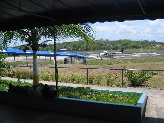
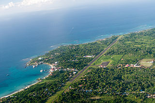
Corn Island International Airport is an airport that serves Great Corn Island on the South Caribbean Coast Autonomous Region. A new terminal has been built and the runway was refurbished so that medium-sized jet aircraft can land the airport. Buses and taxis are both available for transport around the island. It has x-ray machines, two immigration offices.

Punta Huete Airport is an airport located in the municipality of San Francisco Libre in Managua, Nicaragua. The airport is in a sparsely populated section of the municipality. The nearest town is San Benito, 14 kilometres (9 mi) to the east.

Chinandega Airport is an airport serving Chinandega, the capital of the Chinandega Department of Nicaragua. The airport is on the northwest edge of the city.

Los Brasiles Airport is an airport serving Mateare, a municipality of the Managua Department of Nicaragua. The airport is 2 kilometres (1 mi) west of the Lake Managua shoreline and 4 kilometres (2 mi) south of the Apoyeque volcano.

Montelimar Airport is an airport serving the municipality of San Rafael del Sur, Nicaragua.

San Juan de Nicaragua Airport is an airport located in San Juan de Nicaragua, Río San Juan, Nicaragua. The airport was built in 2012 at a cost of almost US$17 million.

Ometepe Airport is the only airport on Ometepe, the largest island in Lake Nicaragua. The airport is in the La Paloma comarca of Moyogalpa, Rivas Department, Nicaragua, 1.6 kilometres (1 mi) south of Moyogalpa.

Emerald Coast Airport is an international airport 10 kilometres (6.2 mi) west of Tola, a town in the Rivas Department of Nicaragua. The airport was opened on November 15, 2015 at a cost of almost US$13 million.

Hato Grande Airport is an airport serving the hamlet of Hato Grande in the Chontales Department of Nicaragua. The runway is 14 kilometres (8.7 mi) southwest of Juigalpa.

Altamira Airport is an airport serving the Agrícola Miramontes farming complex in the Boaco Department of Nicaragua. The runway is 4.8 kilometres (3 mi) north of Lake Nicaragua.

Alamikamba Airport is an airstrip serving the Prinzapolka River village of Alamikamba in the North Caribbean Coast Autonomous Region, Nicaragua. The runway is 3 kilometres (1.9 mi) northwest of the river bend.

Morgan's Rock Airport is an airstrip serving the Morgan's Rock eco-lodge and the city of San Juan del Sur in the Rivas Department of Nicaragua.

Pikin Guerrero Airport is a rural airstrip serving the hamlet of Pikin Guerrero in the Chontales Department of Nicaragua. The runway is 1.5 kilometres (1 mi) east of the hamlet and 4.7 kilometres (3 mi) north of the Lake Nicaragua shoreline.


