Related Research Articles
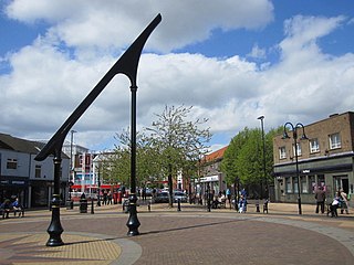
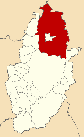
Ashfield is a local government district in Nottinghamshire, England. The population of Ashfield was 127,200 in 2018. The district is mostly urban and forms part of both the Nottingham and Mansfield Urban Areas. There are three towns in the district; Sutton-in-Ashfield, Kirkby-in-Ashfield and Hucknall. The district was formed on 1 April 1974, under the Local Government Act 1972, by the merger of urban districts of Hucknall, Kirkby-in-Ashfield, Sutton-in-Ashfield and parts of Basford Rural District, namely the parishes of Annesley, Felley and Selston.

Worksop was a Rural District in Nottinghamshire, England.
Kettering was a rural district in Northamptonshire in England from 1894 to 1974.
Claypole was a rural district in Lincolnshire, Parts of Kesteven from 1894 to 1931. It was formed under the Local Government Act 1894 from that part of the Newark-on-Trent rural sanitary district which was in Kesteven.
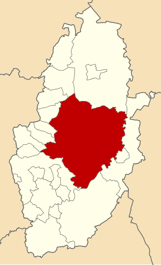
Clowne was a rural district in Derbyshire, England from 1894 to 1974.
Bowland was a rural district in the West Riding of Yorkshire from 1894 to 1974. It was named after the Forest of Bowland, which it included.
York was a rural sanitary district in Yorkshire, England, until 1894. It was based on the York poor law union, and included parishes in the West Riding, the North Riding and the East Riding, forming a ring around the city.
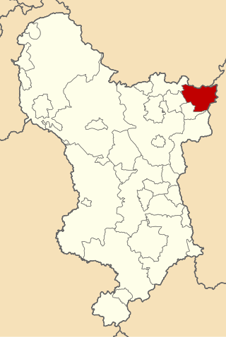
South East Derbyshire was a rural district in Derbyshire, England from 1894 to 1974. It covered an area to the south-east of Derby.
Southwell was a rural district in Nottinghamshire, England from 1894 to 1974.
Newark was a rural district in Nottinghamshire, England from 1894 to 1974.
East Retford was a rural district in Nottinghamshire, England from 1894 to 1974.
Misterton was a rural district in Nottinghamshire, England from 1894 to 1935.

Bingham was a rural district in Nottinghamshire, England from 1894 to 1974.
Leake was a rural district in Nottinghamshire, England from 1894 to 1935.

Stapleford was a rural district in Nottinghamshire, England from 1894 to 1935.

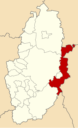
Blackwell was a rural district in Derbyshire, England from 1894 to 1974. It was created under the Local Government Act 1894 based on that part of the Mansfield rural sanitary district which was in Derbyshire.
Middleton Cheney was a rural district in Northamptonshire, England from 1894 to 1935.
Gainsborough was rural district in Lincolnshire, Parts of Lindsey from 1894 to 1974.
South Wilford was a civil parish in Nottinghamshire from 1894 to 1935. It was formed under the Local Government Act 1894 from the parts of the parishes of Wilford and Lenton which were not part of the county borough of Nottingham. It formed part of the Basford Rural District.

Skegby is a village and former civil parish, now in the unparished area of Sutton in Ashfield, in the Ashfield district of Nottinghamshire, England, located two miles west of Mansfield and one mile north of Sutton-in-Ashfield, close to Stanton Hill lying on the B6014 road. Skegby sits on both sides of a deep valley near the source of the River Meden. The parish covered about 1,433 acres and used to include the then hamlet of Stanton Hill. In 1931 the parish had a population of 6519.