
Porthcawl ( ) is a town and community in the Bridgend County Borough of Wales. It is located on the south coast, 25 miles (40 km) west of Cardiff and 19 miles (31 km) south-east of Swansea.

Swansea Bay is a bay on the southern coast of Wales. The River Neath, River Tawe, River Afan, River Kenfig and Clyne River flow into the bay. Swansea Bay and the upper reaches of the Bristol Channel experience a large tidal range. The shipping ports in Swansea Bay are Swansea Docks, Port Talbot Docks and Briton Ferry wharves.

Bridgend County Borough is a county borough in the south-east of Wales. The county borough has a total population of 139,200 people, and contains the town of Bridgend, after which it is named. Its members of the Senedd are Sarah Murphy MS, representing the Bridgend Constituency, and Huw Irranca-Davies MS representing the Ogmore Constituency, and its members of the UK parliament are Chris Bryant, Chris Elmore, and Stephen Kinnock.

Kenfig is a village and former borough in Bridgend, Wales. It is situated 1 mile (1.6 km) inland on the north bank of the Bristol Channel, and just south-west of the M4 motorway. To the east is the town of Bridgend, at approximately 6 miles (10 km), and the capital city of Cardiff, at 24 miles (40 km). To the west lies Port Talbot, at approximately 7 miles, and Swansea at approximately 18 miles.
The Skerries, coming from the Old Norse word sker, are a group of sparsely vegetated rocky islets (skerries), with a total area of about 17 hectares lying 3 kilometres (1.9 mi) offshore from Carmel Head at the northwest corner of Anglesey, Wales. The islands are important as a breeding site for seabirds, and they attract divers, who come to visit the numerous shipwrecks. The Skerries Lighthouse sits atop the highest point in the islands.

Pyle is a village and community in Bridgend county borough, Wales. This large village is served by the A48 road, and lies less than one mile from Junction 37 of the M4 motorway, and is therefore only a half-hour journey from the capital city of Wales, Cardiff. The nearest town is the seaside resort of Porthcawl. Within the Community, to the northeast of Pyle, is the adjoining settlement of Kenfig Hill, North Cornelly also adjoins Pyle and the built-up area had a population of 13,701 in 2011.

SS Samtampa was a 7,219 ton steamship wrecked on Sker Point, off Porthcawl and Kenfig, Wales, in the Bristol Channel on 23 April 1947. At the time of the shipwreck, the Samtampa was operated by the Houlder Line. The Samtampa had been launched as the SS Peleg Wadsworth, a liberty ship built by the New England Shipbuilding Corporation at South Portland, Maine, and launched on 12 December 1943. Sent to Britain under the Lend-Lease program, the ship was renamed, and managed by the Houlder Line on behalf of the Ministry of War Transport.

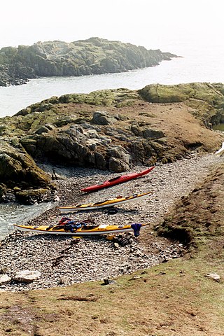
Sker House is a historic building in Wales. Originally built as a monastic grange of the Cistercian order over 900 years ago, it is situated just outside the town of Porthcawl, near Bridgend. Little remains of the original structure and it was completely rebuilt in the late sixteenth century. Its residential form appears to have been determined by the preceding monastic grange. The house was made famous as the basis of R. D. Blackmore's book The Maid of Sker.

Nash Point is a headland and beach in the Monknash Coast of the Vale of Glamorgan in south Wales, about a mile from Marcross. It is a popular location for ramblers and hiking along the cliffs to Llantwit Major beach. The lighthouse meadow is a Site of Special Scientific Interest, containing rare plants such as the tuberous thistle, and other wildlife such as choughs can be seen.

Cornelly is a community and electoral ward in Bridgend County Borough, South Wales. As of 2011 the population of the Cornelly ward was 7,059.

Kenfig Castle is a ruined castle in Bridgend County Borough in Wales that came to prominence after the Anglo-Norman invasion of Wales in the late 11th century.

Kenfig Pool is a national nature reserve situated near Porthcawl, Bridgend. Wild storms and huge tides between the 13th and 15th centuries are mainly responsible for creating the Kenfig dunes near Porthcawl, as they threw vast quantities of sand up over the Glamorgan coast. This buried the nearby borough of Kenfig, and its castle, of which only the ruined keep survives. At 70 acres the second largest freshwater lake in south Wales. Kenfig Pool lies at the heart of the national nature reserve and is a valuable stopping point for migrating birds. The lake's maximum depth is about 12 feet. An island, built by the aristocrats living in nearby Margam to encourage wildfowl to nest there, has long since sunk beneath the waters.
South Cornelly is a village in Cornelly, Bridgend county borough, Wales. The village is close to North Cornelly, Pyle and Porthcawl, and junction 37 of the M4 motorway, which runs along its northern side. It is in the historic county of Glamorgan. The population was 471 in 2011.

Merthyr Mawr Sand Dunes are sand dunes and a Site of Special Scientific Interest in Bridgend, south Wales. The village of Merthyr Mawr is nearby.
The Port Talbot & District Football League, also known as the Port Talbot Football League is a league competition featuring non-professional association football clubs in the area of Port Talbot, South Wales. Founded in 1926, it is one of the oldest such competition in Wales. The main competition consists of two divisions named "Premier League" & "Division One". The Premier League is a feeder to the South Wales Alliance League Division One, and therefore sits at tier 7 of the Welsh football pyramid.

In the United Kingdom, the term listed building refers to a building or other structure officially designated as being of special architectural, historical, or cultural significance; Grade I structures are those considered to be "buildings of exceptional interest". Listing was begun by a provision in the Town and Country Planning Act 1947. Once listed, strict limitations are imposed on the modifications allowed to a building's structure or fittings. In Wales, the authority for listing under the Planning Act 1990 rests with Cadw.

St James's Church is a Grade I listed church in Pyle, Bridgend County Borough, south Wales. A church was present in the area during the Norman period, but due to sand invasion by the later 14th century a new church had to be built, using some of the earlier materials. The date 1471 displayed on the roof indicates that the church was rebuilt at that time. In 1877 the church was extensively renovated, and it was further restored by F. W. Waller in 1891, when the chancel was given a new roof and the church was fitted with a new organ chamber. St James's Church became a Grade I listed building on 26 July 1963.
The Mumbles lifeboat disaster occurred in 1947 off south Wales when the Mumbles lifeboat was undertaking a rescue off Sker Point but was overwhelmed by the sea. All eight people in the lifeboat died as result.

Maid of Sker is a 2020 first-person survival horror game developed and published by Wales Interactive. The game is set in 1898 in the Sker Hotel, on an imaginary island called Sker Island. The protagonist, Thomas Evans, is invited by his lover, Elisabeth Williams, to uncover the mysteries of the hotel after she notices her family's strange behavior. While exploring the hotel, Thomas learns cult followers called "The Quiet Ones" control the place. He finds notes and gramophone records scattered around the hotel that reveal the history of Elisabeth's family.
