A trail, also known as a path or track, is an unpaved lane or a small paved road not intended for usage by motorized vehicles, usually passing through a natural area. In the United Kingdom and the Republic of Ireland, a path or footpath is the preferred term for a pedestrian or hiking trail. The term is also applied in North America to accompanying routes along rivers, and sometimes to highways. In the US, the term was historically used for a route into or through wild territory used by explorers and migrants. In the United States, "trace" is a synonym for trail, as in Natchez Trace.

The West Highland Way is a linear long-distance route in Scotland. It is 154 km long, running from Milngavie north of Glasgow to Fort William in the Scottish Highlands, with an element of hill walking in the route. The trail, which opened in 1980, was Scotland's first officially designated Long Distance Route, and is now designated by NatureScot as one of Scotland's Great Trails. It is primarily intended as a long distance walking route, and whilst many sections are suitable for mountain biking and horseriding there are obstacles and surfaces that will require these users to dismount in places.

A pedestrian is a person traveling on foot, whether walking or running. In modern times, the term usually refers to someone walking on a road or pavement, but this was not the case historically.

The Icknield Way is an ancient trackway in southern and eastern England that runs from Norfolk to Wiltshire. It follows the chalk escarpment that includes the Berkshire Downs and Chiltern Hills.

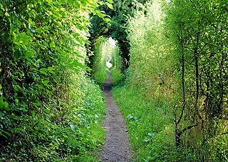
A footpath is a type of thoroughfare that is intended for use only by pedestrians and not other forms of traffic such as motorized vehicles, bicycles and horses. They can be found in a wide variety of places, from the centre of cities, to farmland, to mountain ridges. Urban footpaths are usually paved, may have steps, and can be called alleys, lanes, steps, etc.

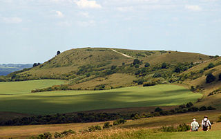
The South Downs Way is a long distance footpath and bridleway running along the South Downs in southern England. It is one of 16 National Trails in England and Wales. The trail runs for 160 km (100 mi) from Winchester in Hampshire to Eastbourne in East Sussex, with about 4,150 m (13,620 ft) of ascent and descent.
The Cumbria Way is a linear 112-kilometre (70-mile) long-distance footpath in Cumbria, England. The majority of the route is inside the boundaries of the Lake District National Park. Linking the two historic Cumbrian towns of Ulverston and Carlisle, it passes through the towns of Coniston and Keswick. The route cuts through Lakeland country via Coniston Water, Langdale, Borrowdale, Derwent Water, Skiddaw Forest and Caldbeck. It is a primarily low-level route with some high-level exposed sections.
St Swithun's Way is a 34-mile (55 km) long-distance footpath in England from Winchester Cathedral, Hampshire to Farnham, Surrey. It is named after Swithun, a 9th-century Bishop of Winchester, and roughly follows the Winchester to Farnham stretch of the Pilgrims' Way. The route was opened in 2002 to mark the Golden Jubilee of Elizabeth II.

The Monarch's Way is a 625-mile (1,006 km) long-distance footpath in England that approximates the escape route taken by King Charles II in 1651 after being defeated in the Battle of Worcester. It runs from Worcester via Bristol and Yeovil to Shoreham, West Sussex.

The Southern Upland Way is a 344-kilometre (214 mi) coast-to-coast long-distance footpath in southern Scotland. The route links Portpatrick in the west and Cockburnspath in the east via the hills of the Southern Uplands. The Way is designated as one of Scotland's Great Trails by NatureScot and is the longest of the 29 Great Trails. The Southern Upland Way meets with seven of the other Great Trails: the Annandale Way, the Berwickshire Coastal Path, the Borders Abbeys Way, the Cross Borders Drove Road, the Mull of Galloway Trail, the Romans and Reivers Route and St Cuthbert's Way.

The Hong Kong Trail, opened in 1985, is a long-distance footpath from Victoria Peak to Big Wave Bay on Hong Kong Island. It is a 50-kilometre (31 mi) walking route which passes through the five country parks on Hong Kong island. The trail is extremely popular with local residents for its unique combination of well-marked paths through verdant woods that offer relief from the sun on sunny days, and featuring numerous streams and waterfalls. The trail offers a wide variety of terrain — it can be steep at some parts, flat at others, with both gradual ascents and descents. The trail takes a very indirect route; termination points Victoria Peak and Big Wave Bay are less than 11 km apart. Because the trail is composed of eight sections, much shorter runs or hikes are possible. The popular running path on Bowen Road connects to both Sections 3 and 4 via the steep ascent up the Wan Chai Gap Trail. The best detailed guidebook, which breaks down each of the eight sections with detailed notes, maps and photos, is The Serious Hikers Guide to Hong Kong (the book also outlines three other 50 km+ hiking trails in Hong Kong — the Wilson, the Maclehose, and the 70-km long trail that circumnavigates Lantau Island. In 2013, Hong Kong Trail was awarded the 10th best city hiking trail in the world by Lonely Planet.

The Cambrian Way, initially an unofficial long distance footpath in Wales running from Cardiff to Conwy, was officially recognised in 2019. Primarily a mountain walk, it runs over many of the highest and most scenically beautiful areas of Wales. It was pioneered in the 1960s and 1970s by walker Tony Drake, who later produced a guidebook of the walk.
Walking is one of the most popular outdoor recreational activities in the United Kingdom, and within England and Wales there is a comprehensive network of rights of way that permits access to the countryside. Furthermore, access to much uncultivated and unenclosed land has opened up since the enactment of the Countryside and Rights of Way Act 2000. In Scotland the ancient tradition of universal access to land was formally codified under the Land Reform (Scotland) Act 2003. In Northern Ireland, however, there are few rights of way, or other access to land.

The Ordnance Survey (OS) is the national mapping agency for Great Britain. The agency's name indicates its original military purpose, which was to map Scotland in the wake of the Jacobite rising of 1745. There was also a more general and nationwide need in light of the potential threat of invasion during the Napoleonic Wars. Since 1 April 2015, the Ordnance Survey has operated as Ordnance Survey Ltd, a government-owned company, 100% in public ownership. The Ordnance Survey Board remains accountable to the Secretary of State for Science, Innovation and Technology. It was also a member of the Public Data Group.
The rambler organization charity Ramblers is the trading name of the Ramblers Association, Great Britain's leading walking charity. The Ramblers is also a membership organisation with around 100,000 members and a network of volunteers who maintain and protect the path network. The organisation was founded in 1935, and campaigns to keep the British countryside open to all.

A long-distance trail is a longer recreational trail mainly through rural areas used for hiking, backpacking, cycling, horse riding or cross-country skiing. They exist on all continents except Antarctica.

The Dane Valley Way is a long-distance footpath through Derbyshire, Staffordshire and Cheshire, England. It runs from the Pavilion Gardens in Buxton to the end of the River Dane, where it enters the River Weaver in Northwich.
The Frome Valley Trail is a long-distance footpath in Dorset, England which follows the River Frome from Evershot to Dorchester and will, when completed, extend to Poole Harbour.